
SLAM-based Mobile Mapping
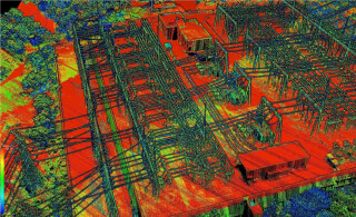
The vMS3D is a mobile mapping system combining the best of inertial, GNSS, and SLAM technologies.
The Smartest Mobile Mapping System
VIAMETRIS has just launched a new solution: the vMS3D, a mobile mapping system combining the best of inertial, GNSS, and SLAM technologies to offer an innovative solution with attractive performance/ price ratio.

vMS3D, mounted on a vehicle
The Best of GNSS, Inertial, and SLAM
The vMS3D solution takes into account the advantages and disadvantages of each technology, depending on their conditions of use:
- GNSS: When the GNSS receiver provides reliable data, for instance in open sky environment, the solution relies on its position. If a GNSS outage or disturbance occurs, the system chooses between inertial or SLAM-based data
- SLAM: Position computed from SLAM is preferred in dense environments where surrounding objects are very diverse and close, such as in urban canyons or forests. SLAM capabilities are limited in environments where objects are too far or not distinguishable.
- Inertial: Velocities and orientation information provided by the Inertial Navigation System (INS) are able to assist the navigation in all the cases where GNSS and SLAM are limited. The Inertial Navigation System provides roll and pitch to constraint all LiDAR data, so the point cloud is referenced at ground level. Turn rates are also very helpful, especially when an abrupt change of direction occurs. Indeed, orientation compensation is required between two scans when the LiDAR is in motion.
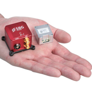
Ellipse-D, The Smart Choice of VIAMETRIS
The innovative SLAM computation allows VIAMETRIS to rely on miniature and cost-effective inertial sensors while other systems on the market require higher accuracy inertial systems. Ellipse sensors deliver 0.1° accurate attitude.
With an integrated INS like the Ellipse-D, offering a single communication interface and built-in synchronization to the GNSS and LiDAR, we have been able to concentrate on our SLAM expertise
Jérôme Ninot, VIAMETRIS
What is SLAM?
The principle uses either image or LiDAR based localization to determine the distance between the sensor and surrounding objects. Feature-based SLAM uses corners or particular shapes to calculate the position of the sensor. However, in areas without feature to locate, such as land fields or wide open area, this approach falls short,” said Jérôme Ninot, President and Founder of VIAmetris.
Do you have questions about this case study?
Get in touch with SBG Systems, and they would be happy to answer any questions you have about pricing, suitability, availability, specs, etc.

Related products


