SABRE-SCAN™ Integration with Applanix OEM Boards Redefines Mobile Mapping
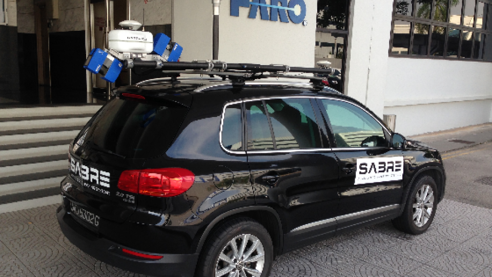
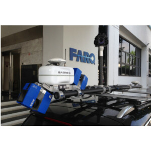
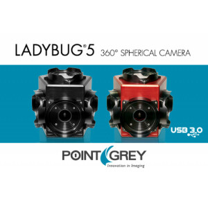
Using Applanix Direct Georeferencing OEM boards, SABRE ADVANCED 3D integrates precise positioning into the SABRE-SCAN™, a high-performance mobile mapping system with FARO® laser scanner and panoramic Ladybug®5 camera.
Benefits
- Rapid deployment, survey at up to highway speeds
- Transportable for International Survey Ops on any vehicle
- Maps large areas safely
- High precision, accuracy
Overview
- Need for precise positioning technology in transportable, “multi-use” design.
- SABRE-SCAN™ to deliver quick installation, rapid mobilisation, and fast dismantling process into two shipping cases.
- Product required easy configuration to attach to most vehicles for survey use across land, sea, and air internationally.
- Multifaceted integration: compatability with FARO® Focus 3D Laser Scanner, Ladybug®5 camera for DG Imagery.
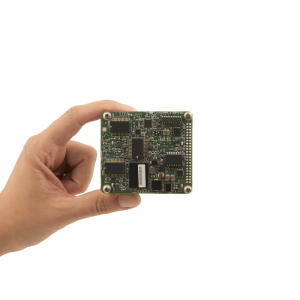
- Applanix GNSS-Inertial technology selected for accurate positioning.
ABOUT SABRE ADVANCED 3D
SABRE ADVANCED 3D designs, develops and manufactures 3D remote sensing survey solutions for the geospatial industry. These solutions are designed to capture detailed 3D point clouds and HD camera imagery information for 3D visualization and mapping, allowing data extraction for “as-built” modelling. SABRE strives to further the development of enhanced mapping solutions and to streamline the 3D data capturing process, from acquisition to end-deliverable. A principal design feature of the SABRE-SCAN™ mobile mapping system is the compact build of the FARO® Focus laser scanner, which provides high-precision and high-definition 3D point clouds. It has a highly portable form factor for ease of use and deployment. For more product details and specifications.
NEED
SABRE ADVANCED 3D recognized the demand for a hybrid precise positioning technology in the mobile mapping and scanning market, and so set out to create the SABRE-SCAN™ hybrid system to offer flexibility – with detachable laser scanners for static scanning and a compact modular design for ease of deployment, internationally. To maximize utility and productivity, any such system requires easy configuration for moving vehicles (land, sea, and air), and must have a simple setup and dismantling process.
"Applanix is a core market leader. Their AP boards are the main sensors used with the [SABRE-SCAN™] system, [and they] always deliver the same thing: highly accurate, dependable, repeatable results."
Pursuing this goal, SABRE designed the SABRE-SCAN™. This highly portable system enables the FARO® Focus laser scanner to be utilized for mobile mapping large-scale survey operations while supporting quick detachment of the laser scanners for conventional static spherical laser scans when mounted on a tripod. To enhance the collected survey data, users can also add a Ladybug®5 camera to simultaneously create georeferenced imagery.
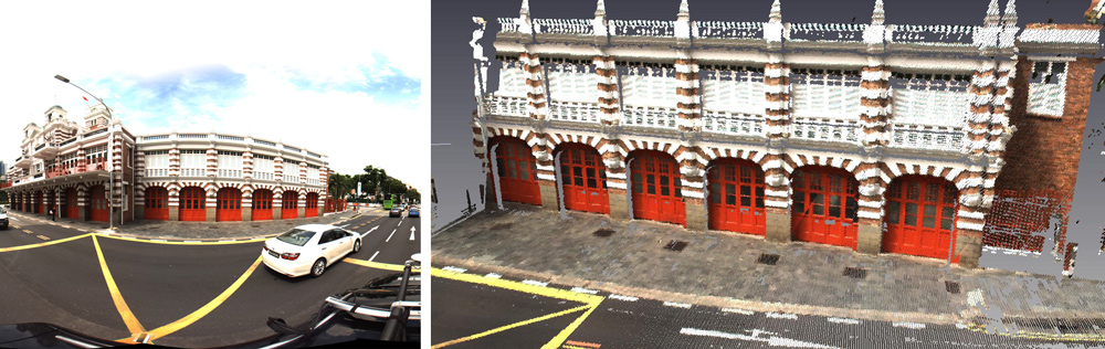
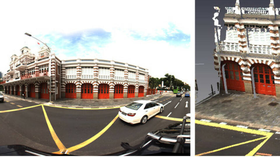
Side-by-side comparison of a camera image (left) and the mobile-mapped colourized 3D point cloud image (right), both captured by the SABRE-SCAN™
CHALLENGE
The challenge of building such a versatile and portable product was in its multifaceted nature: the new system would have to integrate with the FARO® Focus 3D for high-resolution scanning, offer various grades of IMU data, work compatibly with the Ladybug®5 camera for imagery, and offer point cloud colourization. To expertly balance such a wide range of demands with high-level precision and lightweight design, SABRE ADVANCED 3D turned to Applanix.
SOLUTION
Developing the SABRE-SCAN™ system required working with an industry leader in positioning technology and in customer support concerning product integration, for a wholly flexible and tailored experience. First, Applanix’s unique selection of highly-customizable OEM boards simplified the integration process so that otherwise complex, fixed components could work together effectively in mapping. Even when factoring in the DG boards’ diverse specification options, the hardware was still lightweight and compact enough to accommodate the SABRE-SCAN™’s fully portable design.
Also, from a product standpoint, Applanix’s many price point options provide customers with the flexibility of a scalable implementation process to build their products with future development or upgrades in mind. SABRE-SCAN™ chose the Trimble AP-20 board as the primary IMU sensor, with the option to use higher-grade sensors if so required. Applanix also offers the POSPac MMS software, an intuitive software used to generate even more highly accurate post-processed data, which can be integrated anytime.
However, it was Applanix’s adaptable approach which helped ease the integration and combined efforts of all such factors. Traditionally, the more complex an integration, the more in-depth product knowledge is required; Applanix’s highly proficient team of experts were on hand to offer both creative and comprehensive solutions for every step of the production process.
When discussing Applanix’s involvement with SABRE-SCAN™ 3D’s Dynamic LiDAR solutions, SABRE’s CEO Paul Edge touted the company’s responsive nature as a key factor to the success of the integration into SABRE ADVANCED 3D’s key product lines.
"Applanix has been very supportive: they're quick to respond to support our needs through the development process, are reactive to suggestions, and are always evolving their technology to become more compact, lightweight, and easy to use." – Paul Edge, CEO of SABRE ADVANCED 3D.
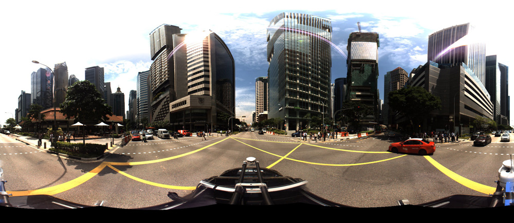
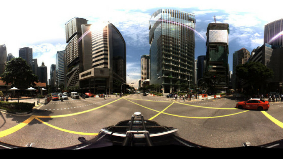
SABRE-SCAN™ panoramic in Singapore
DEPLOYMENT
Because of its adaptable nature, the SABRE-SCAN™ mobile mapping system has been deployed in multiple sectors for an array of applications, including transportation (road/highway mapping and autonomous vehicles), oil and gas, construction and civil engineering, urban planning, ports and harbours, public safety (law enforcement, security, civil, and military defence), robotics, drones, and remote sensing.
"Our team has been very happy with Applanix's support. The hardware, software, and customer support are all excellent." – Paul Edge, CEO of SABRE ADVANCED 3D
Do you have questions about this case study?
Get in touch with Trimble Applanix, and they would be happy to answer any questions you have about pricing, suitability, availability, specs, etc.


![3月21日-封面[1].jpg](https://cdn.geo-matching.com/voeE1ywo.jpg?w=320&s=6b3b1a0215d770f8797653e9202a8f52)


