
OxTS Launch the xNAV650 INS - Their Smallest, Lightest and Most Affordable INS to Date
On Monday, 22nd March 2021, Inertial Navigation System experts, Oxford Technical Solutions released the latest in their line of Inertial Navigation Systems (INS) – the xNAV650. Their smallest, lightest and most affordable INS to date!
Inertial Navigation Systems provide surveyors with absolute position, timing and inertial measurements (heading and pitch/roll) that they can integrate into their survey projects. These measurements, when combined with data from other devices (such as LiDAR sensors and cameras), can greatly enhance the surveying process - leading to a greater survey ROI.
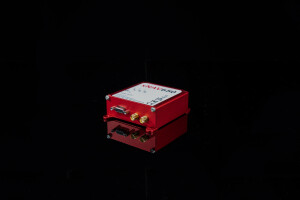
The xNAV650 is OxTS’ smallest, lightest and most affordable INS to date. Combining 20 years of navigation experience with the latest cutting edge MEMS IMU technology and survey-grade GNSS receivers, the xNAV650 delivers the reliability and precision OxTS’ customers have come to expect – all in their smallest enclosure yet!
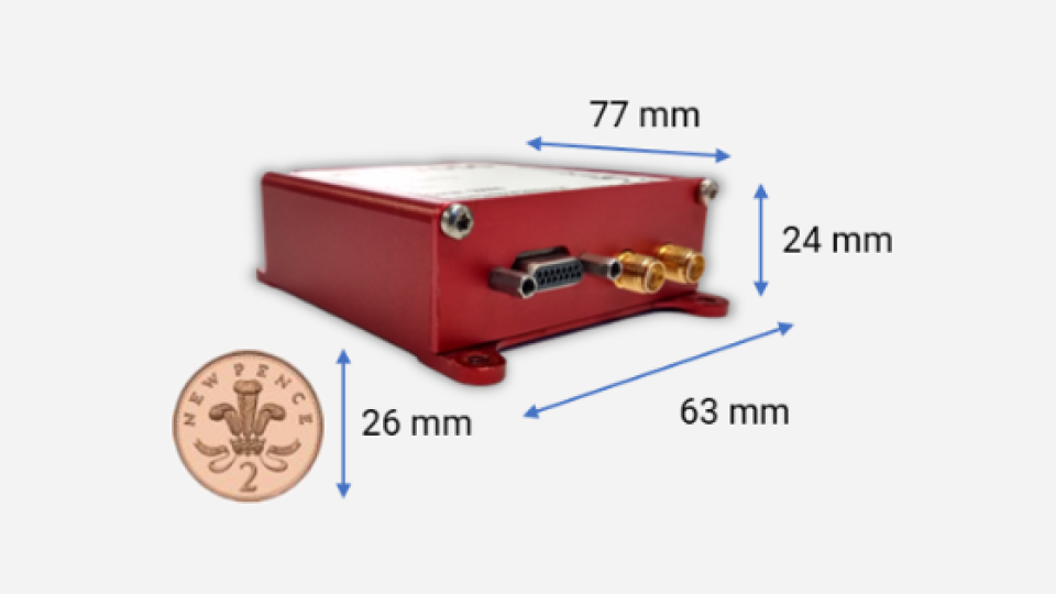
The xNAV650 provides highly accurate and reliable measurements – even when payload size and weight are imperative to consider. It measures 77 x 63 x 24 mm and weighs only 130 g.
Learn more about the xNAV650 INS.
Applications of the OxTS xNAV650 INS
Small and lightweight, the xNAV650 INS is suitable for a wide range of applications where using an Unmanned Aerial Vehicle is the preferred data collection method.
Example applications include:
- Bridge Survey
- Building Survey
- Coastal Monitoring
- Forestry Survey
- Map Creation
- Pipeline Exploration
- Rail Survey…..and more!
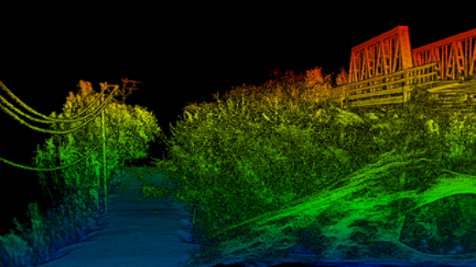
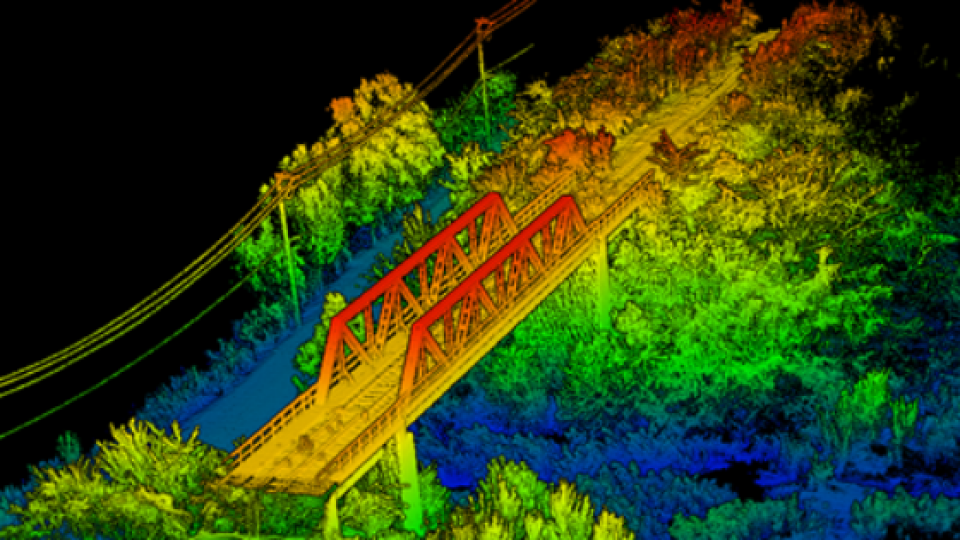
xNAV650 INS Used for Mapping and Monitoring an Aging Bridge
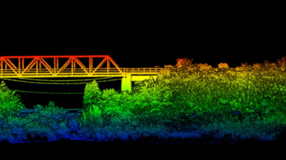
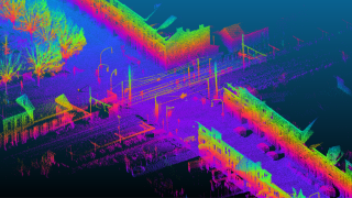
OxTS’ partner Dronezone srl used the xNAV650 INS and a Velodyne VLP-16 LiDAR on a drone to conduct a scan of an aging bridge to look for structural and potential hazards from overgrown foliage.
By fusing the timing, position and inertial data from the INS, with the raw data of the Velodyne VLP-16 (using OxTS’ LiDAR georeferencing software OxTS Georeferencer), the surveyor was able to produce a highly accurate 3D pointcloud of the bridge.
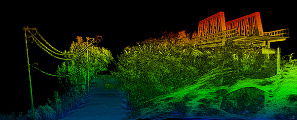
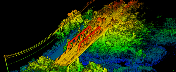
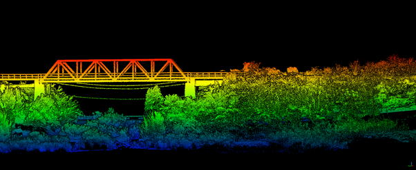
Fusing the position and inertial data from the xNAV650 INS with the Velodyne VLP-16 LiDAR data provides a fantastic level of clarity. This can be seen in the foliage, electricity lines and side of the bridge.
The resultant pointcloud has enabled the engineers to easily and accurately pinpoint areas of the bridge that need closer attention.
Contact OxTS to discuss your application
One INS – Multiple Integration Possibilities
The survey mentioned in this article was produced using an xNAV650 INS and a Velodyne VLP-16 LiDAR. However, the data from OxTS Inertial Navigation Systems can be fused with the data from almost any LiDAR sensor. Using our own LiDAR georeferencing software, OxTS Georeferencer, we can help you georeference pointclouds specifically from Velodyne, Hesai and Ouster sensors.
There is also work underway to integrate new LiDAR sensors from an even wider range of manufacturers into OxTS Georeferencer – allowing OxTS INS users to build a full navigation solution where much of the integration work is already taken care of.
Learn more about OxTS Technology Partnerships
What Software is Included with OxTS Inertial Navigation Systems?
OxTS NAVsuite software is included with all OxTS Inertial Navigation Systems. This full range of software tools allows users of OxTS’ devices to configure and post-process data with ease.
Other optional software features are also available including Precision Time Protocol (PTP) and gx/ix tight-coupling technology.
- PTP allows for a much simpler LiDAR survey set-up over ethernet whilst simultaneously stamping out time-drift by utilising the high-quality INS clock source – GNSS.
- GX/IX tight-coupling technology, OxTS’ own proprietary navigation engine, ensures that users of OxTS Inertial Navigation Systems receive the most accurate measurements possible even in tough GNSS conditions.
OxTS xNAV650 INS Enables Surveyors to Take Advantage of Highly Accurate Inertial Measurements
The OxTS xNAV650 INS enables surveyors to take advantage of highly accurate inertial measurements when payload size and weight is imperative to consider.
This data can be quickly and easily combined with raw data from a range of LiDAR sensors (using OxTS Georeferencer) to output accurate georeferenced pointclouds.
Do you have questions about this product news?
Get in touch with Oxford Technical Solutions - OxTS, and they would be happy to answer any questions you have about pricing, suitability, availability, specs, etc.


