
Obtain High Quality Aerial Survey Data With GNSS and IMU Equipped Airborne Laser Scanners
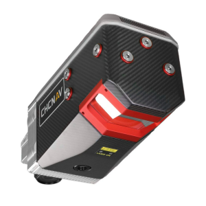
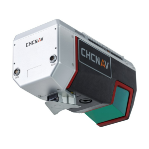
CHC Navigation (CHCNAV) announced the release of the AlphaAir 1400 (AA1400) and AlphaAir 2400 (AA2400) Lidar systems. AA1400 and AA2400 are very lightweight and compact airborne laser scanners that are easily installed on various UAV platforms or small survey aircraft and helicopters. They are ideally adapted to high-density point corridor mapping applications, day or night, under leaf-on and leaf-off conditions or with dense vegetation to provide reliable results.
“Nowadays, it is critical to obtain the highest data quality for the majority of aerial survey projects. In addition to state-of-art GNSS and IMU sensors, the AA1400 and 2400 also integrate RIEGL’s VUX LiDARs with their unique Waveform-LiDAR technology, allowing echo digitization and online waveform processing. Multi-target resolution is the basis for penetrating even dense foliage,” said Andrei Gorb, Product Manager of CHC Navigation’s Mapping and Geospatial Division. “The continuously rotating polygonal mirror wheel enables scanning speed of up to 400 lines per second, allowing for effective coverage of large areas when used from fast drones or aircraft.”
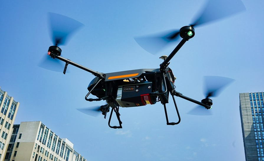
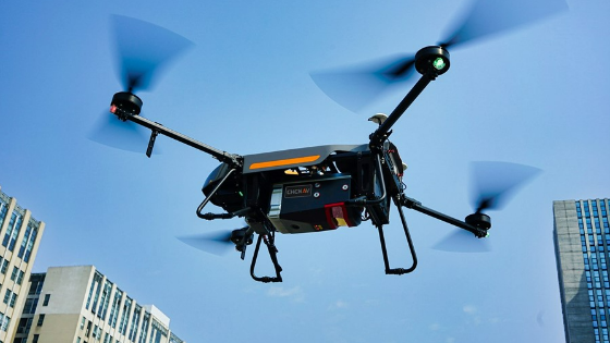
The BB4 UAV is equipped with the AA2400 scanner for the city mapping task.
Aerial Laser Scanning with Outstanding Accuracy
Combining with industrial-grade GNSS and high precision IMU systems, the AA1400 and 2400 provide a 2 to 5 cm survey-grade accuracy. Their built-in premium RIEGL VUX-120 and VUX-240 Lidar sensors feature a high-speed data acquisition rate of up to 1.8 MHz and scan speed up to 400 lines per second. It provides linear accuracy of 1 to 2 cm on long-range scanning and perfectly suits the fixed-wing UAV corridor mapping application.
High-Quality Aerial Imaging
CHCNAV offers several external cameras add-ons for the AlphaAir. Users can choose from 42, 100 or 150 MP fully calibrated sensors for data acquisition. And setups can include nadir or nadir and oblique cameras from Sony or PhaseOne. By obtaining high-resolution geo-referenced and oblique imagery, more applications can be supported, increasing the return on investment for the client.
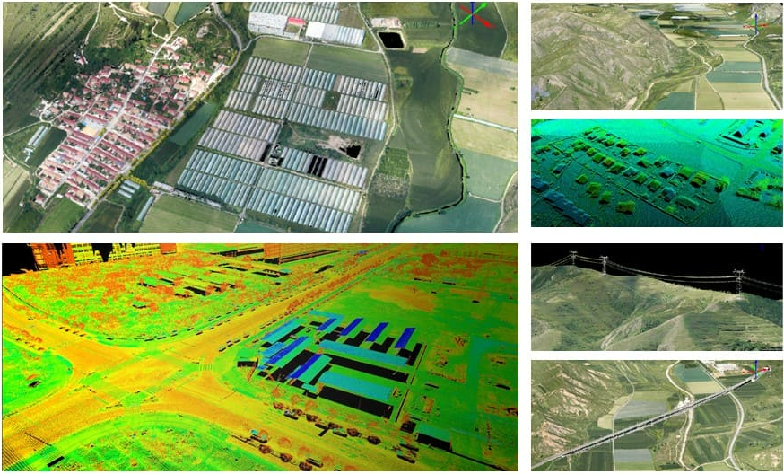
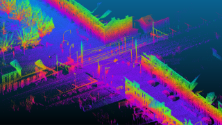
The scanning results of the AA1400 and 2400 Lidar Series.
Cable-Free Lidar System Connection
The one-click connection of the AlphaPort to the power source and camera makes the installation of the AA1400 and 2400 very quick and easy, eliminating the need for additional accessories and time for camera calibration. The AA1400 and 2400 reduce the risk of cable damage caused by aircraft vibration and acceleration during takeoff and landing.
A Comprehensive Ecosystem
CHCNAV provides a full range of solutions that allows a complete Lidar solution to be added to the users’ geomatic services. The software suite includes the CoCapture UAV field application for fully automated reality capture and real-time mission tracking, and the CoPre desktop software for semi-automated point cloud processing.
The AA1400 and 2400 Lidar series solutions are available worldwide today through the CHCNAV distribution network.
About CHC Navigation
CHC Navigation (CHCNAV) creates innovative navigation and positioning solutions to make customers' work more efficient. CHCNAV products and solutions cover multiple industries such as geospatial, construction, agriculture and marine. With a presence across the globe, distributors in more than 120 countries and more than 1,500 employees, today CHC Navigation is recognized as one of the fastest-growing companies in geomatics technologies.
CHC Navigation invites potential dealers to apply for cooperation. Our dealers have a choice to represent one or more mobile mapping products based on the potential customers’ needs in their region. We communicate openly and frequently, build mutual trust, and help generate larger gains for every dealer.
For more information about the dealership opportunities, please fill out and submit the form:
Do you have questions about this product news?
Get in touch with CHC Navigation | CHCNAV, and they would be happy to answer any questions you have about pricing, suitability, availability, specs, etc.


