
Multibeam Echosounder Used in Bathymetric Survey of Hungarian Lake
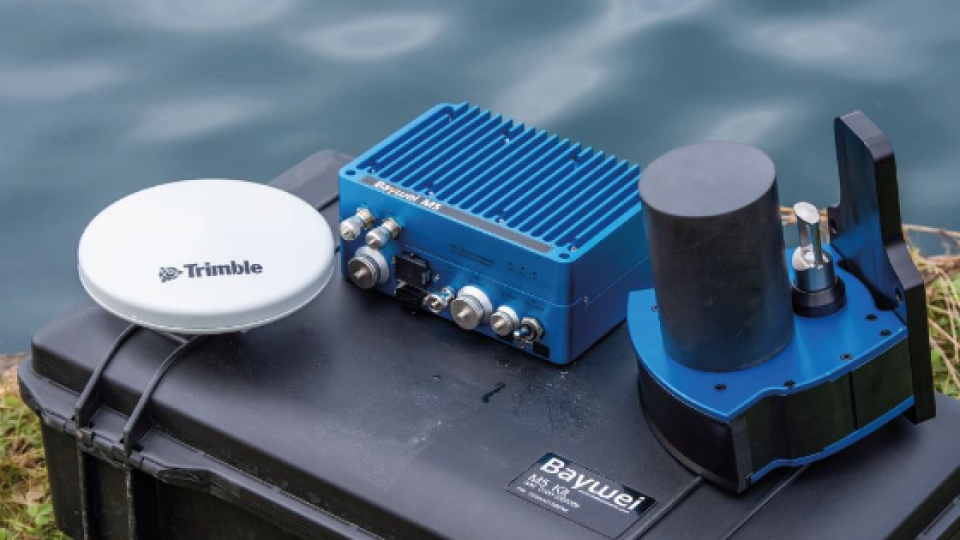
Baywei M5 is a versatile, high-resolution Multibeam Echosounder, which is also extremely simple to install and use. The tightly coupled GNSS/INS makes it easy to integrate even on ultra-small vehicles (including USVs) and very quick to mobilize. Its hydrodynamic form factor and its low power consumption make it the perfect choice for small autonomous surface vehicles.
The Survey Site
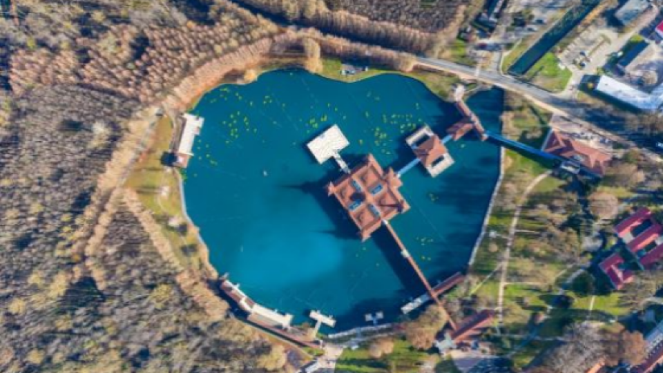
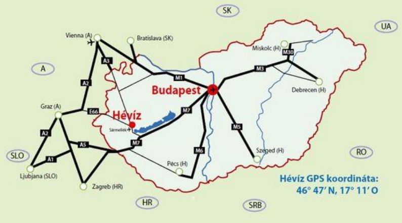
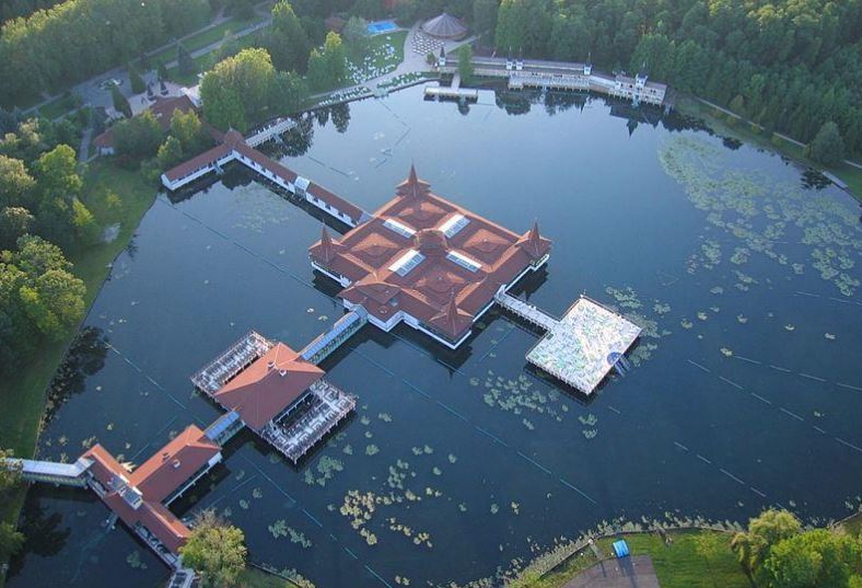
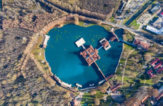
Lake Hévíz (Lake Héviz) is located in Hévíz, Hungary, near the western end of Lake Balaton Lake. It is the largest thermal lake in the world which is available for swimming (47,500 square metres (511,286 sq ft) in the area). The flow of water is very strong and the water in the lake is completely replenished every 72 hours. Its minimum depth is 2 meters, reaching a maximum depth of 38 meters, exactly at the point where the hot thermal water comes out to the surface.
(source)
In 1953 the first divers reached the bottom but couldn’t enter the inside of the spring crater. In 1972 two divers discovered a narrow gap at the bottom of the lake, 60-80 cm high and 2-3 m wide, which turned out to be the entrance to the spring-cave.
Finally, in 1975 István Plózer and his team entered this narrow gap where they had to fight against 39,5 ºC heat and a strong current of 30-40 thousand litres of water. After this narrow gap, they found a cave of 17 meters in diameter. There they found the secret of Hévíz, two springs. On the eastern side they found a colder spring (26,3ºC), and on the western, a hot spring (41ºC). The amount of the hot water is 9 times bigger than the discharge of the cold spring, so when they mix, the resulting temperature will be 39,5 ºC.
(source)
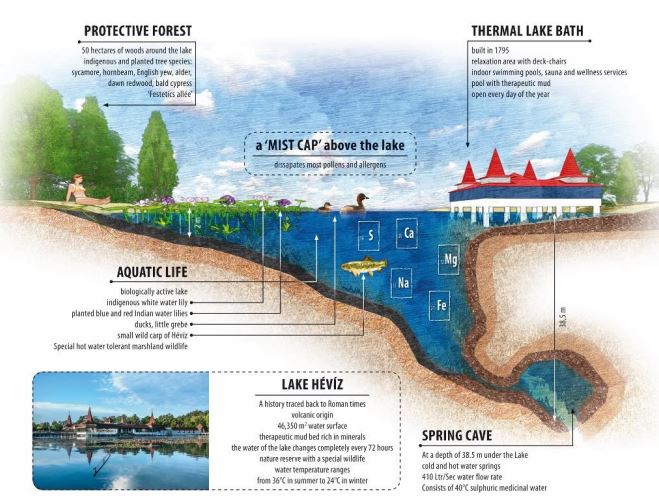
The fauna and flora (dominated by water lily) are unique in Lake Hévíz due to the temperature and chemical composition of the water, which contains carbonic acid, calcium, magnesium, hydrogen carbonate, reduced sulfuric compounds as well as oxygen in solution. Several species so far can be found only in this lake.
(source)
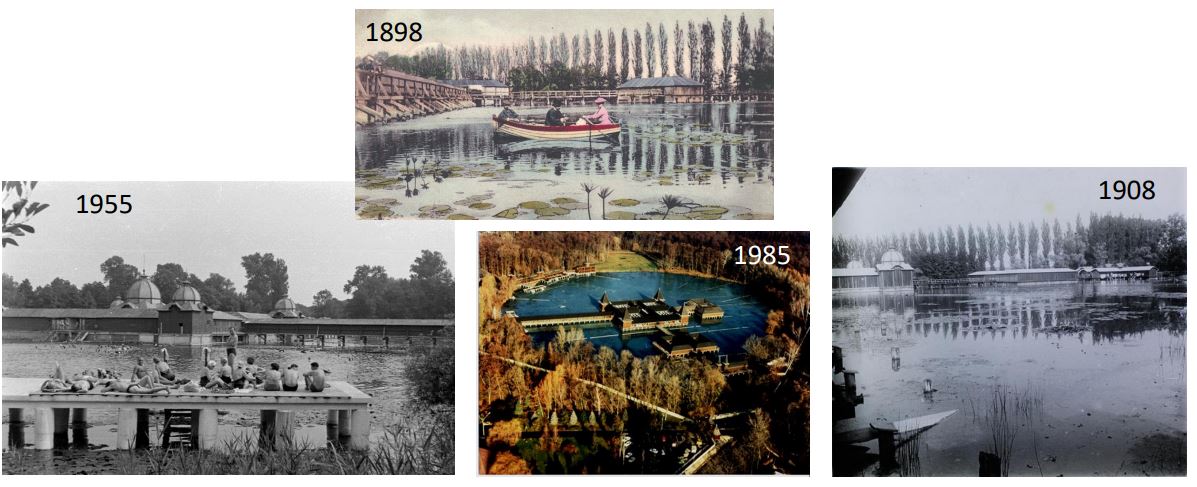
More than 150 years Lake Hévíz is a well known balneological site (later spa), due to the chemical composition and the temperature of the water. Internet is full of old and even older postcards to document this.
The Survey Task
As you can see earlier, Lake Héviz is a very interesting site from a hydrological, geological, bathymetrical and balneological point of view. However,
- Due to the challenges of the lake (depth, temperature, strong water stream from the spring cave),
- The very high number of spa visitors and
- The local restrictions (boat traffic in spa opening times is not allowed), only limited scuba dives happened, and the bathymetric survey was limited for a simple, Singlebeam Echosounder (SBES) survey a long time ago.
However, a consequence of the COVID19 pandemic was the lockdown of the Lake Héviz Spa from mid-November 2020. Therefore, local researchers had a chance for detailed underwater research and approached us to help them with a detailed bathymetric survey.
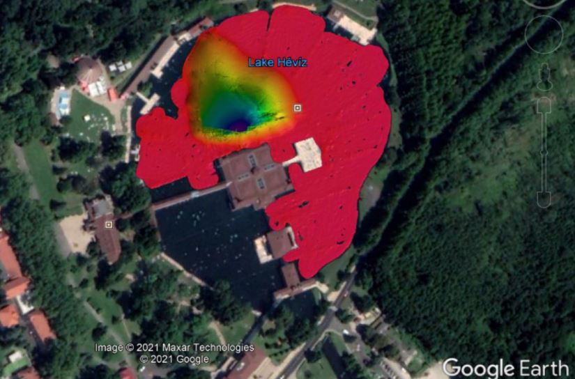
Finally, on 21st February 2021, on a cold, but sunny day, we surveyed 3/4th of the lake with a Multibeam Echosounder (MBES) first time in history.
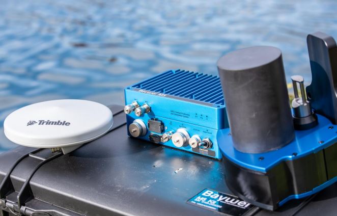
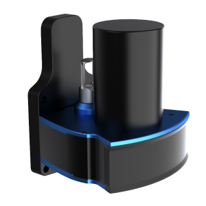
The Used Survey Equipment
Baywei M5 is a versatile, high-resolution Multibeam Echosounder, which is also extremely simple to install and use. The tightly coupled GNSS / INS makes it easy to integrate even on ultra-small vehicles (including USVs) and very quick to mobilize. Its hydrodynamic form factor and its low power consumption make it the perfect choice for small autonomous surface vehicles.
This cost-effective MBES was built around market leaders’ components using the highest design, integration, and assembling standards. The system includes not only an integrated SVP but also a simple Data Collection Utility Software.
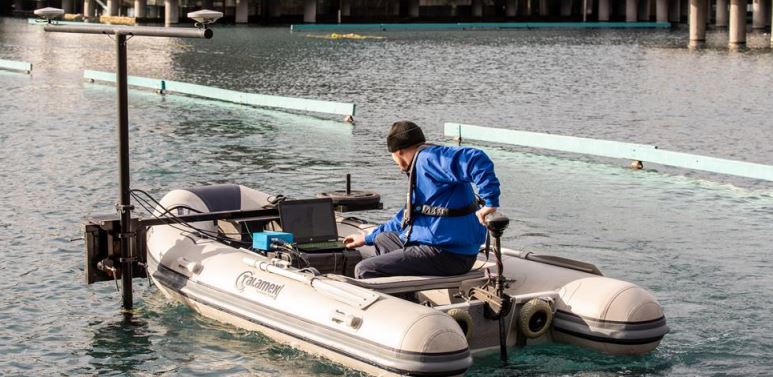
Installation of the Baywei M5
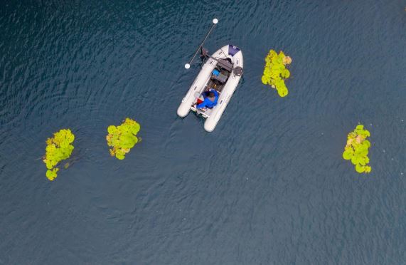
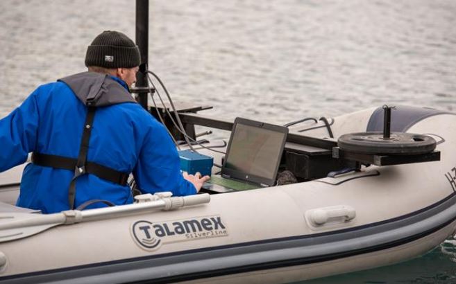
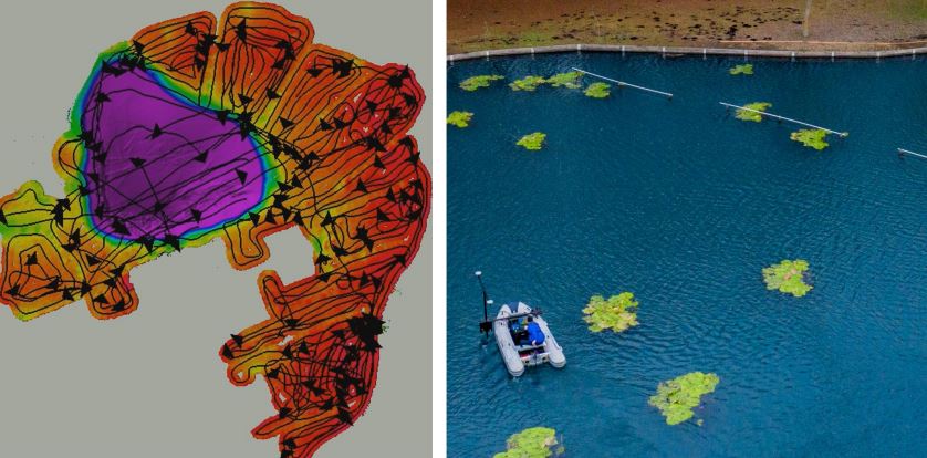
Due to local restrictions, we used a small electric engine driven 3.5 m (11.5 ft) inflatable boat. The engine used its own battery. On such a small survey platform Baywei M5 was an ideal solution, as it is a small and lightweight Multibeam Echosounder, with the GNSS/INS and the SVP integrated. For M5 MBES a sinusoidal power inverter generated 230VAC from a 100Ah (12VDC) work battery. The laptop we used operated from its internal battery. We placed the two GNSS-antenna and the sonar on a T-pole/Console over the side.
Bathymetric Survey and Data Processing
For high accuracy 3D positioning and heading data, we used the “RTK on 4G” correction services of GNSS.HU Even in this challenging environment we used only the standard setup parameter set of Baywei Graphical User Interface. The survey was controlled from the Baywei Data Collection Utility Application.
The whole system installation and bathymetric survey took half day. For post-processing, we applied QPS Qimera.
As a good 3/4th of the lake is extremely shallow (0.5 – 2.0 m) we need to place the survey tracks extremely close to each other in those areas. Anyone running a bathymetric survey with MBES tries to run parallel lines. In this project, however, this was simply impossible! Due to the water lily groups and the long bars (used as handrails by the resting patients), the whole survey was sailed with continuous manoeuvring!
Results of the Bathymetric Survey
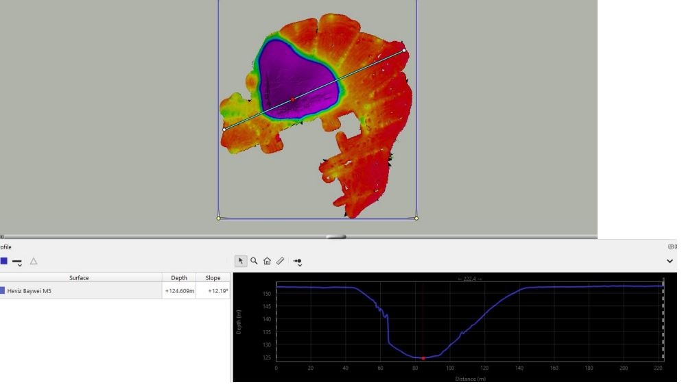
Cross Section
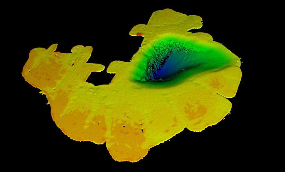
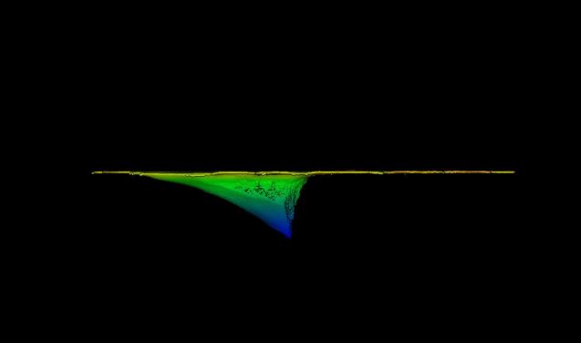
3D Views
Do you have questions about this case study?
Get in touch with Baywei Multibeam Sonars, and they would be happy to answer any questions you have about pricing, suitability, availability, specs, etc.


