Mobile Laser Scanning vs. Terrestrial Laser Scanning
In the last few years, the practice of mobile laser scanning (MLS) has become an established surveying method. Companies are appearing everywhere focussing solely on mobile mapping, offering services like never before due to the flexibility of systems available on the market. As equipment reduces in size, there are few things a LiDAR sensor cannot be mounted to and the cost of obtaining such a system is also shrinking.
So where does this leave the more traditional method of terrestrial laser scanning (TLS)? Going out and surveying a site with a static scanner mounted atop a tripod is still commonplace and TLS systems remain the go-to in certain sectors thanks to their reliability and ruggedness.
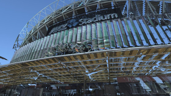
We recently found ourselves on a job ‘down-under’ where we were using the ROBIN Mobile Mapping System to scan Sydney’s Olympic Stadium. We carried out the job and thought it would be interesting to compare the results to an identical theoretical project with a Terrestrial Laser Scanner to find out whether there is a place for both kinds of technology in this ever–evolving market. For this particular experiment we based our comparison on carrying out the project with a RIEGL VZ-400i Terrestrial Laser Scanner.
There were two sections to the Olympic Stadium project, the area immediately around the stadium and the wider Olympic Park. The first, smaller part of the project was captured by walking with ROBIN in backpack setup. For the second, larger area of data capture, ROBIN was quickly reconfigured onto its vehicle mount and the rest of the survey was carried out in ‘drive’ mode. For both areas we’ve tried to estimate how many scan positions would be required to cover the ROBIN’s range with a TLS.
Backpack vs TLS
The first section of the Olympic Park to be scanned was the Olympic Stadium and Arena. With ROBIN in backpack mode, following the orange trajectory shown in the aerial view to the right, this area of the project took just 30 minutes to capture. This time included mounting of the pod onto the backpack mount, initialisation and deinitialisation, as well as the capture time itself.
Were we to use a TLS for this capture, we would need at least thirty separate scan positions, each approximately 26m apart. An imaginary scan setup is shown above with each different position shown in green. With each scan taking 30 seconds to complete, as well as the time taken to walk to each position, collapse and setup the tripod again (around three minutes), data capture could take around 2 hours.


Vehicle vs TLS
Following backpack data capture around the stadium and arena, the wider Olympic Park was scanned using ROBIN in drive mode. ROBIN was switched from the backpack mount over to the vehicle mount, a simple process which takes no longer than five minutes. The 3.5km section shown in orange below was captured in just 40 minutes.
Using a TLS for a project 3.5km long would require many scan positions and take considerably more time. Based on placing the scanners 26m apart over a slightly smaller area (not including initialisation trajectory from the MMS), we estimate this would require 88 different scan positions. At approximately three minutes a time, this survey would take over four hours. This might be a great job for somebody on a sunny Sydney afternoon, but it’s not really a practical solution for scanning large areas on a regular basis!
Processing
In terms of data capture over a large area, ROBIN is a clear winner for its flexibility and ability to capture data quickly. The system is easily switched between backpack and car mounts and once capture has begun, there is no need to change anything about the setup. However, due to the nature of mobile mapping, post-processing does take little longer. GPS and IMU data must be matched together to create a trajectory which is then combined with raw laser data to create a georeferenced point cloud. The majority of this is done by the computer, but it does require some ‘man’ hours too. For the backpack scan, which took only 30 minutes to capture, post-processing took two days. This
was made up of 60% computer time and 40% manual processing. For the vehicle scan, processing took a day, again with a 60/40 split between computer and manual data processing.
While Terrestrial Laser Scanners are bulky and take time to setup for a large project, they are the perfect partner for small surveys which need a quick turnaround. The VZ-400i in particular has a feature called automatic on-board registration which automatically creates a basic pointcloud within a few minutes of data capture so there is no need to manually process anything. If you were to colour, clean and carry out quality assurance on the data, paired with the automatic processing, this could take less than half an hour.

Results
While it’s difficult to compare the results from Mobile Mapping and Terrestrial Laser Scanning, as they are both two very different methods of data collection, we have added the accuracies and point densities to the table below.
| MLS (backpack) 5kph | MLS (vehicle) 30kph | TLS | |
|---|---|---|---|
| Accuracy (Absolute) |
30mm | 20mm | <10mm |
| Accuracy (Relative) |
3-5mm | 3-5mm | 3-5mm |
| Point Density | 60,000pts/sqm at 2m 4600pts/sqm at 26m |
6,000pts/sqm at 2m 460pts/sqm at 26m |
250,000 pts/sqm at 2m 1,600 pts/sqm at 26m |
Because a TLS is static it’s much easier to position it in the world compared to an MLS which is always moving, thus there is little difference between relative and absolute accuracies for TLS. You can see the jump from relative to absolute accuracies for mobile laser scanning from single to double figures. But even this absolute accuracy is still very high – think of how large the earth is; being able to position a point to within 2/3cm of its actual location is pretty impressive stuff! (For definitions of absolute and relative accuracy, have a look at our laser scanning jargon blog.
There is also quite a difference between point densities achieved, both at 2m and 26m. While the point density achieved with MLS is lower, it is more uniform than that produced by a TLS survey. TLS data is at its highest density close to the scan positions, with a rapid fall-off as the range increases. With MLS data, the scanner’s position is constantly moving, and so it is able to record dense data across more of the survey area. If higher point densities are required you could simply walk (or drive) more slowly or do repeated passes of an area. Despite the lower point density on paper, mobile mapping systems are still able to produce high quality pointclouds at lower densities than TLS system. Have a look at our data screenshots of the project to prove it!
Terrestrial Laser Scanners will continue to be a key player in the sector due to their low cost, durability and ease of use. A point cloud can be produced in mere moments, which is an amazing feat for such complex LiDAR technology. As time progresses TLS systems will become even smaller, more affordable and automated.
However, with the advent of big data, whether it’s for security reasons, environmental use or our advancement towards total automated, there will become a need to scan every square inch of the planet; this is where Mobile Mapping Systems come in. An MMS is an essential bit of kit for capturing large areas and places that are inaccessible with a TLS system. The ROBIN Mobile Mapping System is the perfect solution for a society that demands more data than ever before as it can be used on foot, on a vehicle or in the air. There are no limits to what can be achieved with Mobile Mapping and we are excited to see how we can develop the technology for more applications and sectors.


