


Join CHCNAV's Geomatics Community & Explore Dealership Opportunities
Since 2003, we have been a trusted partner to a global network of professionals and organizations in construction, engineering, environment, agriculture, mining, oil & gas, science, cadastral, and surveying services (hydrographic offices, natural resources management firms, and offshore wind farms). Whether our clients are private companies or individuals, or public organizations, we provide reliable and affordable technology to meet their needs. With the increasing demand for accurate and cost-effective technology, we anticipate strong growth and invite potential geomatics industry partners to join us in serving this market. We have the solutions to meet your clients' demands for accuracy and affordability, no matter where you are located.
CHC Navigation delivers GNSS-enabled systems and solutions that cater to various geomatic applications, including surveying in cadastral, construction, mapping, mine, and marine environments.
Since 2003, we have been a trusted partner to a global network of professionals and organizations in construction, engineering, environment, agriculture, mining, oil & gas, science, cadastral, and surveying services (hydrographic offices, natural resources management firms, and offshore wind farms). Whether our clients are private companies or individuals, or public organizations, we provide reliable and affordable technology to meet their needs.
With the increasing demand for accurate and cost-effective technology, we anticipate strong growth and invite potential geomatics industry partners to join us in serving this market. We have the solutions to meet your clients' demands for accuracy and affordability, no matter where you are located.
Explore the major geomatic applications where CHCNAV's high-precision, reliable, and robust GNSS solutions are the go-to tool:
Cadastral Surveying
With increasing urbanization, the need to accurately measure property boundaries becomes essential. Authorities need accurate land mapping to manage properties efficiently. CHCNAV's smart antennas and GNSS total stations play a crucial role in providing this information.

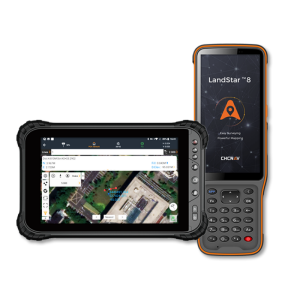
Figure 1. The i83, the 1408-channel multi-band IMU-RTK GNSS receiver, provides unparalleled productivity for GNSS measurements, stakeout surveys, and other typical construction tasks.
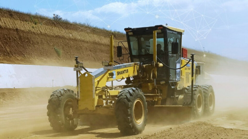
Construction Surveying and Earthmoving
Accurate measurements are essential to ensure that buildings, roads, and other structures are built according to plan. The CHCNAV's GNSS smart antennas, sensors, field controllers, and software provide surveyors with the accurate data they need to do their jobs efficiently. In addition, the CHCNAV's GNSS RTK networks can significantly improve construction project operations by providing consistent positioning accuracy for all surveying tasks across the site and between various operators, regardless of the brand of RTK rover used.
Our GNSS machine control solutions enable equipment operators to do their work efficiently by bringing significant gains in productivity, accuracy, and speed to earthmoving and grading jobs.
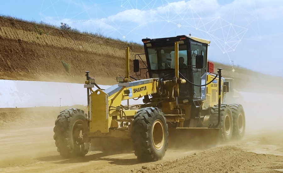
Figure 2. The TG63 (installed on the grader), a high-accuracy automatic GNSS/INS grade control system that is designed to improve the quality and efficiency of grading operations.
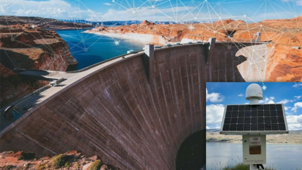
Infrastructure Monitoring
CHCNAV GNSS sensors and antennas help prevent natural disasters and enable rapid emergency response by monitoring critical infrastructure and the physical environment. Our server-based CPS RTK Network software, P5 geodetic GNSS stations, and C220GR2 GNSS antennas provide a powerful enterprise solution that delivers the highest accuracy and uninterrupted positioning and navigation services.

Figure 3. The C220GR2, a high-performance GNSS/CORS antenna with the P5 reference station, and an example of a typical application - the GNSS-based reservoir dam monitoring.
Mine Surveying
Accurate GNSS positioning is crucial in every phase of open pit mining. Highly accurate topographic information is required for the operational safety of staff and machinery and for the success of mining operations throughout the life cycle, including exploration, discovery, development, production, and reclamation. CHC Navigation offers a full range of advanced technologies to help mining companies streamline exploration and development and gain a competitive advantage.
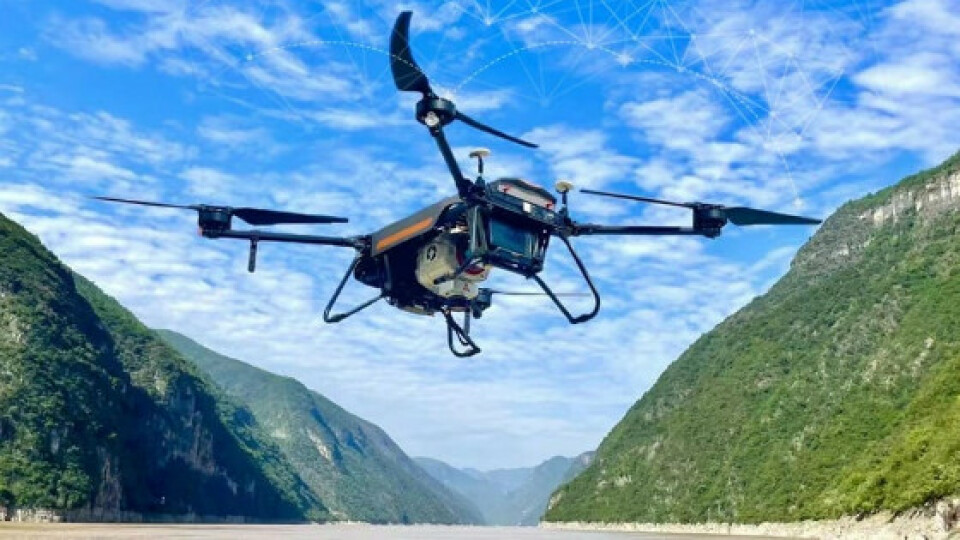
Mapping and GIS, Photogrammetry, Laser scanning
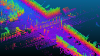
Collecting accurate GNSS data is essential for mapping, environmental planning, and urban design. Aerial surveys for 3D modeling require real-time or post-processed GNSS data for georeferencing, and high-precision GNSS systems are used to georeference point clouds generated by laser scanning and mobile mapping systems. CHCNAV offers devices designed to meet the need for highly accurate topographic information fundamental to the achievement and reliability of any project.
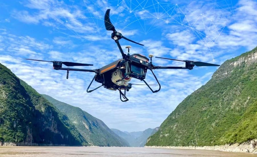
Figure 4. The BB4, a professional UAV reality capture platform, is equipped with the AlphaUni 900/1300, a long-range LiDAR system.
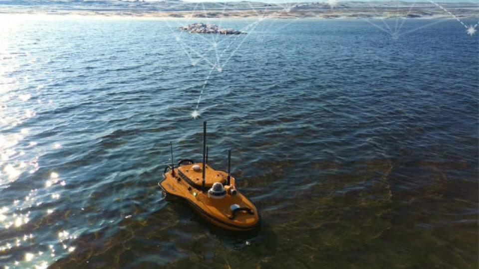
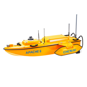
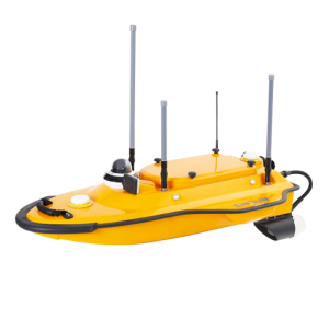
Marine Surveying
The marine survey encompasses a wide range of activities that rely on GNSS technology, including seabed exploration, tidal and current estimation, and offshore monitoring through bathymetric and hydrographic surveys. The results of these activities are critical to marine construction and navigation. CHCNAV's versatile and robust USVs can be equipped with instruments such as a single or multibeam echo sounder, GNSS RTK receiver, and other sensors. This reduces survey time, improves work efficiency, and generates high-resolution data that consistently meet the stringent requirements of hydrographic survey projects.

Figure 5. The Apache 3 USV, equipped with the GNSS IMU sensor and single beam echosounder, takes a bathymetric survey in the freezing lake water.
We offer our dealers the flexibility to choose the products that best meet the needs of their potential customers in their region. We foster trust and work towards mutual growth and success through open and frequent communication.
Send an inquiry to us to discover new opportunities now and unlock the potential for growth in your region by becoming a CHCNAV distributor!
___
About CHCNAV
CHC Navigation (CHCNAV) creates innovative GNSS navigation and positioning solutions to make customers' work more efficient. CHCNAV products and solutions cover multiple industries such as geospatial, construction, agriculture, and marine. With a presence across the globe, distributors in more than 120 countries, and more than 1,600 employees, today CHC Navigation is recognized as one of the fastest-growing companies in geomatics technologies. For more information about CHC Navigation [Huace:300627.SZ], please visit: https://www.chcnav.com/about-us/overview
Do you have questions about this product news?
Get in touch with CHC Navigation | CHCNAV, and they would be happy to answer any questions you have about pricing, suitability, availability, specs, etc.
Related articles


