
Imajing Mobile Mapping System Supporting Disaster Recovery Plan of Porto Rico
Hurricane Maria has literally devasted Porto Rico island in November 2017 with huge consequences on human lives, habitations and infrastructures.
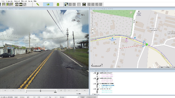
JC & Associates, a local engineering company equipped with imajing mobile mapping technology since 2015, imajbox® twin S cameras and imajview® GIS software, will support Porto Rico Department of Transportation in the realization of its disaster recovery plan. Their skills with imajing technology is a key factor in this project where the entire main road network will be surveyed to globally assess the damages, compare with existing data to define priorities for interventions and estimate the associated cost.
imajing compact end-to-end mobile mapping system is perfectly suited to the need of having a rapid and efficient solution to address this large-scale project.
Do you have questions about this case study?
Get in touch with imajing, and they would be happy to answer any questions you have about pricing, suitability, availability, specs, etc.

Related products


