
Idled Employees Collect Accurate Location Data of City Assets
As coronavirus disease 2019 (COVID-19) struck Florida, Sarasota began locking down its municipal buildings, and the daily workload of many city employees waned. City manager Tom Barwin sent out a notice to all departments looking for creative ways to productively occupy these workers.
William Rockwell, a GIS coordinator for the city, proposed idle staff be put to work collecting much-needed accurate location and attribute data on city assets. Rockwell worked out a proposal with city IT director Herminio Rodriguez. Now, municipal staff whose traditional daily work has decreased due to the pandemic are spending time on the city’s streets adding crucial data to the map.
“The financial commitment was small from the city, but the return could be huge,” Rodriguez said. “The city could start capturing this massive amount of data that it really needs.”
Rapid Workforce Transformation
Rodriguez joined Sarasota five years ago to rebuild an IT department from scratch, complete with an enterprise geographic information system (GIS). Last year, Rodriguez hired Rockwell to rebuild the city’s GIS and update its data. In the past, Sarasota had outsourced its GIS data collection, but the data was never reliable and was now outdated.
“We want to be able to make data-driven decisions, and GIS is a big component of that,” Rodriguez said.
To meet their goals of building a GIS, Rodriguez and Rockwell determined they would need to either update or re-create all the city’s information assets. They had estimated the costs to be in the hundreds of thousands of dollars in outsourced labour over the course of at least five years. But the newly available city staff would be able to perform the work for no additional charge.
Because the city had an enterprise GIS, there were also no extra software costs. The city also had a box of extra iPhones leftover from a service provider migration, which could be converted into offline data collection devices. The only cost would be for professional-grade GPS receivers to enhance the iPhones’ accuracy.
Hit the Streets
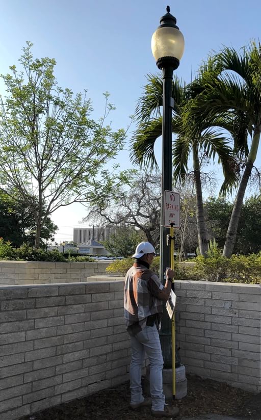
Rockwell met with city subject matter experts to decide which asset types to focus on. They prioritized data collection on city streetlights because of the numerous requests for information from outside organizations, such as Florida Power & Light Company and the Florida Department of Transportation. The team also determined that road signs would be easy to map. Working from home, Rockwell set up 14 data collection kits. Each kit consisted of an iPhone loaded with Collector for ArcGIS, the city’s mobile device management software for security, a range pole, and the Eos Arrow 100 Global Navigation Satellite System (GNSS) receiver.
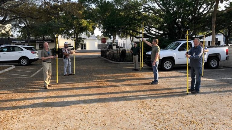
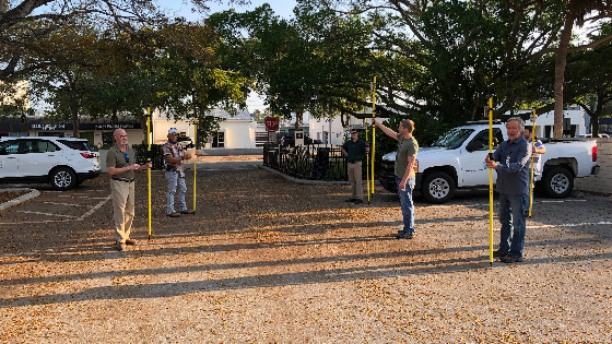
The next day, Rockwell met five city employees at the city hall parking lot for the first group training. The employees took care to follow social distancing guidelines while Rockwell explained the basic concepts of data collection. Employees practised collecting sample data so Rockwell could address any initial concerns.
Rockwell handed out reflective vests, printed maps, and markers. The printed map consisted of 28 full or partial grids of the city. This allowed members of the newly improvised data collection crew, most of them not very familiar with GIS, to easily mark off where they had collected data each day.
“Once they’re done, they text or call me, and I can give them a new quarter section to take on,” Rockwell said.
Boost for Employees in Tough Times
At the end of each day, after the workers have synced their data, Rockwell assesses the team’s progress. In the first few days, this allowed him to quickly spot any errors, such as photos not collected with the assets, and take corrective action.
Planning technician Billy Cooney had used GIS in the past, but he usually spent his time assisting senior planners, such as by measuring rights-of-way. Now Cooney is committed to spending two days per week doing field data collection. “I try to help out wherever I can,” Cooney said. “It’s nice that I have a project that gets me out and walking around, especially now that I’m working from home and socializing less.”
The extra hands are helping Sarasota accelerate its planned GIS database improvements while keeping city staff productive during the pandemic. To date, seven fieldworkers have collected data on 4,135 of the city’s 6,000 streetlights and 7,950 of the city’s 16,000 road signs. Then, they will collect data on the city’s 35,000 trees. Overall, the response to the project has been overwhelmingly positive.
“I’m thrilled the city is supporting this initiative,” Rodriguez said. “To be able to take employees doing very, very different jobs and put them in the field, this wouldn’t have been possible in a normal environment.”
“To be able to take employees doing very, very different jobs and put them in the field, this wouldn’t have been possible in a normal environment.”
Accurate Field Data Collection Components
Sarasota’s GIS coordinator William Rockwell configured the asset inventory application using Collector for ArcGIS. The app comes as part of the city’s GIS license and offers a variety of helpful data collection features, including the ability to work in disconnected environments.
Rockwell set a three-feet accuracy threshold in the app to ensure correct asset locations. Fieldworkers could take pictures of assets and see and update existing data rather than collect it from scratch.
For GPS receivers, Rockwell chose Arrow 100 Global Navigation Satellite System (GNSS) receivers, manufactured by Esri business partner Eos Positioning Systems. The Arrow 100 connects seamlessly with Collector for ArcGIS to provide submeter accuracy.
electric
utility
esri
municipality
arrow 100
gps
transportation
glonass
galileo
collector
arcgis
eos positioning systems
city
local government
council
data collection
submeter
beidou
iphone
ios
Do you have questions about this case study?
Get in touch with Eos Positioning Systems, and they would be happy to answer any questions you have about pricing, suitability, availability, specs, etc.

Related products

![3月21日-封面[1].jpg](https://cdn.geo-matching.com/voeE1ywo.jpg?w=320&s=6b3b1a0215d770f8797653e9202a8f52)


