
How OxTS Inertial Navigation Systems Improved the Accurary of Lidar and Photogrammetric UAVs and Drones
Through quick and simple Lidar integration and flexible use cases, Dronezone improved their data collection method giving their customers an improved Survey and Mapping solution. The following case study talks about how they did it and the role OxTS had in their success.
Professional-level Lidar and Photogrammetric UAVs and Drones
Dronezone are builders of professional-level UAV’s and drones, designed with you, the customer, to meet a wide set of requirements and project needs.
They equip their drones with several sensors as required for your project to meet the needs of topography, surveillance, road or traffic inspections and agricultural projects amongst others.
As well as manufacturing drones for sale, Dronezone also contract out their drones and provide Photogrammetry and Lidar scanning services.
Their family of drones include the DZ4H Orion, DZ4XL Perseus, D6 Ara and the DZX8 Heavy.
Why OxTS Inertial Navigation Systems Were Used for Improving the Accuracy of UAVs and Drones
Their existing method of collecting data was something that Dronezone identified as an area for possible improvement. Once they engaged with OxTS and spoke with our INS specialists they realised that OxTS could help them reach their goals.
After investigating several solutions, it became clear to Dronezone that there were very few commercially available products that met their needs. Of the products they did find they quickly realised they needed time to perform some level of integration with the Velodyne VLP-16 and time to test both the software and hardware – time and resources they didn’t have.
The resources aspect was critical to their decision. Most of the solutions they found and investigated focused on hardware components and typically pointed the customer to a collection of open-source software development kits that could be used to integrate the components.
The goal: Improved Accuray for Lidar and Photogrammetry Drones
Dronezone wanted to add Lidarscanning capabilities to their family of UAV/drone products.
They include Lidarand Photogrammetry sensor options for their custom build drones and wanted to be sure that they were offering all the right capabilities and accuracies to suit both the requirements and budgets of their customers.
They approached OxTS with a requirement to offer an integrated INS solution that would provide their customers with the best possible accuracy for their Lidar and Photogrammetry projects at the right cost against the final output.
They wanted a solution that was flexible and would allow them to quickly and easily produce, highly accurate, reliable point clouds.
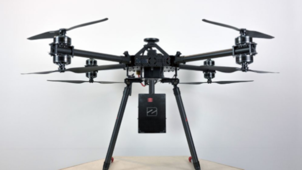
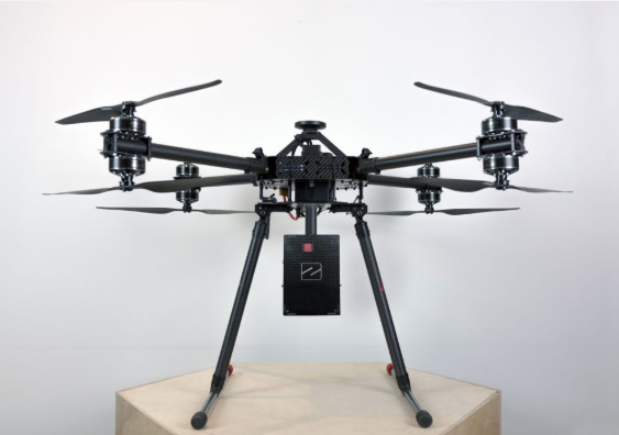
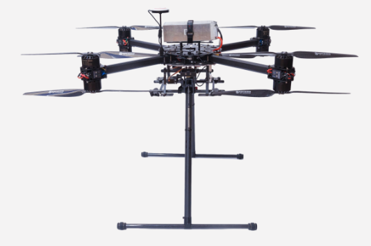
For their first project with OxTS Dronezone used the DZX8 Heavy
The Challenges: Finding an INS to combine GNSS and IMU data with a Lidar Scanner
The initial challenge Dronezone had was to find a commercially viable INS product that would allow them to combine GNSS and IMU data with a Lidar scanner, in this case the Velodyne VLP-16, to produce a georeferenced pointcloud from an aerial Lidarscan.
They understood that Lidar pointclouds are only as accurate as the trajectory data attached to each laser return, so a range of solutions is provided with the OxTS xNAV250 to help ensure the data met the requirements.
The Solution: How OxTS Compact and Lightweight INS
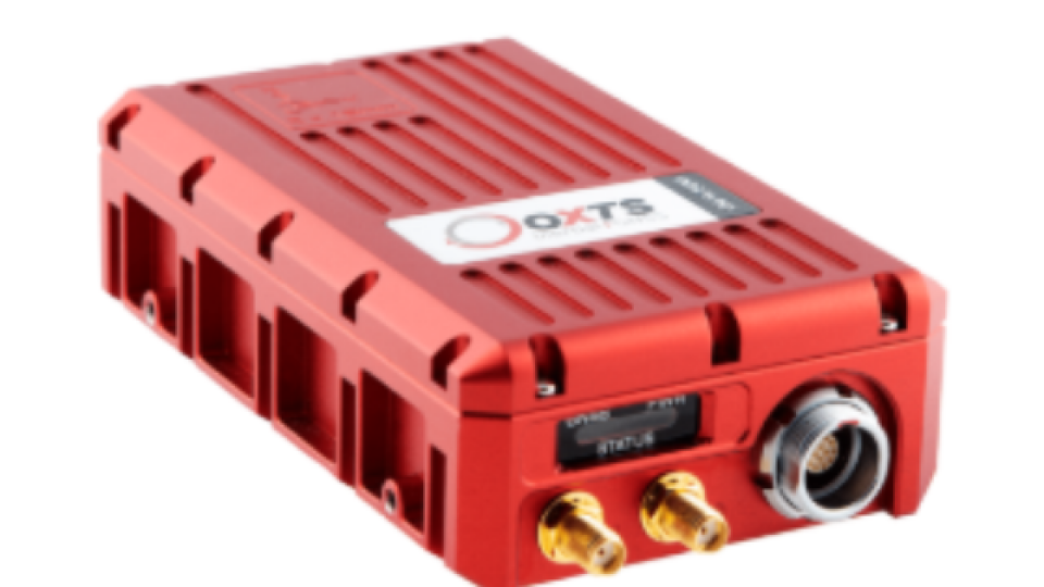
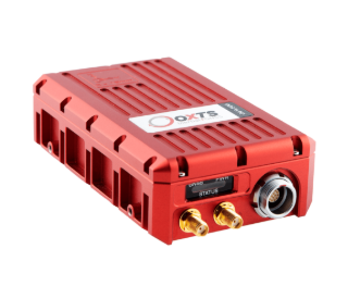
Dronezone’s chosen solution needed to be highly accurate and the xNAV250 fitted the bill perfectly as it has:
Roll/pitch accuracy – 0.05°,
Position accuracy – 0.02m RTK/PPK
Heading (2m baseline) accuracy – 0.1°
Not only did the solution need to be accurate, it also needed to have a proven track record, be easy to configure AND require no custom software development.
The Solution: How OxTS compact and lightweight INS Solutions Helped Improved the Accuracy of Lidar and Photogrammetric UAVs and Drones
Dronezone spent some time researching the survey and mapping market and made the decision that the xNAV series of products were the best fit for their requirements.
The xNAV product series is a compact and lightweight INS solution specifically designed for the drone and UAV market. Whilst the form factor is small, the performance is anything but.
For Dronezone, the most important feature of the xNAV product is that it integrates seamlessly with Velodyne Lidar. However, the advanced features available with the xNAV250 also helped make their decision that much easier. With a guaranteed pitch/roll accuracy of 0.05°, a 0.1° heading accuracy and less than 2 cm positioning accuracy, even in difficult GNSS environments, Dronezone felt that the xNAV250 would be able to ensure accuracy of data – another key requirement for Dronezone AND their customers.
Thanks to OxTS’ VLP-16 hardware integration guide and a beta release of OxTS Georeferencer (prior to March’s v1.0 full release), Dronezone were able to build their hardware and software workflows up with ease as soon as they received their xNAV delivery.
They also used the NAVsuite software to post-process the navigation data which utilised the trademarked tight-coupling technology gx/ix™.
The OxTS Difference
The gx/ix™ technology is made up of OxTS’ own RTK/PPK navigation processing engine, as well as a tightly-coupled integration of the GNSS and IMU, which combine to provide centimetre-level position accuracy and get much improved performance in GNSS obstructed areas.
OxTS have designed the xNAV range of products to integrate seamlessly with the Velodyne VLP-16, and other Lidar, by designing a flexible array of connector interfaces to connect the devices and providing onboard storage within the INS to record and store the Lidarand navigational data; thus reducing the weight of the payload in removing the necessity for an additional onboard computer and providing a simple way to post process your data.
After working with OxTS on this project, Dronezone found OxTS to be very easy to work with. All their support requirements were picked up quickly and responses very helpful. During the process Paris Austin, the OxTS Business Manager for Survey and Mapping was always on hand to help. Dronezone found him to be very patient and able to solve most of their issues himself.
Implementations
The implementations of the solutions were very successful, although this did progress differently than first planned. Due to some of the constraints of a drone environment, there were several physical implementation issues such as cabling, antenna placement, physical integration of the xNAV & VLP-16 and mounting of the final product that Dronezone had to overcome.
To overcome some of these issues Dronezone made the decision to develop three versions of their solution; a handheld/backpack version, a car mount version and finally a drone mounted version. A ‘plug-and-play’ mounting mechanism allowed Dronezone to share the same xNAV and VLP-16 module.
The Results: What was the final outcome?
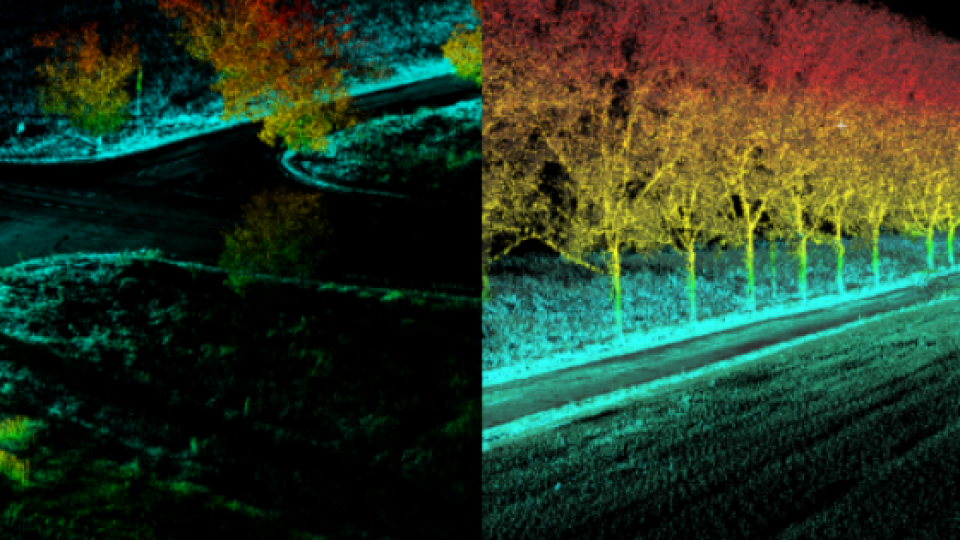
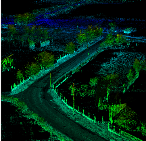
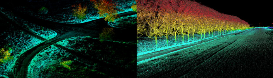
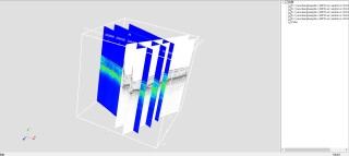
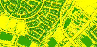
Dronezone tested all solutions in multiple scenarios. All were able to achieve highly accurate, georeferenced pointcloud output.
The first project that Dronezone undertook was to map 45 km of road. Using their previous method this would have taken Dronezone approximately five days. With the xNAV250 and VLP16 they were able to reduce this by over 50% to less than two days, whilst simultaneously gaining superior accuracy and a true 3D representation.
The ability to use the product in several different ways will not only provide Dronezone and their customers with a much more flexible, efficient way of collecting data, it will help improve operations and save money.
“The ability to use the product as a handheld unit, car mounted or drone mounted solution allows our customers increased flexibility and significant cost savings”
Nora Jurca, Business Development Manager – Dronezone
It is this flexibility that has really helped OxTS stand out. As the xNAV can be used in a number of ways, it has meant that Dronezone and their customers are no longer limited to terrain restrictions, size of roads or accessibility which has meant that they have been able to collect more data and greatly improve the quality of the pointcloud output.
This increased accuracy has opened many more use cases and potential revenue streams for Dronezone including combining Photogrammetry with Lidarpointclouds for real life 3D models. They can also now serve many different clients in many different industries using Lidar generated 3D models.
The simplicity of the integration and connectivity of the two devices made this a simple decision for Dronezone in order to reduce complexity and provide a quick and seamless build for each customer.
OxTS also provides their NAVsuite software suite, licence-free with each device, once again providing a cost-effective solution for Dronezone customers to review, produce and export their flight data.
Do you have questions about this case study?
Get in touch with Oxford Technical Solutions - OxTS, and they would be happy to answer any questions you have about pricing, suitability, availability, specs, etc.

Related products


