How CHCNAV Playing an Active Role In Optimizing Mining Operations and Topographic Mapping With UAV Lidar ?
Why Lidar survey is the go-to solution for optimizing mining operations? Traditional measurement methods mainly use GNSS, total station, and other equipment, requiring surveyors to go to the site to perform the measurements, but it is typically not safe and time-consuming. In addition, the data results cannot be visualized globally; they are just represented by several single 3D measured points, which leads to difficulties in meeting the digital requirements of modern mines for rapid updates. But UAV Lidar solutions can help overcome the challenging topography, hazardous conditions, and other typical mine site issues.
Why Lidar Survey is the Go-to Solution for Optimizing Mining Operations?
Mines are in constant production, resulting in an ever-changing terrain, and therefore require the collection and processing of large amounts of information with great accuracy. In the case of coal or iron ore mines, inaccurate measurements result in inefficient operations and can even affect the outcome and quality of the project.
Traditional measurement methods mainly use GNSS, total station, and other equipment, requiring surveyors to go to the site to perform the measurements, but it is typically not safe and time-consuming. In addition, the data results cannot be visualized globally; they are just represented by several single 3D measured points, which leads to difficulties in meeting the digital requirements of modern mines for rapid updates. But UAV Lidar solutions can help overcome the challenging topography, hazardous conditions, and other typical mine site issues.
Light Laser Detection and Ranging (Lidar) is one of the most cutting-edge technologies in the field of surveying and mapping today. Installed on a drone for mine surveys, it allows measuring the three-dimensional coordinates of objects on the ground, penetrating the vegetation and applying a point cloud filtering method to generate a high-precision DTM. Aerial surveying eliminates safety concerns for on-site surveyors, and it takes only minutes to hours to complete the measurement of the entire site, significantly improving production efficiency.
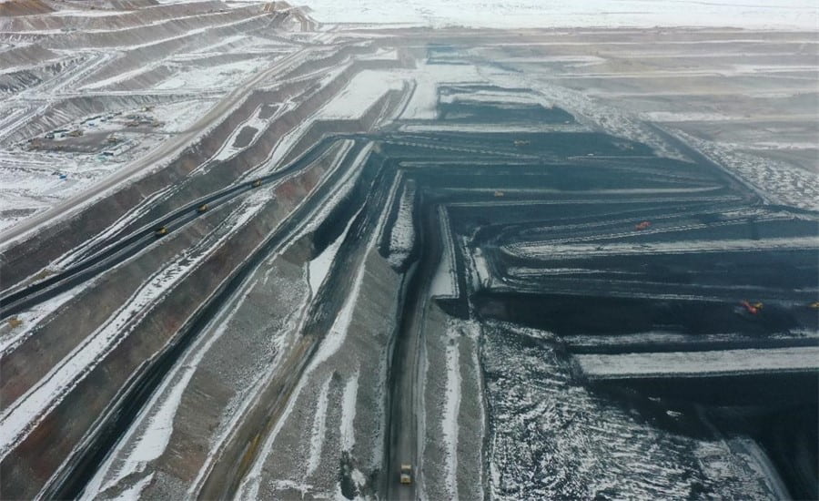
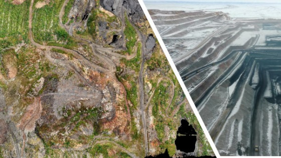
Figure 1. Aerial view of the mining site.
The case study was carried out in a typical mine site environment to produce an actual three-dimensional model of the current site, replacing the typical two-dimensional CAD drawings and photos. The BB4 UAV, AlphaAir 450 Lidar scanner and CoPre software from CHCNAV and Global Mapper software from Blue Marble Geographics were used in this project.
How to Perform a Lidar Survey of a Mine Site in 3 Steps?
Step 1. Perform the airborne survey with a high-performance package, such as CHCNAV's BB4 UAV and AA450 Lidar.
- The BB4 UAV is a high-end unmanned aircraft system designed for professional industrial applications. The hull with pre-installed arms and antennas reduces the time required for setup, making the platform ready for use in just 2 minutes with the option to install various cameras and Lidar with up to 7 kg payload.
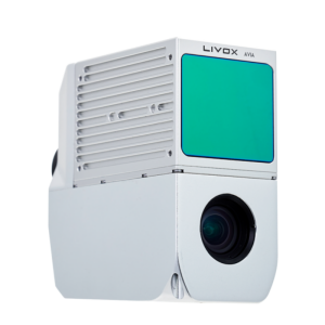
- AlphaAir 450 is an airborne Lidar system with a built-in high-precision IMU, GNSS, advanced 3D scanner, and industrial-grade 26 MP camera, used for mining surveys, power line inspection, topographic mapping, agricultural and forestry surveys, and more. This all-in-one, lightweight, rugged and easy-to-use system offers high precision capabilities at an affordable price point. It is bundled with the CoPre, a powerful and accurate 3D point cloud processing software.
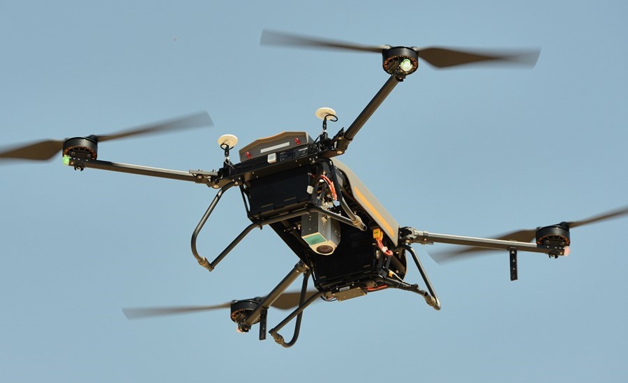
Figure 2. The BB4 UAV and AA450 Lidar scanner are performing the aerial survey.
Step 2. Data processing to generate the 3D point cloud of the site.
Transfer the raw laser and camera data, merge it with INS trajectory using CoPre software and generate the files in LAS format in the required coordinate system.
- CoPre is a desktop software, that provides instant access to all raw data from CHCNAV Lidar systems. CoPre supports one-button click automated processing of point cloud, picture georeferencing, point cloud colourization, depth map, and results in output. For experts who value the quality of data, CoPre provides advanced processing. It can solve the layering problem of multiple point clouds, improve relative accuracy by an efficient strip adjustment algorithm, and improve the absolute precision of the point cloud with GCPs.
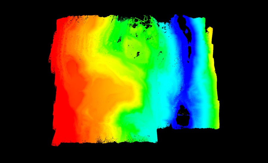
Figure 3. Point cloud of a part of mining site generated in CoPre Software.
It is also possible to colourize the point cloud with true colours using CoPre’s one-click shading function during processing. The image processing module can automatically organize photos and colour point clouds in the background.
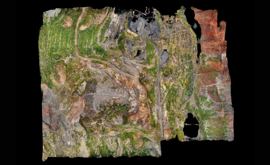
Figure 4. Mining site point cloud with the RGB colourization made in CoPre Software.
Step 3. Calculate the mine site volume using the Global Mapper software.
Import of point cloud data, extraction of ground point cloud parts, selection or import of range lines to be measured, generation of volume calculation results and report output.
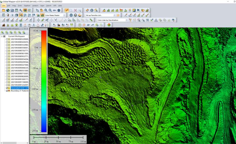
Figure 5. The volume calculation process for the mining site in Global Mapper software.
Table 1. The final parameters of the mining site area, extracted from the report
|
Total Volume |
545. 27424 m3 |
|
Total Enclosed Area |
0.004137 km² |
|
Total Length Perimeter |
267.32 m |
Mine site managers praise the value of UAV Lidar surveys in their day-to-day operations
The adoption of drone-based 3D data acquisition technologies is now a necessary element in optimizing mining operations. CHCNAV's UAV Lidar solutions play an active role in the digitizing of mine maintenance and operations by providing access to efficient acquisition and processing of multi-source 3D spatial data. CHCNAV's Mobile Mapping Division makes this digitization process accessible and affordable by merging technologies, from millimetre-precision GNSS sensors to ultra-precise long-range scanners, for massive 3D data acquisition over small or large areas.
Do you have questions about this case study?
Get in touch with CHC Navigation | CHCNAV, and they would be happy to answer any questions you have about pricing, suitability, availability, specs, etc.


