GNSS/INS Technology for Mobile Mapping Systems
Mobile mapping refers to the collection of geospatial data using mapping sensors mounted on moving platforms such as cars, marine vessels or airplanes. Mobile mapping systems utilize GNSS technology combined with Inertial Navigation Systems (INS) to enable the rapid and accurate calculation of continuous 3D position, velocity and attitude (roll, pitch and yaw). It is critical that all GNSS position and INS attitude data is time synchronized to the mapping sensors to enable the direct and precise mapping of landscapes, objects or features.
What is Mobile Mapping?
Mobile mapping refers to the collection of geospatial data using mapping sensors mounted on moving platforms such as cars, marine vessels or airplanes.
Mobile mapping systems utilize GNSS technology combined with Inertial Navigation Systems (INS) to enable the rapid and accurate calculation of continuous 3D position, velocity and attitude (roll, pitch and yaw). It is critical that all GNSS position and INS attitude data is time synchronized to the mapping sensors to enable the direct and precise mapping of landscapes, objects or features.
NovAtel’s tightly coupled SPAN® GNSS/INS technology is utilized by many in the mobile mapping industry to ensure that the highest quality GNSS + INS data is available for reliable, highly accurate 3D position, attitude and velocity measurements at data rates up to 200 Hz.
Waypoint® Inertial Explorer® is well integrated with NovAtel SPAN products and maximizes the performance of your GNSS/INS hardware by ensuring you get the position, velocity and attitude accuracy your application requires. Inertial Explorer also supports processing with third party IMU data and comes preconfigured with aerial, ground vehicle, pedestrian, and marine processing profiles. Inertial Explorer supports an external DMI, heading updates, external coordinate and velocity updates along with gyro stabilized mounts.
Land Applications
- Corporate asset and infrastructure management
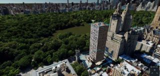
- 3D imagery for online mapping tools, street level views and mobile apps using map data
- Road mapping and highway facilities management by local and federal governments
- Accurate assessment of road or highway conditions for emergency response planning and day-to-day travels
- Military and defense applications that survey changes in landscapes or movement of assets or troops
- Rail and utility corridors
- Indoor mapping
Technology
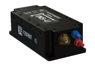
- NovAtel’s SPAN® technology couples NovAtel’s GNSS receiver technology with an Inertial Measurement Unit (IMU). We offer a variety of IMUs to provide the accuracy required by each application. In land mobile mapping applications varied degrees of accuracy and IMU grades would be needed.
- Maximize the performance of your GNSS/INS hardware by getting the position, velocity and attitude accuracy your application requires with assistance from Waypoint post processing tools.
- Integrate NovAtel’s SPAN technology with wheel sensors, cameras, LiDAR and other sensors to achieve the best results.
-
NovAtel CORRECT™ provides a single source for GNSS correction services and support. As a comprehensive NovAtel supplied solution it makes it easy to achieve the best possible position. Centimetre, decimetre, and metre-level solutions are available with corrections delivered by TerraStar.
Airborne applications
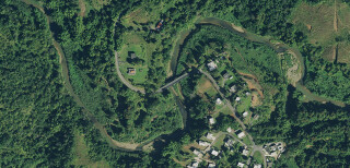
- Online mapping tools incorporating aerial imagery
- Aerial survey
- Pipeline surveys
- Mining (digital terrain models, deformation monitoring, topographic maps, exploration, mine design, volume measurements etc.)
- Aerial fire detection/fighting
- Environmental monitoring and protection
- Disaster relief and prevention
- Search and rescue
- Urban planning
- Geography and cartography
- UAV + LiDAR mapping
Unmanned Aerial Vehicles (UAV)
- Surveillance/security
- Agriculture – crop management
- Urban planning
- Search and rescue
- Disaster relief and prevention
- Mineral exploration – oil and gas, mining, geology
- Online mapping tools incorporating aerial imagery
Technology
- NovAtel’s SPAN® technology couples NovAtel’s GNSS receiver technology with an Inertial Measurement Unit (IMU). We offer a variety of IMUs to provide the accuracy required by each application. In airborne mobile mapping applications higher grad IMUs are typically needed. Smaller all-in-one systems or OEM can be used for UAV applications.
- Maximize the performance of your GNSS/INS hardware by getting the position, velocity and attitude accuracy your application requires with assistance from Waypoint post processing tools.
- Integrate NovAtel’s SPAN technology with cameras, LiDAR and other sensors to achieve the best results.
- NovAtel CORRECT™ provides a single source for GNSS correction services and support. As a comprehensive NovAtel supplied solution it makes it easy to achieve the best possible position. Centimetre, decimetre, and metre-level solutions are available with corrections delivered by TerraStar.
Marine applications
- Hydrographic survey – seafloor mapping, underwater detection/exploration, bathy LiDAR
- Dredging
- Search and rescue operations
- Offshore positioning/drilling operations
- Accurate assessment for pipeline routing
- Mapping and monitoring of underwater habitats
- Current and sediment monitoring
Technology
- NovAtel’s SPAN® technology couples NovAtel’s GNSS receiver technology with an Inertial Measurement Unit (IMU). We offer a variety of IMUs to provide the accuracy required by each application. In marine mobile mapping applications higher grade IMUs are typically required.
- Enclosures, cards and MEMs IMUs have all been integrated at the OEM level.
- Maximize the performance of your GNSS/INS hardware by getting the position, velocity and attitude accuracy your application requires with assistance from Waypoint post processing tools.
- Integrate NovAtel’s SPAN technology with multi-beam, single-beam, side-can sonar and other sensors to achieve the best results.
- ALIGN heading solutions are required to generate precise positioning and heading for the hydrographic market.
- The ability to input INS updates for submerged applications using a Remotely Operated Vehicle (ROV) or an Automatic Underwater Vehicle (UAV) providing accurate, real-time positioning.
Do you have questions about this article?
Get in touch with NovAtel, and they would be happy to answer any questions you have about pricing, suitability, availability, specs, etc.
