Extract Building Corners Fast and Precise using X-Ray Functionalities
Karst is a beautiful region of Slovenia, most famous for a long list of natural and cultural heritage wonders. Bora-swept region is home to a unique subterranean landscape, like the famous Postojna Cave and the Škocjan Cave, Lake Cerknica, one of the largest intermittent lakes in Europe, Lipizzaner horses, red wine and very specific architecture.
PROJECT DESCRIPTION
Situation
An Architecture company was contracted to make a survey map of the rustic villa for the purpose of establishing cadastral boundaries and Historical Restoration of the Villa with several courtyards and external walls, very common for karst architecture. Outcome data needs to allow complete 1:1 replication of original architecture.

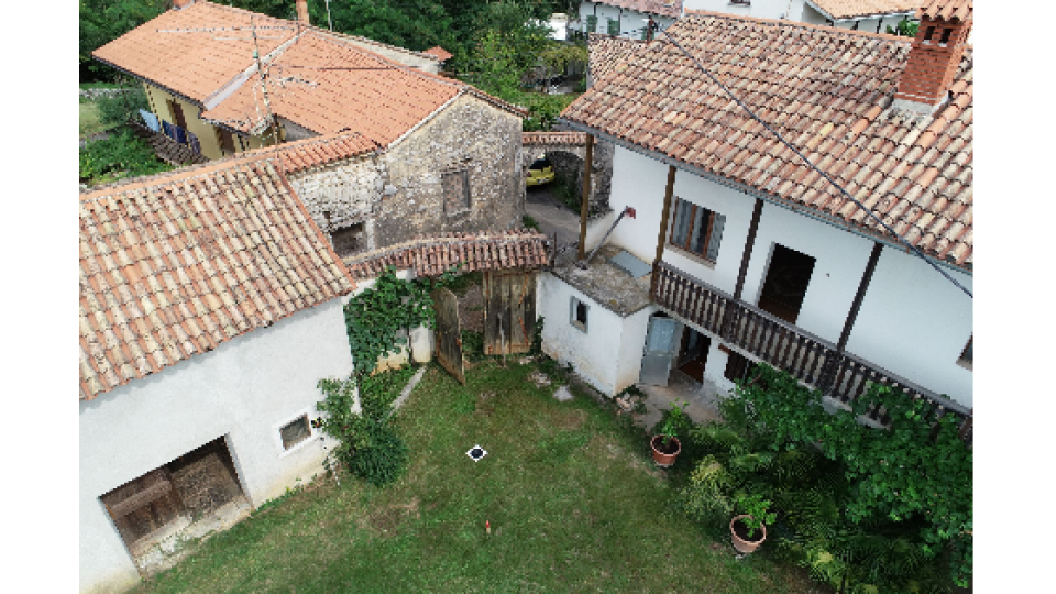
Image 1: Rustic Villa
The problem
Several courtyards and crocked old walls are making this project extremely complex as it is difficult to measure and collect all the appropriate number of points needed for high-quality data which would later allow proper restoration and documentation.
Taking a traditional approach with a total station was extremely time-consuming and complex (due to the number of points measured and the fact that the total station needs to be moved around) and it did not provide enough quality data and the level of accuracy that was expected.
Approach
Due to the challenges, they had with accuracy and the number of points to be measured, the architectural company decided to try for the first time, a completely new approach for them, so they contacted the 3Dsurvey team to help them with completing the survey map with the use of a drone and 3Dsurvey software. For the purpose of this project, Marko and Vid (3Dsurvey Team) went on the field together with the architect, to take pictures of the location and Villa with a drone This allowed them to process all the data in the office later on.
Solution
In only 2 hours, the team has taken 617 images in 3 flight missions with Phantom 4 RTK. The first mission was a top-down mission to secure good images of the rooftops. In a second mission, they chose “double grid” used to take images from multiple sides and suitable for flying closer to objects so it can capture more vertical details. The third mission was done in manual mode to collect additional images of the critical parts of the house for better detail.
To achieve a survey-grade accuracy 5 special 3Dsurvey Ground control targets were used which are automatically located on images during the processing stage. On top, to properly and accurately measure building corners, a special function called X-RAY was used, which allows user to draw walls without even measuring them.
With this, work on the field was completed.
Project tools and specs:
Drone: DJI Phantom 4 RTK
Number of images: 617 images (4 flight mission; 3 using DJI flight app, 1 manual)
area of interest: 150m x 120m.
The field survey took 2 hours. 2 persons involved
Location: Village Sveto, Slovenia
Processing
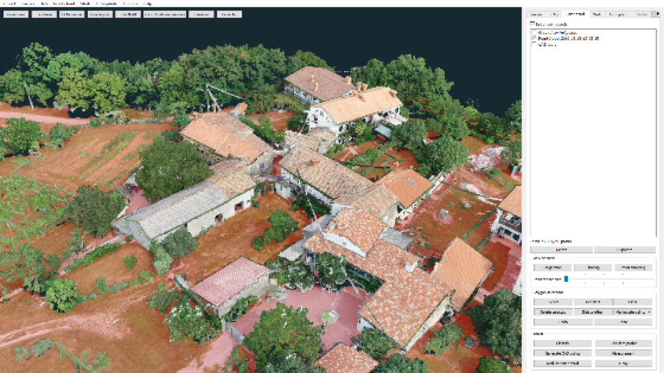
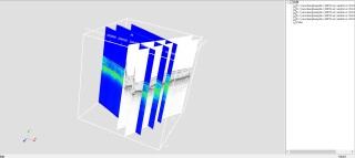
The processing part is always done in the office. For this project, It took less than 1 hour for images and telemetry to be imported into the software. Import was followed by the first part of the workflow which is the orientation step, where the user needs to orientate automatically recognised ground control points with GNSS measurements. This is all that needs to be done for the reconstruction step which creates a highly detailed 3D point cloud model.

Image 2: 3D Point Cloud
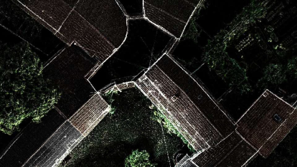
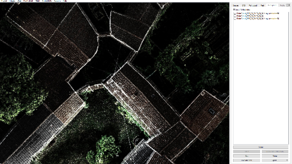
Creating an orthophoto map of the walls is the next step in the process. Instead of manual line drawing and trying to find the correct points which follow the wall lines and corners, the team used the latest feature of 3Dsurvey called X-RAY. This feature automatically creates an orthophoto map of the walls, by recognizing groups of vertical points and identifying them as walls of the building. X-RAY makes walls visible on the map through the rooftops and it can be later draped on the digital terrain model and boundaries are simply drawn with CAD tools in no time and effort, which decreases the amount of time needed to draw the lines by 10-fold and also increases the accuracy of the project.
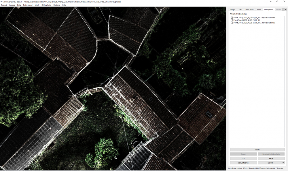
Image 3: Orthophoto map with visible walls
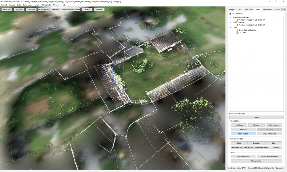
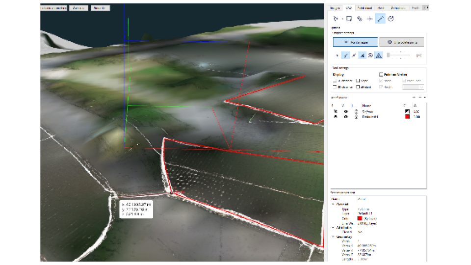
Image 4: Digital terrain model with X-ray image drape on to it

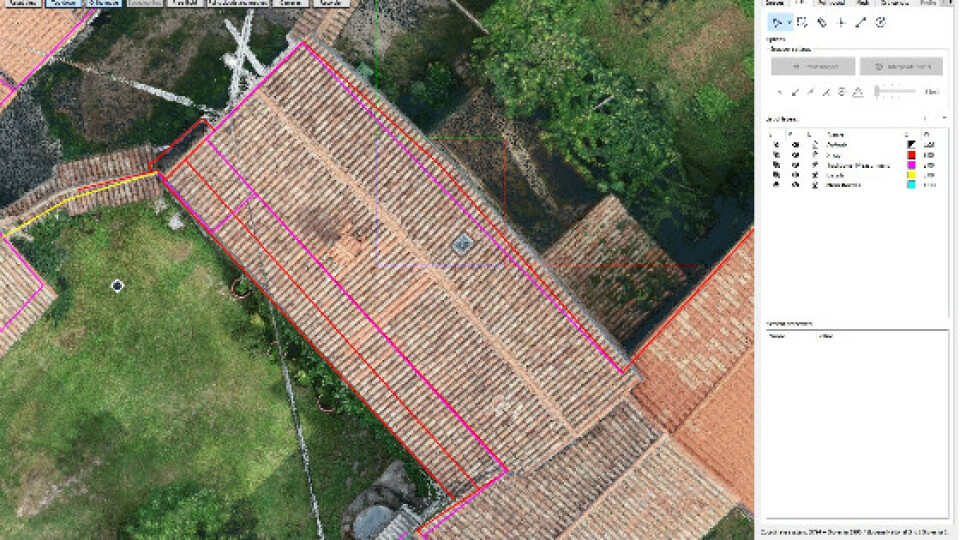
Imaqe 5: Comparison between traditional (purple) and X-ray (red) measurments
Results
- 3D model in OBJ format, standard 3D format
- Orthophoto map in JPG and KMZ ready for Google Earth
- CAD lines in DXF
Benefits
- 10 x Faster and easier drawing of walls and corners for survey map
- No need for additional measurements with a total station on the field
- More accurate compared to the traditional approach with a total station.
Do you have questions about this case study?
Get in touch with 3Dsurvey, and they would be happy to answer any questions you have about pricing, suitability, availability, specs, etc.


