
Esri + Eos
Mobile GIS Workflows Reach Maturity Collector for ArcGIS Leaps Ahead with RTK Workflows and Automatic Satellite Metadata Capture Originally published in the Esri Water and Wastewater Newsletter in 2017.
Read the original article with images here on page 9.
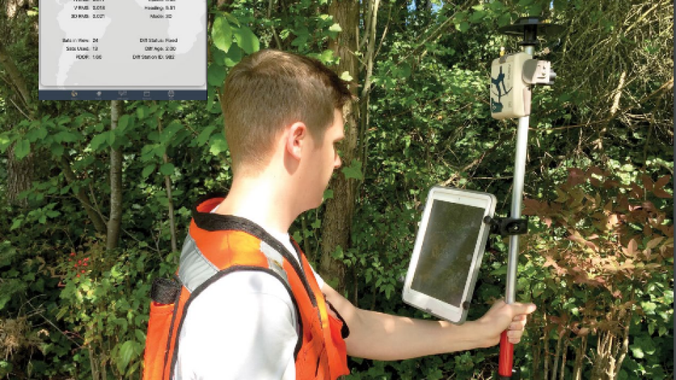
There are many white papers highlighting the cost-saving benefits of switching from collecting field data using a handheld Global Navigation Satellite System (GNSS) unit running ArcPad software, taking photos with digital cameras, and writing on paper data sheets to the modern workflow of utilizing a mobile GIS solution. As a former project manager of field surveys, I can attest to these budget and time savings, and I can definitively say that ruggedized iPads paired with Eos Arrow GNSS receivers for mobile GIS workflows make for happier field crews.
This mobile GIS workflow uses a tablet or smartphone running Esri’s Collector for ArcGIS software paired with an external Bluetooth GNSS receiver to record new field data viewed on a large screen (with aerial imagery easily available), monitor assets, and even capture photos linked directly to each data point. There is no need for paper data sheets, a digital camera, or a handheld GNSS unit. A mobile GIS system also takes advantage of real-time data transfer from the field for sharing data with coworkers and management via cellular service.
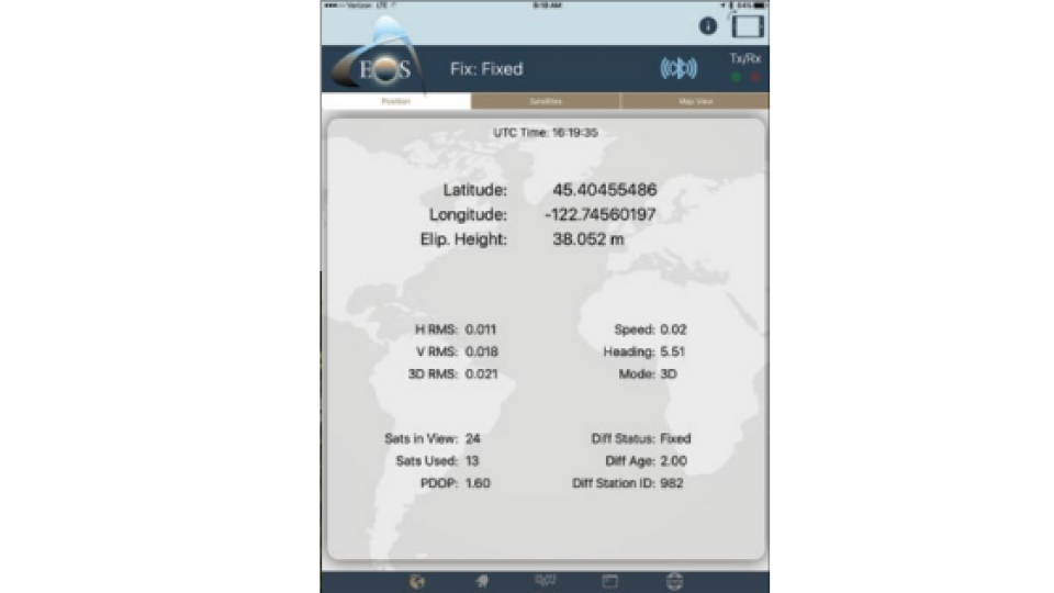
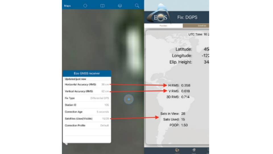
The Missing Piece of Mobile GIS and High-Precision GNSS What has been lacking from nearly all mobile GIS apps available today is the ability to record the Bluetooth GNSS receiver’s metadata with each data point collected. Metadata includes everything from the number of satellites used at the time data was electronically collected to the fix type (GPS, DGPS, RTK Fix/Float) and estimated horizontal and vertical accuracies. This location information can be viewed on a mobile device via the GNSS receiver’s proprietary app but not recorded.
The typical workflow for field users has been to flip back and forth between the Collector app and the GNSS receiver’s proprietary app to view their estimated accuracy. Estimated accuracy is important to know, since most fieldwork is required to have accuracy levels ranging from submeter and subfoot to centimeter, depending on whether users are delineating a wetland, trying to locate a buried asset, or recording an asbuilt pipeline before it is covered over. If their particular work requires recorded estimated accuracy values with each point, then they would have had to handwrite the estimated accuracy displayed in the GNSS receiver’s proprietary app and then flip back to Collector and collect their data. This workflow is very cumbersome and isn’t always accepted by the field surveyor’s management or clients. Thus, the problem of not being able to automatically record values like accuracy has forced some people to stick with old software and workflows.
GNSS
ArcGIS
esri
GIS
Collector for ArcGIS
GPS
Mobile GIS
High-precision
high-accuracy
field data collection
Do you have questions about this article?
Get in touch with Eos Positioning Systems, and they would be happy to answer any questions you have about pricing, suitability, availability, specs, etc.

Related products


