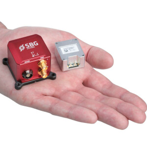
Ellipse2-D integrated in the BOE UAV-based LiDAR Solution
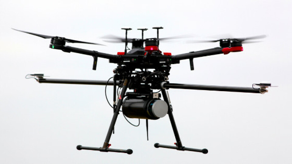
BoE Systems entered the mobile mapping industry with the ELV16 Scanner, the most compact aerial-based LiDAR solution on the market. The ELV16 Scanner is equipped with a Velodyne LiDAR sensor and an SBG Systems Ellipse2-D inertial navigation sensor.
ELV16 Scanner: a versatile, economic, and smart solution for LiDAR data acquisition.
The ELV16 Scanner includes a complete drone-based aerial LiDAR data collection and control system. The ELV16 Scanner’s success centers around a superbly integrated Velodyne LiDAR sensor, Ellipse2-D inertial navigation system, GNSS antennas, an onboard computer, communication equipment, and a dedicated power supply. All securely mounted to a DJI Matrice 600 Pro UAV for simple, safe, and effective access to the work site.
The ELV16 Scanner is remotely operated through a simple yet effective, user-friendly interface. Featuring a robust suite of continuous monitoring capabilities, the operator can control and monitor the streaming data acquisition from start to finish with a few taps on a smart device or clicks on a laptop.
“You can start your data acquisition at take-off, or you can start the data collection when the UAV is right on top of the specific zone to survey, and then stop it whenever you want” declares Jason Littrell, founder of BoE Systems.
ELLIPSE2-D for UAV Motion Compensation and Point Cloud Georeferencing
Ellipse2-D is a Dual Antenna Inertial Navigation System which embeds an RTK GNSS receiver with post-processing capabilities. It is widely used in the mobile mapping industry because of its smart balance of accuracy, weight and price.
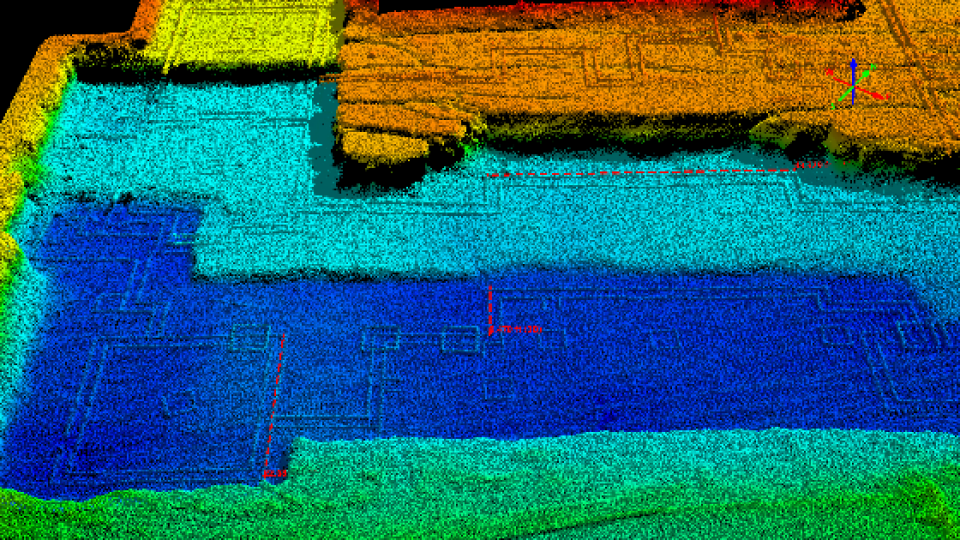
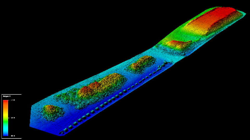
The Ellipse2-D provides roll, pitch, GNSS-based heading and centimeter-level position. It is used to compensate for the UAV motion, and thus to orient and geo-reference the point cloud generated by the LiDAR sensor. GNSS-based heading makes it immune to magnetic field, so the UAV can get close to power lines without disturbance.
“We heard some good reviews about SBG sensors being used in the surveying industry, so we conducted some tests with the Ellipse2-D and the results were exactly what we needed” concludes Jason.
Do you have questions about this case study?
Get in touch with SBG Systems, and they would be happy to answer any questions you have about pricing, suitability, availability, specs, etc.

Related products


