
Economical GNSS Chipset for Application in Structural Health & Deformation Monitoring Solution
Since GNSS technology has been widely used in the field of deformation monitoring and has been a high-cost problem, a dual-frequency, multi-system, low-cost GNSS chip solution is proposed for this field. In this paper, the feasibility of this solution in the field of deformation monitoring is verified by comparing it with mainstream multi-frequency multi-system high-precision receiver and simulating common deformation monitoring environments. The test results show that this solution can guarantee the accuracy and effectiveness of positioning, while its low cost, low power consumption and small size means it has high value for engineering project applications.
By Nander Yang & Richard Pan,
Hi-Target International Group Limited
1 Introduction
Deformation monitoring provides real-time monitoring of the position, space and deformation of an object. Common deformation monitoring includes landslide monitoring, mine monitoring, road and bridge monitoring, dam monitoring, construction monitoring, etc. It has been developed for a long time in foreign countries. Now, with the continuous development of China’s economy and technology, the market for deformation monitoring is getting bigger and bigger, and deformation monitoring technology is also increasing rapidly [1]. Among the many deformation monitoring solutions, GNSS technology is the most widely used and important. Compared with other technical schemes, the GNSS scheme has many advantages. These are the following:
① High accuracy, in the case of a short baseline, it can be accurate up to a millimeter.
② Unaffected by the weather, visibility, etc.
③ Large monitoring range and low data fluctuation [2].
At present, China has world-class infrastructure and manufacturing power, which means there are trillions of projects carried out every year. In 2019 alone, about 1.8 trillion yuan of road construction was completed [3]. A large number of roads and bridge monitoring equipment and programs are often needed as a result to prevent the loss of roads and bridges due to natural disasters, illegal overloading, etc. Conventional high-precision GNSS receivers have been widely used in practical projects, but their high price and power consumption have led to high engineering application costs.
However, with the development of GNSS technology, as well as product hardware and software, many low-cost chip-based solutions have gradually appeared.
In this paper, the feasibility of a low-cost dual-frequency, multi-system GNSS chip solution for deformation monitoring applications will be validated by various aspects.
2 Affordable GNSS chipset solution
2.1 Affordable GNSS chipset solution supplier camp
At present, several manufacturers provide high-precision GNSS chipset solutions in the market, such as Ublox, Septentrio, Broadcom, etc., and a number of domestic companies, such as Unicorecomm, Allystar, MTK, Techtotop, etc. The characteristics of being small, low cost, and having low power consumption has been brought about by the use of chipsets, which are rapidly driving the development of GNSS receivers.
2.2 Ublox-F9P solutions
The low-cost receiver used in this paper is the ZED-F9P chip module from Ublox. The chip-based design makes it a small, low-cost, low-power device, and the low-cost dual-band multi-system solution has had a revolutionary impact on traditional multi-band, multi-system, high-precision boards. The F9P module, which has 184 channels and supports dual-band GPS, GLONASS, GAL, BDS, QZSS systems with RTK positioning accuracy of 0.01m+1ppm, has met the needs of deformation monitoring.
2.3 Hardware architecture analysis for a low-cost solution
The low-cost solution tested in this paper is a dual-band multi-system GNSS receiver from the Hi-target company, with built-in F9P module, Cortex-A5 processor and power consumption that is less than 2.5W, with an embedded Linux operating system and web interface, built-in dual spiral air antenna, and 4G communication module. The overall size is 65*65*165mm and the cost is only 1/4 of a similar multi-band, multi-system receiver. It is a real low-cost, low-power GNSS receiver.
3. System principle analysis
3.1 Monitoring platform framework
The receiver sends international RTCM3.3 format differential telegrams via standard TCP Client protocol to the server, which is the Hi-target company's real-time monitoring platform. The communication link between the receiver and the server is a 4G network communication. 3.2 Data-solving strategy
At present, there are two common GNSS-based techniques in the field of deformation monitoring. One is the static relative positioning technique based on GNSS [5]. A GNSS receiver is set up on a known point and the other on the monitoring point, and they simultaneously collect their observation data for the baseline solution, which usually requires continuous observation for 1~3h or even longer to get highly accurate results. Static relative positioning technology has been the most important technology in the field of deformation monitoring due to it having the advantages of high precision and high reliability. The other technique is GNSS-based rapid positioning technology. The most common is called RTK (Real-Time Kinematic), which is a real-time dynamic differential positioning technology based on carrier phase observations. This can solve the three-dimensional coordinates of a monitoring point in a specified coordinate system in real-time by setting up one of the GNSS receivers on a known point as a reference station and another GNSS receiver on the monitoring point. The reference station then transmits RTCM (Radio Technical Commission for Maritime Services) differential correction data to the monitoring station in real-time through either a wired or wireless network, and the monitoring station can quickly converge to centimeter-level accuracy within a few seconds. Because of its rapid convergence to centimeter accuracy, it is widely used to monitor and provide early warnings of potential or sudden geological disasters, such as landslides and mudslides.
In the subsequent experiments in this paper, the performance indicators of low-cost GNSS receivers will be analyzed by using these two monitoring techniques.
4 Experiment design and analysis
The experiments will make an objective assessment of the suitability of low-cost receivers for deformation monitoring, and scrutinize three aspects: static data quality, internal compliance accuracy, and the actual monitoring effect.
4.1 Experiment 1: Comparison of the quality of long-term static data
To make the experiment more convincing and controlled, a professional CORS split receiver with a 3D choke antenna built into the BD970 motherboard from Trimble as a comparator for this experiment. This experiment introduces the best-performing scheme in the high-precision field as a reference, and aims to make the results fair and objective.
1. Trimble receivers and low-cost receivers were set up in the same open environment for long periods to collect raw static observations with a sampling time of 10 hours and a sampling frequency of 1s. The data were analyzed afterward using relevant tools, such as rtkLib. In this experiment, the quality of static data will be evaluated by scrutinizing three aspects: calendar element integrity, search capability, and signal-to-noise ratio (SNR). Epoch integrity: Both receivers performed flawlessly. No epoch data was missed during the 10 consecutive hours of acquisition, and the intact epoch data was the basis of the solution.
2. Satellite search capability: As shown in Figure 4, the number of satellites searched by the low-cost receiver ranged from 18 to 29, and the number searched by Trimble receivers ranged from 26 to 35, with a difference of 6 to 8 satellites. The results of the experiment show that the satellite search capability of low-cost receivers is indeed weaker than the capability of Trimble receivers. However, from the perspective of monitoring, the 18 to 29 satellites already meet the daily positioning and decoding needs.
Signal-to-noise ratio analysis: SNR mainly represents the ratio between the noise signal and carrier signal. The higher the SNR, the less noise there is in the signal [6]. In a good environment, with the receiving antenna performing well, the SNR can reach more than 35db-HZ.
4.2 Experiment 2: Precision accuracy test
The low-cost receiver was set up at a fixed point in an open environment for the internal conformity accuracy testing. The device was connected to the reference station for the real-time RTK solution. The baseline length was about 1km and 1000 3D coordinate data was automatically collected. The sampling rate was 1s.
The collected 3D coordinates were then exported into a map and projected onto the WGS_1984_UTM_Zone_49N coordinate system (Guangzhou, Guangdong Province, China). The results of the experiment showed that there were no anomalous deviations in the 1000 collection points and the x and y directions were within 1cm. The vertical direction was highly accurate, within 2cm, and operated with precision accuracy.
4.3 Experiment 3: Monitoring system validation and analysis of the results
A low-cost GNSS receiver was set up at a fixed point for the simulated deformation monitoring experiments. The receiver used its 4G network to send RTCM3.3 packets to the server over the standard TCP protocol with a frequency of 1s. The server was equipped with Hi-Target's independently developed comprehensive monitoring cloud platform to provide a real-time online solution.
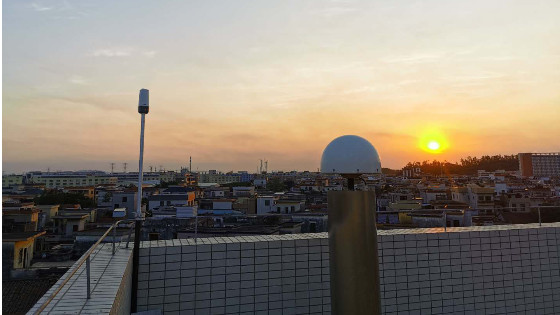
The test site was the rooftop of a 10-story building in Guangzhou with a baseline length of about 1km. It can be seen from the results that the horizontal displacement accuracy was kept within 3mm and the 3D displacement accuracy was kept at about 1cm.
To demonstrate the effectiveness and accuracy of the monitoring, the monitoring station was moved in order to create deformation during the experiment. The first time it was 30cm for the suddenly shifting in the monitoring point, and the second time it was 30cm for the gradually shifting in the monitoring point, 60cm in total. The monitoring results show that after the monitoring station was moved 60cm, the horizontal displacement accuracy and 3D accuracy were both about 1mm, with good accuracy and consistency.
4 Conclusion
In the past, engineers started off by using single-frequency GNSS receivers for deformation monitoring and this technology then gradually developed into multi-frequency, multi-system solutions that are now widely used. GNSS technology is becoming increasingly sophisticated and its performance is gradually surpassing the requirements of deformation monitoring. This paper has tested and compared low-cost receivers, scrutinizing several different aspects. The analysis results showed that the receiver meets both the accuracy and reliability requirements in the field of deformation monitoring. With the development of GNSS technology, it is clear that low-cost, low-power consumption and miniaturization will become the trend, and the application of low-cost solutions can effectively reduce the cost of projects and have great commercial value for both project implementation and program promotion.
After the experiments above were carried out, the following conclusions can be drawn:
1. Although the results found there is a gap between low-cost receivers and traditional high-precision board receivers in terms of their satellite search capability, signal strength, etc., it is clear the receiver has greater accuracy and stability in a static and open environment, which meets the high-precision measurement standard.
2. Low-cost GNSS chip solutions have matured, and the low-cost, low-power consumption, miniaturized receivers will become the trend in the future.
3. Low-cost receivers can guarantee the accuracy and effectiveness of monitoring in the actual monitoring process, and are good enough to be used in the field of deformation monitoring for the monitoring of mining areas, slopes, dams, tall buildings and other areas with a good environment.
References
1. Wansheng Zhao, Wenzi Gong. Summarizing and forecasting for the situation and method of the deformation observation [J].Dam observation and geotechnical testing.1996(03).
2. Youjian Hu, Bo Liu.A summary on the present advances of deformation monitoring. 2006(02).
3. Jing Wang."Big infrastructure" as a building block for development [J]. China Construction Information Technology.2019(02).
4. ZED-F9P_ProductSummary_(UBX-17005151)
5. Wang Li. A Study on Key Technology of High Precision GPS Monitoring for Geological Hazard[J].Journal of Geodesy and Geoinformation Science.2005.
6. Ziming Yin, Mingjian Chen, Jianqiao Yan, Wei Wang, Runyang Zhou. Correlation Analysis for GNSS Multipath and SNR.2016.
7. Looking up to the stars with your feet on the ground China Commercial Space Communications Application Development Research Report 2019 [A].iResearch.2019.
Do you have questions about this case study?
Get in touch with Hi-Target, and they would be happy to answer any questions you have about pricing, suitability, availability, specs, etc.


