
Dual Head Multibeam Echosounder in Tropical Water Survey
The NORBIT WINGHEAD is an integrated Multibeam with Applanix POSMV OceanMaster GNSS/IMU system. Instead of performing multiple standalone calibrations to determine gyrocompass heading alignment, a single Heading Alignment was conducted in the NORBIT GUI software.
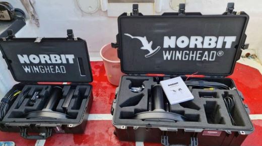
The exercise was jointly carried out between NORBIT and our official reseller for Malaysia, Geohydrocean Services Sdn Bhd (GHOS) between May 4-8, 2021 at Malacca, Malaysia. A vessel of opportunity was sourced on-site and rapidly mobilised within a couple of hours with the NORBIT WINGHEAD system. The NORBIT WINGHEAD is integrated with a POSMV OceanMaster GNSS/IMU system and is transported in two 21” pelican cases, complete with cables and Sonar Interface Unit (SIU).
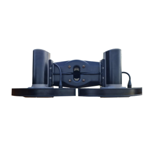
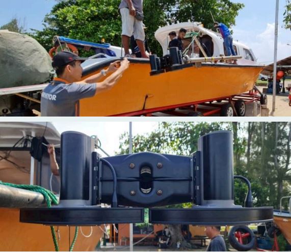
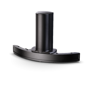
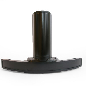
The Dual Head system was mounted on an over the side aluminium pole mounted on a swivel secured to the vessel. The vessel was approximately 9m in length and 2.5m in breadth. The NORBIT WINGHEAD dual-head was mounted on a NORBIT angled 37.5° bracket (see overleaf picture) with the receiver array facing forward. An optional 10° angle bracket is also available.
Real-time positioning was obtained using the Marinestar G2 DGNSS signal directly injected into the POSMV OceanMaster module. Positional data was further enhanced in post-processing using the Applanix PP-RTX solution and depth are based on EGM96 Geoid Model.
The NORBIT WINGHEAD is an integrated Multibeam with Applanix POSMV OceanMaster GNSS/IMU system. Instead of performing multiple standalone calibrations to determine gyrocompass heading alignment, a single Heading Alignment was conducted in the NORBIT GUI software.
The purpose of the Heading Alignment calibration is to determine the fore-aft mounting error of the two GNSS antennas based on the IMU Reference Plane. The separation between Antenna 1 & Antenna 2 is 2m as measured on the mounting pole. Heading Alignment calibration derived corrections values are saved to the POSMV system.
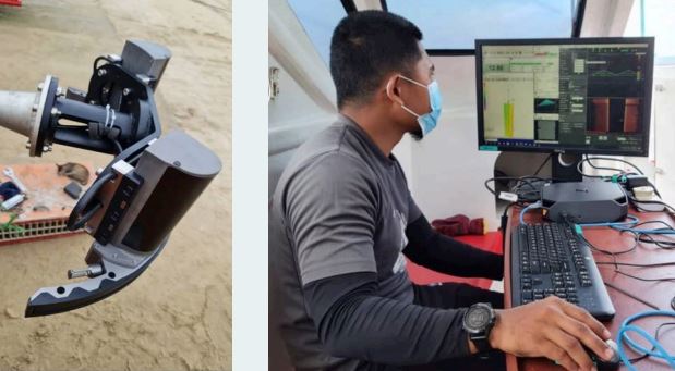
Although the POSMV IMU is rigidly mounted within the housing of the NORBIT WINGHEAD transducer, a patch test is still recommended to determine minute mounting errors and especially in a dual-head mounting, to determine the actual tilt angle of the bracket (37.5°). A patch test is conducted for each transducer to determine each transducer’s mounting error. Derived results of the patch test are used in the processing of the data in CARIS.
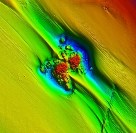
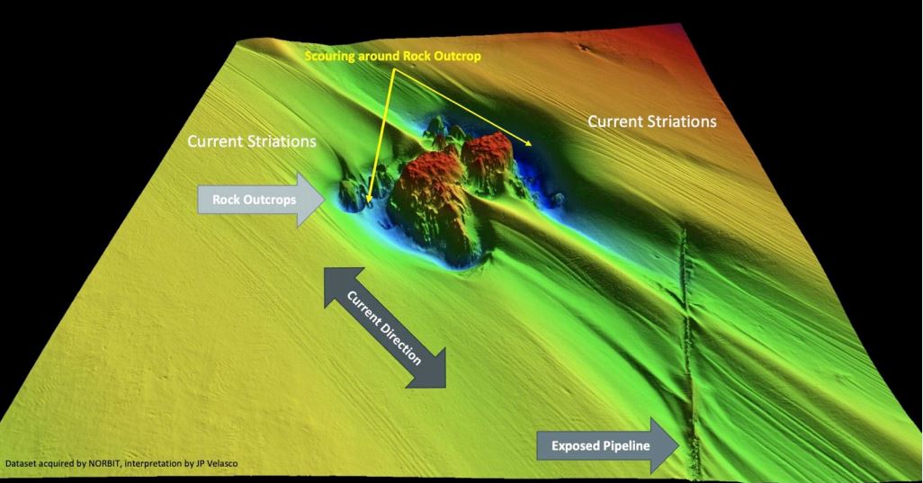
A seabed feature of interest was also surveyed to demonstrate the high-resolution capability of the NORBIT WINGHEAD system.
- A rock outcrop with a height of approximately 13m in 20m of water with the highest point of the outcrop at approximately 10m depth.
- An exposed pipeline is seen approximately 200m to the southeast with an NS alignment.
- It seems that a strong current runs in an NW/SE direction as observed from the outcrop scouring and exposed pipeline.
- Multiple linear striations can be observed in the same direction of the current stream.
- Note that depth is referencing to EGM96 geoid model.
The NORBIT WINGHEAD is a versatile high-resolution next-generation Multibeam Echosounder (MBES) designed with the upgradable capability to meet future requirements. The design platform allows for expansion with future technological advancement. The NORBIT WINGHEAD being a compact MBES is easily transportable by any form of commercial transportation and deployed to any vessel of opportunity with either a locally manufactured over the side pole or the NORBIT PORTUS pole setup.
For a more permanent installation, a hull mount configuration is available with a standalone POSMV OceanMaster IMU installed on the vessel’s Central of Gravity (COG). As demonstrated from the sea trial, the NORBIT WINGHEAD is capable to deliver a high daily production yield, thus minimise the vessel’s operational hours on-site and yet deliver high-resolution seabed mapping in a compact system, especially with the NORBIT Data Acquisition Software(DCT). For information on Dual Head swath coverage, please contact NORBIT.
Do you have questions about this case study?
Get in touch with NORBIT Subsea, and they would be happy to answer any questions you have about pricing, suitability, availability, specs, etc.


