Drone Images in Topocad Point Cloud Processing Software Enhance Survey Drawings
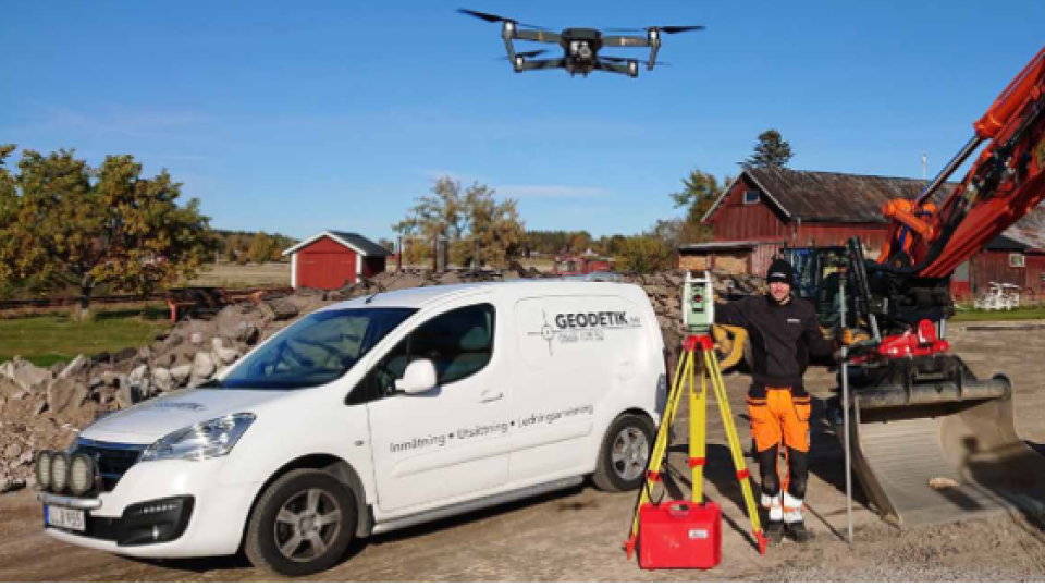
t's about doing it right from the start. To get a base that complies with reality, survey technician Markus Johansson on Geodetik sends up a drone. With day-to-day pictures and surveyed objects, the design or drawing in Topocad is up-to-date. The number of errors are decreasing, Markus says.
- Incorrect drawings are time thieves!
The words come from Markus Johansson who is a Survey technician at Geodetics in Värmland, Sunne, Sweden - and lots of people agree on this. Markus faces the problems during his workday, especially on stake out assignments.
It can be designed areas that haven't been updated or old handwritten situational plans where I need to check if the information is correct.
Because there is a sharp boundary between reality, how the terrain actually looks like, and the long time ago documented design. A difference that can have major consequences because a defective basis can cause problems when the real terrain doesn't match the theory on paper.
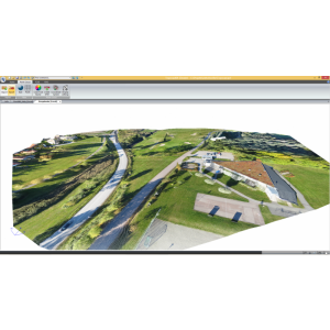
Rasterized drone images
To bridge the gap between theory and reality, Markus uses a particular working method. First, he produces a daily image of the area in a project. To do this he uses a drone.
I'm flying with the drone and taking pictures every 100 meters with a 4megapixel camera, says Markus. It's enough for me to easily distinguish an object, such as a water well or a drain pipe.
The next step is to import the images in Topocad, where they are placed in a separate layer at the bottom of the structure. Also, the pictures have been rasterized in the software. But it's important that the image is in the right place in relation to the projected drawing, which is in another layer. Reference points in the image are therefore crucial.
I search for three objects in the natural landscape which can be reference points, such as a manhole visible from above when the picture is taken. The three points I survey with GNSS or a total station so that I can refer to the correct coordinates in Topocad.
In Topocad, the drawing has established coordinates and the software rotates the coordinates of the drone image according to the drawing coordinates. This way, the picture adjusts to the right place when the position information becomes exactly the same in both drawing and image. After this, Markus continue to add new information, for example, drawing new lines or adding new coordinates.
Markus uses the image as an external reference in Topocad, which he can turn on or off as needed to clarify what it looks like during a design or stake out.
Visualizing Drone Pictures for Decision-makers
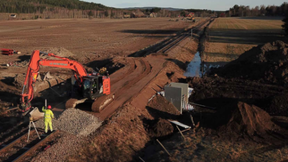
Markus not only uses drones to design work but also to follow how a project develops: The first flight is decided according to a route. The same route can be repeated after a certain period of timeand take photos of the changes that have occurred during the work process. Then Markus already have the reference points since before and he can just add the new pictures in Topocad.
Gradually, a knowledge of how the project proceeds is growing as more images are added. Each image becomes a progress report that can facilitate the decision-making process for both the client and the construction project management, especially when they are not in the same location as the project. The drone becomes the tool for visualizing and communicate different stages of the workflow.
Control to Maintain High-quality Drone Images
The working method also becomes a quality check and this is perhaps the biggest profit. Both the design and the points of the stake out correspond to what it looks like in the terrain. It reduces the number of errors that may waste time and resources. The time thieves are getting fewer.
And I want to eliminate them as early as possible!
For example, time is saved when you discover a house by the side of the road that was not included in the design report. A new design must be carried out but you don't have to go ahead and make a new drawing, which still has to be discarded. Markus often works on surveying existing objects, such as terrain, bridges, or anything else which he afterwards complements with drone images.
It helps the designers to understand what the terrain really looks like, he says.
Several decisions are facilitated because you have the day-to-day information with the exact dimensions. It's about doing it right from the start. This improves the quality of the entire project as the information is verified. This means that the construction project can proceed as planned. The drone and Topocad together provide a quality assured foundation with digital points that correspond to the real terrain.
Related products


