
China's First Gravity and Magnetic Survey Task Carried out by Unmanned Surface Vehicle (USV)
This mission verified the feasibility of simultaneously deploying a gravimeter and a magnetometer on a 5-meter-long USV platform, which can reduce the frequency of equipment replacement and improving work efficiency.
Date: October 2018
Location: Sea area around Qi’ao island, Zhuhai, China
Equipment: M80 multi-function surveying USV platform, Marine Magnetometer Seaspy2, a Sea-Air Gravimeter-2Marine(SAG-2M)
Background: According to the requirements of the Research Institute, an M80 USV was upgraded as a multi-function autonomous water surface surveying platform to adapt to different mission equipment and conduct marine basic data research to the sea area around Qi’ao island in Zhuhai, China.
Gravity and Magnetic Survey Field Operation
In order to smoothen the survey process and reduce hardware failures, engineers integrated the gravimeter and magnetometer to the USV before launching it onto the water. The gravimeter’s main unit, the gravimeter damping table, the gravimeter power module, the gravimeter data acquisition module, the magnetometer main unit, the magnetometer tow body, and the related cables of the two devices are systematically installed.
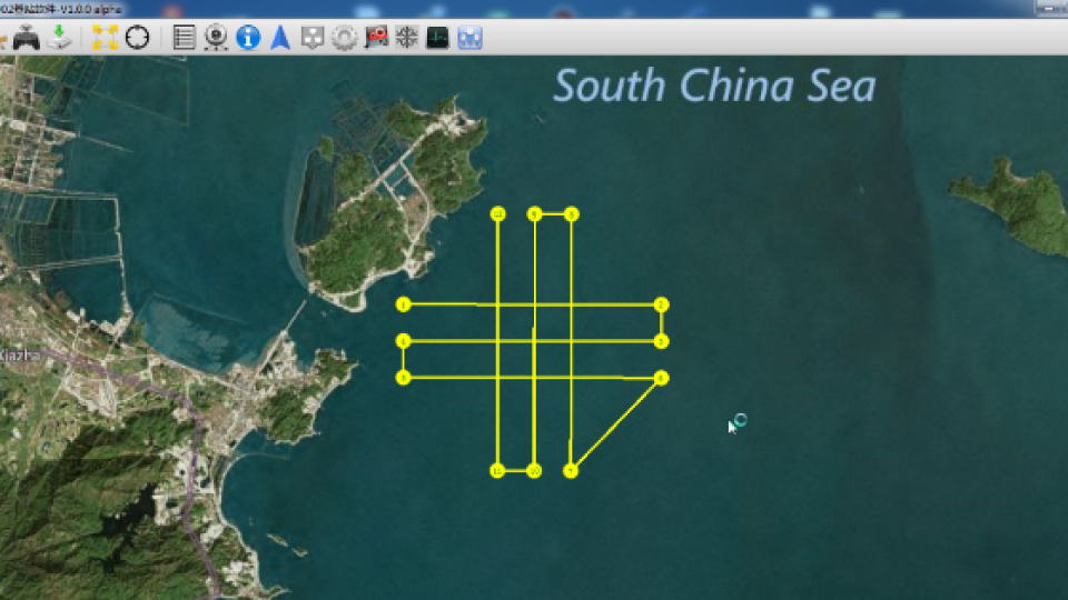
The survey area is located off the coast of Qi’ao Island, with an average water depth of 2 to 3 m and a total area of 7 x 7k㎡. The survey lines are distributed as crossed grids, with 7km length each. The control base station is set on a platform on Qi’ao Island, about 20m above the sea surface. The shore-based communication system uses an omnidirectional antenna, and two engineers are responsible for monitoring the navigation status and survey mission status respectively.
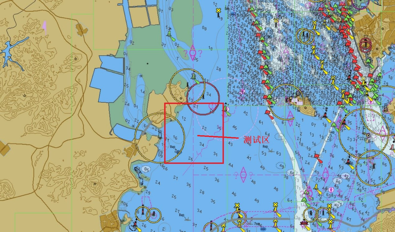
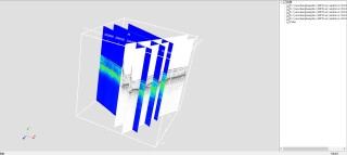
Survey area(Red frame)
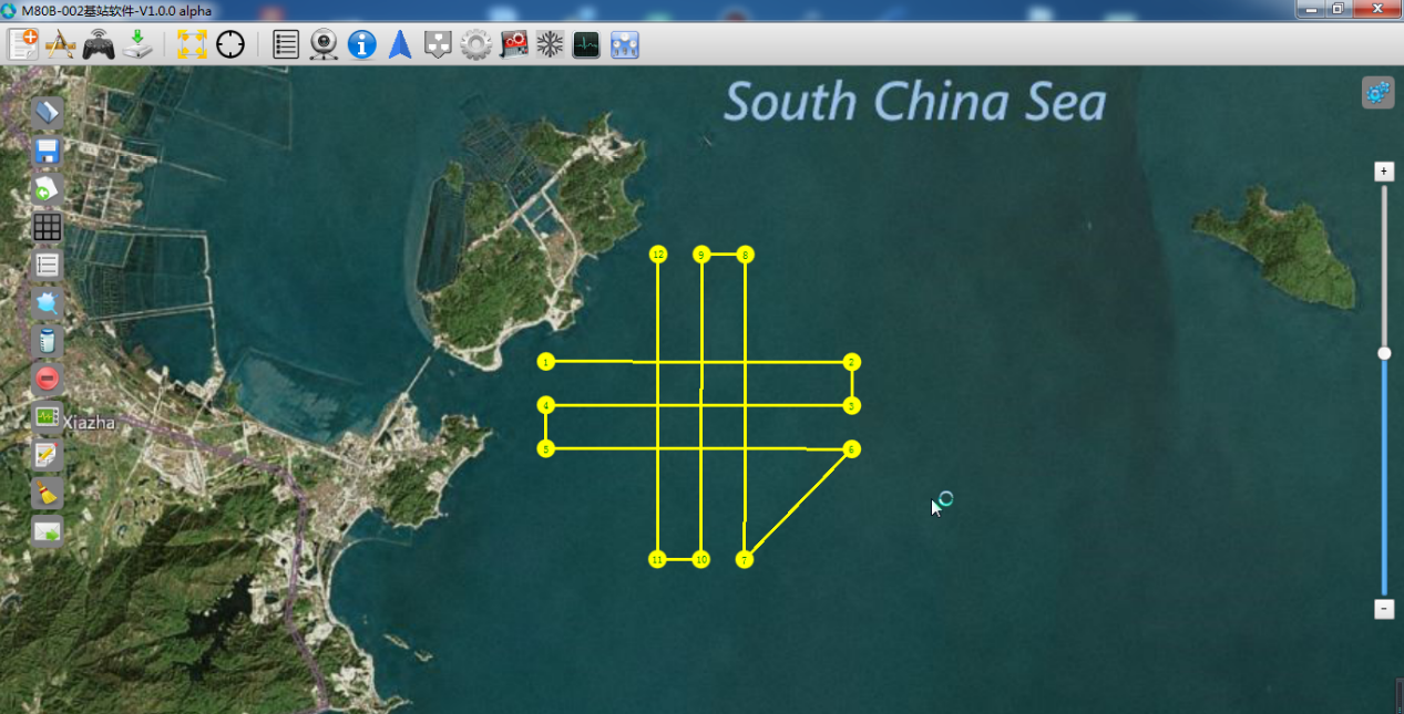
Survey lines shown on the base station interface
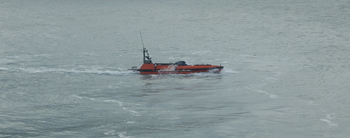
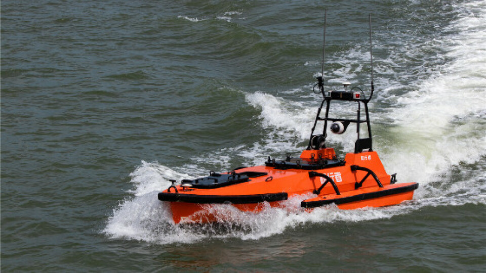
M80 conducting gravity and magnetic survey
Survey result of the gravimeter with an Unmanned Surface Vehicle
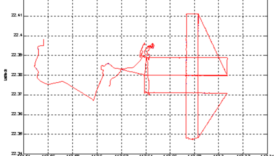
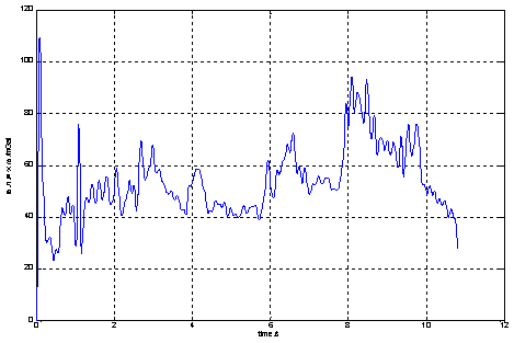
In this mission, the M80 sailed 70km while surveying with the gravimeter. The following is a full-time data in October 2018. The GPS position and velocity data are the differential results obtained by using the predicted ephemeris. The data was not processed by drift, height, and tidal correction. Accuracy within the gravimeter can be controlled within 2mGal, meeting the requirements of standard marine survey specifications.
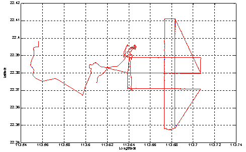
Full Sail route of M80
Free space gravity anomaly curve
Survey result of magnetometer
Equipped with a magnetometer, the M80 completed 70km of survey lines. According to the conclusion of repeated trials, the magnetometer probe has always been maintaining a towing length of 20m during the survey, which is longer than the length of the survey vessel (6m in length), so as to avoid the influence of the magnetic field generated by the USV platform. During the data acquisition process, the working state of the magnetometer was stable, the signal was strong, and the oscillation of the magnetic data was basically less than 0.5nT.
The following two figures are the repeated survey results of the same survey line. It can be seen that the trends are consistent. There’s about 40nT anomaly occurred in both results, which is presumed to be caused by a submarine pipeline.
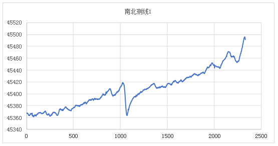
South-North survey line 1
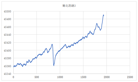
South-North survey line 3
Gravity and Magnetic Survey Task Carried out by Unmanned Surface Vehicle (USV) - Conclusion
This mission verified the feasibility of simultaneously deploying a gravimeter and a magnetometer on a 5-meter-long USV platform, which can reduce the frequency of equipment replacement and improving work efficiency.
The M80 is a seabed detection USV designed and developed by OceanAlpha for surveying the near-shallow sea of the shelf area. It can be equipped with single-beam sounder, side-scan sonar, front view sonar, shallow water multibeam echo sounder, shallow SBP, ADCP, long-baseline, ultra-short baseline, and other acoustic detection equipment, non-contact / contact water quality testing equipment, laser measuring equipment, optical pump magnetic detector, etc. The M80 has the world’s leading autonomous navigation control system and intelligent obstacle avoidance technology, which can perform tasks remotely and realize real-time data transmission. Since the product was launched, it has participated in many important marine survey tasks carried out of national survey organizations.
Do you have questions about this case study?
Get in touch with OceanAlpha USV, and they would be happy to answer any questions you have about pricing, suitability, availability, specs, etc.


