CHCNAV Releases the Latest Topographic Version 8 of Its Landstar Field Data Collection Software
LandStar8 (or LS 8) is a versatile, modular and customizable software for topographic tasks such as surveying, stake out, cadastral, mapping, and GIS. Building on the legacy of LandStar 7, the new LandStar8 brings many new features such as a refined user interface, streamlined workflows, even faster operation, and integrated cloud services.
The Ultimate Survey and Mapping Software Cover All Surveyors’ Needs in the Field.
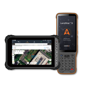
CHC Navigation (CHCNAV) just released LandStar8, a Field Surveying and Mapping application for Android devices. LandStar8 (or LS 8) is a versatile, modular and customizable software for topographic tasks such as surveying, stakeout, cadastral, mapping, and GIS. Building on the legacy of LandStar 7, the new LandStar8 brings many new features such as a refined user interface, streamlined workflows, even faster operation, and integrated cloud services.
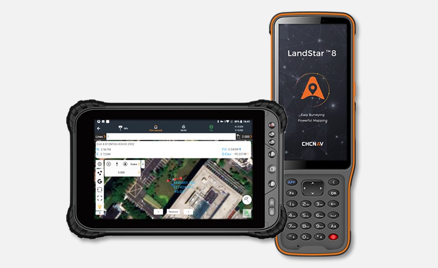
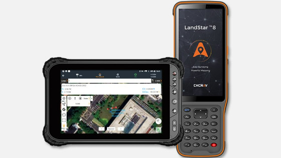
Figure 1: The LandStar 8, land surveying and mapping APP for android devices.
“With LandStar8, we want to provide our users with unprecedented field experience like never before. LandStar8’s modular design allows users to customize the interface according to their usage habits, making it easier and more efficient for field crews to work,” said Rachel Wang, Product Manager of CHC Navigation’s Surveying and Engineering Division. "We also provide more cloud connectivity options for the software users. Whether it is backup, data storage, or remote technical support, users can connect to their data anytime, anywhere."
-
Simplified interface layout to make surveyor’s life easier
LandStar 8 has a simple and intuitive layout with large map windows and sharp graphics. Users can hide features they rarely use and display only those they use on a daily basis, making the interface more straightforward and easier to use. LandStar8 is a flexible and user-friendly field software for surveying and mapping tasks.
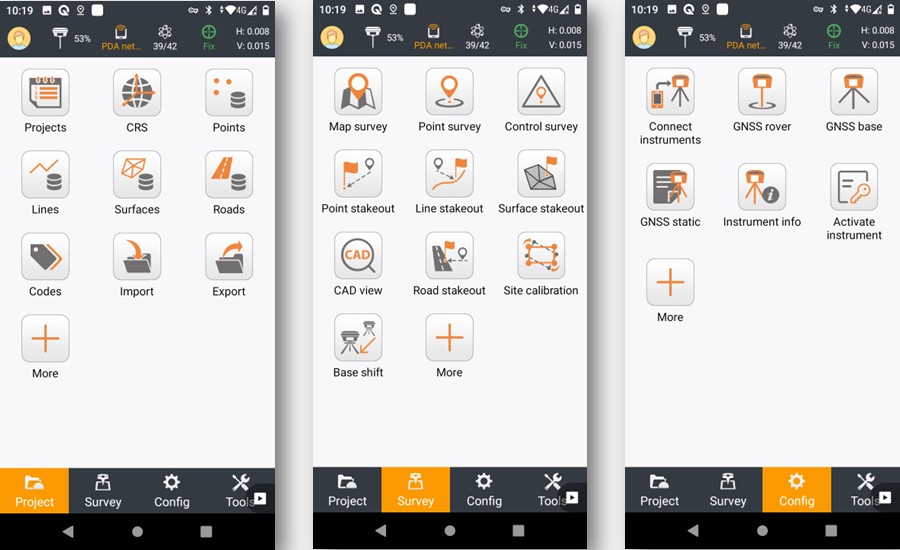
Figure 2. The APP’s layout (only relevant information is displayed, and unused functions can be hidden to make the application even more straightforward and simple to operate).
-
Start surveying in a matter of seconds
On LandStar8, it is easy to copy coordinate settings, control, and staking points from another handheld controller by scanning a QR code. Projects are easily edited and sorted by history and attributes. Custom coordinate systems, geoid models, and coding libraries can be updated at any time by using resource packages. LandStar8 also features a terrain calibration wizard designed specifically for non-expert users.
-
Enhance operator productivity in the field
LandStar8's proprietary MetaCAD graphics engine opens DWG and DXF base maps faster and with smoother rendering. DXF files up to 200 MB can be opened in less than 10 seconds. LandStar8 supports opening external reference files, automatically recognizes CAD length units, and allows editing of CAD base maps directly in the field.
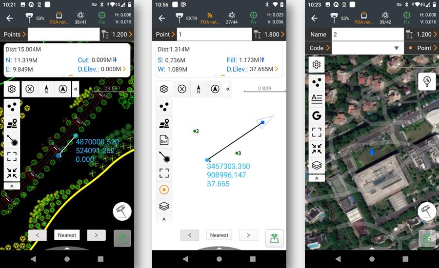
Figure 3. The LandStar 8 APP’s functions are in use.
-
Streamlined communication between the field and office
LandStar8* is designed around a comprehensive cloud-based architecture that supports project backup, collaborative work, data storage, and many other valuable features. Its remote support capabilities help the office helpdesk resolve user problems and provide personalized technical assistance. The "share code" feature allows users to transfer project data between desktop computers and field controllers or between different field controllers quickly to further boost work efficiency.
*Available from November 22, 2022.
__
About CHC Navigation
CHC Navigation (CHCNAV) creates innovative navigation and positioning solutions to make customers' work more efficient. CHCNAV products and solutions cover multiple industries such as geospatial, construction, agriculture, and marine. With a presence across the globe, distributors in more than 120 countries, and more than 1,500 employees, today CHC Navigation is recognized as one of the fastest-growing companies in geomatics technologies. For more information about CHC Navigation
Do you have questions about this product news?
Get in touch with CHC Navigation | CHCNAV, and they would be happy to answer any questions you have about pricing, suitability, availability, specs, etc.


