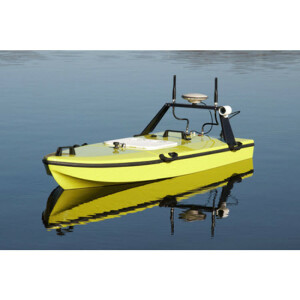
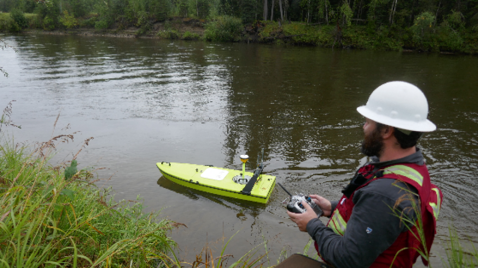
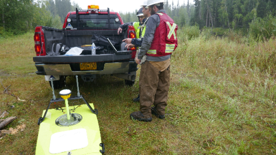
Geo-matching | Your Product Platform for Surveying, Positioning and Machine Guidance Join Geo-matching now!
By CEE HydroSystems
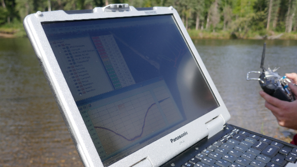
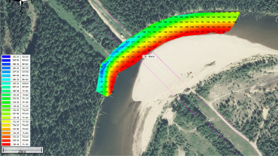
Surveyors and engineers from Alyeska Pipeline, responsible for the 800-mile crude oil pipeline from the oilfield at Prudhoe Bay to the port of Valdez experienced a quantum leap in field work efficiency and data quality with the implementation of a USV survey program using the Trimble GNSS-equipped RTK CEESCOPE on board the CEE-USV. With pipeline depth of burial surveys required annually for all river crossings, the USV offers huge efficiency improvements.
Read moreThe 800 mile (1,287km) Trans-Alaska Pipeline System (TAPS) is the longest pipeline in the USA and carries over 500,000 barrels of crude oil per day through 48” pipe from the oilfield at Prudhoe Bay to the tanker terminal at Valdez.
The pipeline, owned and operated by the Alyeska Pipeline Service Company, crosses varied terrain and includes buried and raised sections, depending on the soil structure below the pipe. There are 34 major river crossings and nearly 500 small stream crossings along the route. The pipeline needs to be periodically surveyed and inspected to ensure asset integrity, safety, and spill mitigation. Part of the survey requirements is the depth of burial surveys for the river crossings where the pipe is routed under the water. The pipeline design calls for a minimum burial depth where the pipe is covered by a certain thickness of sediment over the width of the crossing.
The 800-mile route of TAPS.
Adequate burial ensures the pipe is not exposed to dangerous scouring, particularly at high flow or flood conditions. Any exposed pipe could be subject to stress and presents a failure risk.
Alyeska Pipeline’s survey engineers and subcontractors work together to evaluate each river crossing annually. Methods used have varied over the years but more recently, an acoustic Doppler current profiler (ADCP) has been used to measure the water velocity and depth simultaneously. The ADCP may be deployed from a manned boat or a tethered float for smaller cross-sections. In order to conduct a survey using the ADCP, surveyors would deploy a tag line from one river bank to the other. While there is an access road running the length of the pipeline, simply getting from one side of the river to the other may take several hours by road at some locations. However, once the tag line was set up, the tethered float equipped with the ADCP was pulled across the river to develop cross-section bathymetry data over the pipe. The surveys were time-consuming, provided sparse data over the pipeline, were of suboptimal accuracy owing to the ADCP limitations and often could provide no data at all up or downstream of the pipe location.
Tethered float and ADCP used for previous surveys.
After introducing a successful airborne drone program for above-ground inspection, Alyeska conducted a review to discover new technology that might be available to help with the river cross-sections. The following principal equipment selection criteria were used:
Alyeska surveyors operate Trimble RTK GNSS, and it was critical the new system was compatible with existing infrastructure. Alyeska chose the CEE-USV remotely-operated vehicle with CEESCOPE-LITE single beam survey system incorporating fully integrated Trimble RTK GNSS.
The CEE-USV with Trimble GNSS.
The new USV allows Alyeska surveyors to begin surveying almost immediately upon reaching each site, with tremendous time savings. The high-performance capability of the USV at over 4m/s (13ft/sec) means surveys can be undertaken even with high flow conditions. After setting up the Trimble R10 RTK base station, the USV is powered-up and the CEESCOPE-LITE’s built-in UHF radio automatically locks to the base station and provides RTK corrections to the OEM Trimble RTK receiver inside. There are no data interconnects, for example between a rover smart antenna and the USV, instead, the entire data package is integrated inside the RTK CEESCOPE-LITE. Indeed, there is only one major component in the data system, presenting a significant reduction in the potential for field downtime that could be costly for Alyeska’s remote surveys.
Complete data system – CEESCOPE-LITE.
The CEE-USV transmits survey data to the shore in real time, with Eye4Software Hydromagic acquisition software selected to provide a simplified user interface.