Applying color to Lidar data Using SimActive photogrammetry software
“While lidar is great, everyone understands imagery. Colourizing lidar makes the data much more understandable”, said Jeff Fagerman, CEO at LiDARUSA. “Correlator3D allows our clients to easily colourize Lidar point clouds from their multi-camera system.”
SimActive Inc., a leading developer of photogrammetry software, announces the use of its Lidar point cloud colourization capabilities by users of multi-sensor systems developed by LiDARUSA.
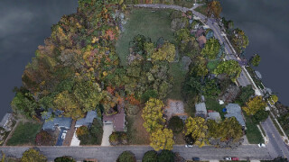
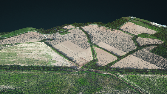
Lidar point clouds are first imported in Correlator3D, to which the collected imagery is automatically registered. The Lidar data are used as a control for the registration process. Each Lidar point is then colourized using the images.
“While Lidar is great, everyone understands imagery. Colourizing Lidar makes the data much more understandable”, said Jeff Fagerman, CEO at LiDARUSA. “Correlator3D allows our clients to easily colourize Lidar point clouds from their multi-camera system.”
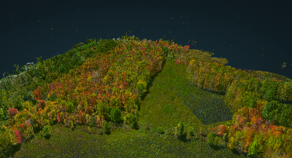
Image 1: Colorized point cloud by using Correlator3D software
About LiDARUSA
LiDARUSA, or Fagerman Technologies, is a family-owned business outside Huntsville, AL. LiDARUSA specializes in laser scanning, photogrammetry, instrumentation and all things geomatics. Years of experience working on best-in-class products have developed our sense of quality and leadership necessary to build only the best systems. For more information, visit www.lidarusa.com.
About SimActive
SimActive is the developer of Correlator3D™ software, a patented end-to-end photogrammetry solution for generating high-quality geospatial data from satellite and aerial imagery, including drones. Correlator3D™ performs aerial triangulation (AT) and produces dense digital surface models (DSM), digital terrain models (DTM), point clouds, orthomosaics, 3D models and vectorized 3D features. Powered by GPU technology and multi-core CPUs, Correlator3D™ ensures matchless processing speed to support rapid production of large datasets. SimActive has been selling Correlator3D™ to leading mapping firms and government organizations worldwide, offering cutting-edge photogrammetry software backed by exceptional customer support. For more information, visit www.simactive.com.
Do you have questions about this case study?
Get in touch with SimActive, and they would be happy to answer any questions you have about pricing, suitability, availability, specs, etc.
Related articles


