All You Need to Know About DJI’s Flagship Full-Frame Photogrammetry Payload
When it comes to creating accurate 3D maps or models of real-life environments, photogrammetry is the go-to technology for surveyors, mappers, GIS professionals, and AEC managers worldwide. Photogrammetry is the science of collecting data and measurements from 2D photos that have been captured from different vantage points, often via drone surveying. These photos are then post-processed using drone photogrammetry software to create high-resolution 2D maps and 3D reconstructions. From these meticulous models, distances, surfaces, and volumes of physical objects can be measured.
Top 7 Features of The DJI P1, Efficiency Through Flexible Full-frame Photogrammetry
Getting the most-precise measurements is an innate goal for anyone investing in drone surveying. And this goal cannot be achieved if you compromise on your surveying sensors.
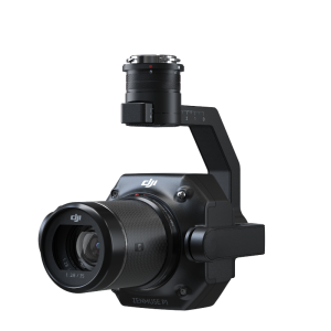
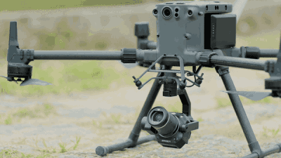
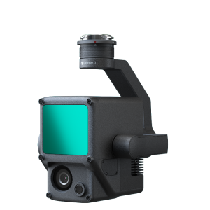
The P1, DJI’s newest payload for a surveying drone, is designed to achieve photogrammetric excellence. The most powerful DJI Enterprise camera payload yet, the P1 promises an unprecedented level of accuracy, performance, and high-precision data collection.
Here are the top 7 features that make the P1 the new benchmark in aerial surveying:
Better Accuracy Thanks to Better Resolution
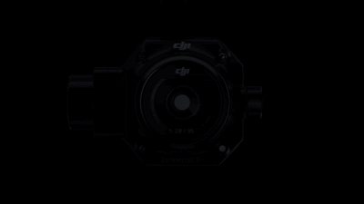
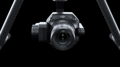
The P1 integrates a 45-megapixel full-frame low-noise high-sensitivity sensor with interchangeable 24/35/50mm fixed-focus lenses.
Not only does this better resolution translate into better accuracy, and, eventually, more precise 3D models, but the versatile P1 payload also gives you a greater degree of flexibility to meet project or client requirements. Moreover, like most other DJI surveying cameras, the P1 uses a Global Mechanical Shutter (achieved with a central leaf shutter) to cancel rolling shutter distortion, allowing the camera to handle shutter speeds of up to 1/2000th of a second.
Superior Actionable Insights by Superior Data Quality
Not all project sites are created equal. In risky environments like landfills or high-altitude construction locations, marking and recording ground control points (GCPs) may not always be feasible. And so, the P1 builds on real-time kinematic (RTK) processing workflows to deliver an enviable accuracy of up to 3 cm horizontally and 5 cm vertically, even without GCPs. This way, you can still meet the centimetre-level accuracy needed for your deliverables and derive actionable insights from them.
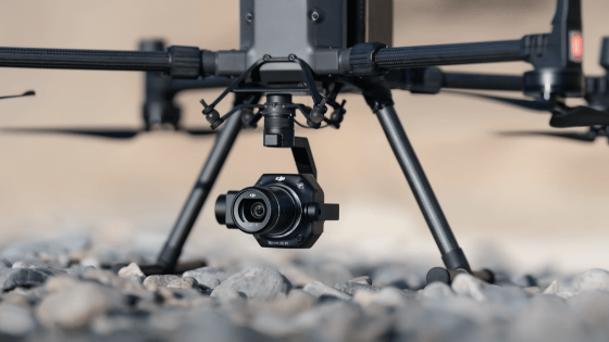
The Robust Gimbal Offers Robust Versatility
The P1 is equipped with a 3-axis stabilized gimbal to compensate for any inadvertent rotational movement of your drone (tilt, roll, and pan). The sensor can provide smooth, clear imagery to enable accurate geo-referenced data gathering with a surveying drone. As such, the risk for data gaps becomes negligible, and you no longer have to worry about the costs associated with re-flying.
Extraordinary Missions Made Possible by Extraordinary Efficiency
With the Zenmuse P1, you can take a photo every 0.7 seconds during the flight. In our test runs, an M300 RTK outfitted with the P1 could survey 3 sq km in a single flight at a GSD of 3 cm. And with a 75 % front overlap rate and a 55 % side overlap, the drone was able to achieve 3 cm horizontal accuracy and 5 cm vertical accuracy. This impressive efficiency will allow you to accomplish much more in much less time.
Smarter Operations Thanks to Smart Oblique Capture
Also helping you achieve more in less time (and with less effort) is the new Smart Oblique Capture feature. In this mode, the P1’s gimbal rotates and captures five different images from five different angles while flying along its predetermined flight path.
Your chosen flight parameters automatically tell the P1 to avoid capturing any unnecessary images (such as those at the periphery of the mapping area) and to only take those photos that are essential to the reconstruction of the region of interest.
What impact does this have on the surveying drone’s efficiency? Because you are spending less time capturing unneeded photos, you can easily cover 7.5 sq km in a single workday (at a GSD of 3 cm). And after collecting your data, you need less time and power to process it into actionable results.
All-powerful Coordination by The All-new TimeSync 2.0
DJI’s TimeSync technology allows a surveying drone to coordinate its camera, flight controller, RTK module, and gimbal to ascertain that the most accurate positioning information is tagged to each and every image. While the Phantom 4 RTK can offer millisecond-level precision, TimeSync 2.0 takes things up a notch to provide synchronization at the microsecond level. And let’s not forget that TimeSync adjusts the geospatial data to the centre of the camera and records it in EXIF and XMP format to maintain data accuracy during post-processing.
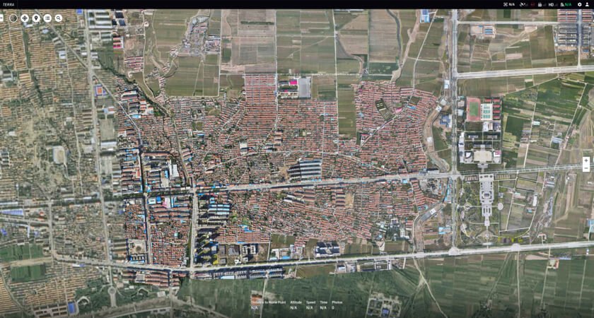
Seamless Post-Processing With The DJI TERRA Integration
The best post-processing software for the data captured by DJI’s drone surveying products, such as the M300 RTK and P1, is DJI’s official software: DJI Terra.
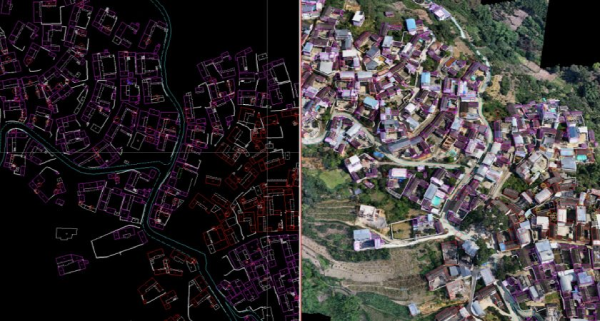
DJI Terra is an all-in-one drone surveying software packed with all the resources you need to plan, visualize, process, and analyze aerial data. Since this intuitive and easy-to-use drone photogrammetry solution syncs effortlessly with DJI’s flagship surveying drone and camera payload, you can expect the most detailed and accurate 3D models and measurements from Terra.
It must also be noted that Terra has optimized its processing speeds exponentially since its launch and is now more efficient than ever. It allows surveyors to work on real-time mapping missions and comes with neat automation features like ‘Region of Interest’ that allow for image reconstruction to be performed on a specific target region.

Filling the Gaps in the Range of Photogrammetry Cameras
The P1 solution is pivotal to DJI’s vision of creating an integrated ecosystem of products, optimizing drones for geospatial data collection, and moving toward intent-driven flights.
This cutting-edge camera payload will empower photogrammetry professionals to conduct complex missions more quickly and efficiently, and allow them to acquire the ultra-high-resolution imagery necessary for creating detailed 2D orthomosaics and 3D reconstructions for geological surveys, hydraulic engineering, historic preservation, and much more. Meanwhile, the P1’s painless compatibility with the DJI Terra software will enable teams to quickly render and visualize the data in real-time and ultimately reduce their post-processing times.
Do you have questions about this case study?
Get in touch with DJI ENTERPRISE, and they would be happy to answer any questions you have about pricing, suitability, availability, specs, etc.


