

Aerial Surveying with GNSS RTK PPK System
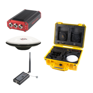
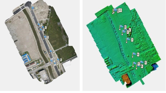
The Tersus Post-Processing Kinematic (PPK) and RTK systems are dual frequency GPS/GLONASS/BeiDou receivers. They allow cm-level position referencing of orthomosaic photos and 3D models without the Ground Control Points (GCPs). It saves hours of mission planning and setup time for surveying.
When using the Aerial Surveying with GNSS RTK PPK System, you typically set the BX306 into the PPK mode, despite the BX306 can output the real time kinematic results. In such mode, you can eliminate the datalink between the airplane and base station.
All GNSS positioning data are stored on board in the BX306 PPK system, without a real-time data link with reference station. The BX306 connect with hot shoe with the camera, we could get camera cm-level locations during the post-processing procedure after flight. The corrected image positions are directly added to the image EXIF and can be imported to photogrammetric software packages such as Pix4Dmapper or Agisoft Photoscan.


Ask a question
We are happy to assist.


By completing this form, you acknowledge and agree to abide by our Terms and Conditions, Privacy Policy and Cookie Policy.
Thank you for your message! Our team tipically to respond to inquiries within 1-2 business days.
Type something to search