
A Volume Measurement Comparison between Photogrammetry and Traditional Survey Methods
Fulmar Sàrl in Switzerland executed a test project for a client, comparing the volume measurements of drone photogrammetry results with ones done by traditional methods. For the previous standard workflow, the client needs to measure a thousand points around the stockpiles, and then extract the volumes by interpolating the points using a calculation software. During the measuring process, they would also need to climb up the pile, which could be very dangerous.
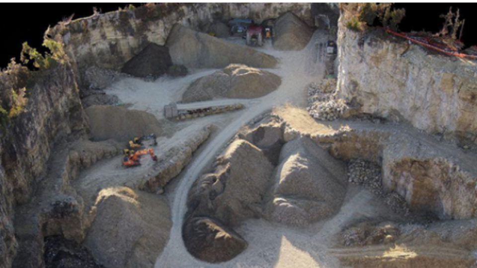
Fulmar captured 119 images of the site with a multi-rotor drone on a sunny and windless day in less than 20 minutes. They relied on a combination of the drone’s GPS and ground targets that were measured with a laser scanner to scale the reconstruction in relative terms.
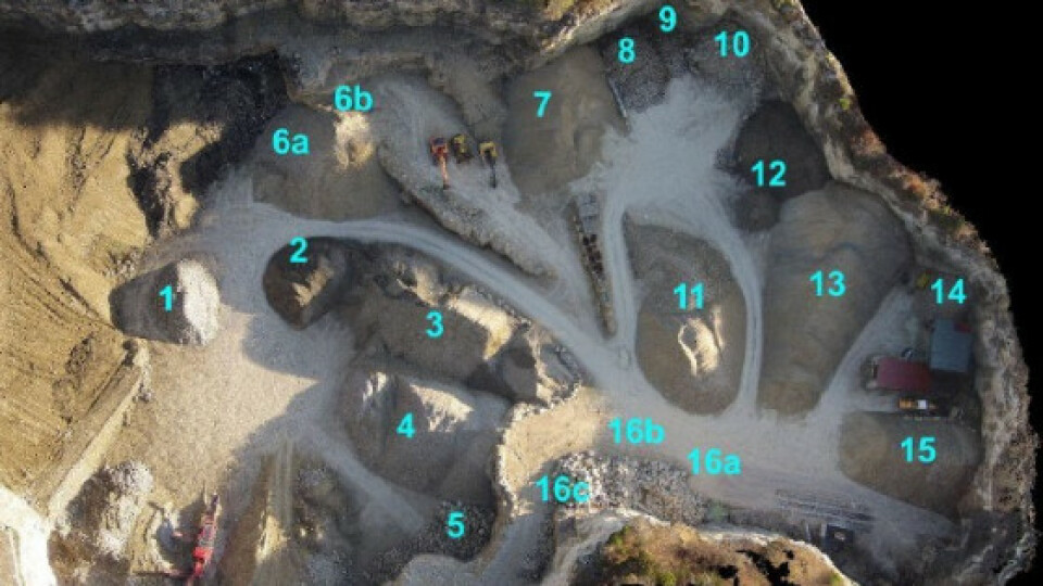
Stockpile overview and volume measurement figures


What influences volume measurements?
Fulmar concluded there are three primary factors that influence the accuracy of volume measurements.
-
The reference base must account for slope inclination
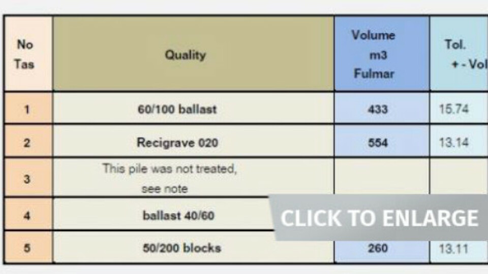
Fulmar had a measurement of 531 m3 that was originally calculated using traditional methods. They then compared the original measurement to what was recorded in a Pix4D project (711 m3) and found that there was a significant difference (34%).
Fulmar realized that the definition of the base surface was not taking the underlying slope into account. They refined the definition of the base surface to account for the slope inclination and calculated the volume relative to the visible periphery of the piles. The result (554 m3) was only 4% greater than the original traditional measurement.

-
The size of the particles and the space between them
Fulmar also noticed that the larger the aggregate size, the greater the difference between the two measurements. Photogrammetry is expected to be more accurate than the interpolated results on larger aggregates because voids are more precisely reconstructed.
- Uncertain boundary lines
Fulmar identified that there was a significant difference when comparing traditional and photogrammetric volume measurements for conjoined stockpiles. However, they found that the measurements were much closer when measuring the entire stockpile.
For example, measuring Stockpile #12 by itself produced a difference of 51% between the two methodologies. By measuring the combined volume of both Stockpiles #12 and #13, Fulmar found a difference of only 1% in the total volume.
 Photogrammetry is comparable to traditional survey methods
The volume measurement results obtained from Pix4Dmapper are comparable to traditional survey methods. Additionally, using drone photogrammetry saves time and avoids exposing surveyors to danger on site operations. In some situations—for example for the large aggregates—we contend that photogrammetry is more accurate than traditional methods that rely on interpolation.

Related products


