5 (Drone) Applications for Airborne Lidar
Lidar is a proven approach for creating accurate and detailed 3D terrain point cloud models. Drone technology is improving very rapidly and offers good alternatives for traditional airborne Lidar surveys using aeroplanes or helicopters. Drone-based airborne Lidar surveys are often cheaper, faster and safer, as a number of applications demonstrate.
What is Lidar?
Lidar (LIght Detection and Ranging) is a surveying technique that uses light in the form of pulsed laser to measure variable distances. It is used to make high-resolution point clouds of terrain and is also referred to as ‘laser scanning’ or ‘3D scanning’ and has terrestrial airborne and mobile applications.
Lidar for Drones
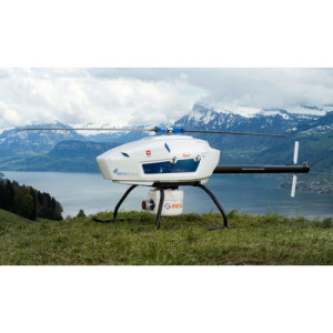
Drones for Mapping and 3D Modelling have improved very rapidly over recent years. Mapping Drones, also known as ‘unmanned aerial vehicles’ (UAVs) or ‘unmanned aerial systems’ (UASs) among various other names, now have larger payloads, longer flight times and can be equipped with better navigation technology and sensors. Some drones can now also be fitted with Lidar sensors to gather data for 3D point cloud terrain models. This is a more economical method for performing surveys of small areas compared to surveys with aeroplanes or helicopters. Moreover, drones equipped with Lidar scanners are used often to survey rough terrain or remote areas.
5 Lidar Applications:
-
Land Surveying:
Airborne Lidar scanners can be used to create a digital terrain model (DTM) or digital elevation model (DEM). Data can be gathered using a drone, aeroplane or helicopter, depending on the size of the surveyed area. A plane can normally acquire swaths of 3-4 kilometres in width in a single flyover. Drones are cheaper, safer and faster for small terrain surveys.
-
Power line inspection:
Detailed information on power lines and distance between poles can be extracted from the point cloud. This enables surveyors to analyse the detailed structure of the power line corridor including vegetation, roads and houses and to identify potential risks.
-
Topographic and bathymetric surveys:
Topographic and bathymetric surveys normally cover large terrains and are often performed with aeroplanes and helicopters. Topographic Lidar maps the land with a near-infrared laser, while bathymetric Lidar uses water-penetrating green light to measure the seafloor and riverbed.
-
Forestry and precision agriculture:
Lidar and aerial photos can be used to identify farm areas that use costly fertilisers to increase productivity. It can also be used for precision forestry to identify specific forest areas in order to increase productivity, reduce costs and preserve the environment.
-
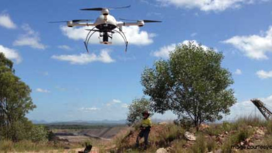
Mining:
It can be used in mining to measure ore extraction space. This is calculated by comparing surface data to previous scans. Drones are often used to survey mines because a faster and more economical option than surveying using aeroplanes. Terrestrial laser scanners and mobile mappers equipped with sensors are also used to survey mines.
More information on airborne Lidar scanners
Geo-matching.com is the world’s largest online product database for surveying, navigation and machine guidance with more than 2000 products. In the Airborne Laser Scanners and UAS for Mapping and 3D Modelling categories you can find de,ailed product information from numerous leading product suppliers such as RIEGL, Teledyne Optec,h and Trimble. Take a look for yourself!
Related products


