3D City Models for Urban Mapping with Aerial Cameras
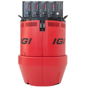
3D urban mapping is required by more cities at a rapid rate. 3D GIS tools are being implemented worldwide by cities transitioning into smart and interconnected metropolises. Since 1970, Aerowest GmbH of Dortmund, Germany has provided acquisition and processing of geospatial data from aerial photographs. Since February 2017 they have operated IGI’s UrbanMapper with eight Phase One Industrial 100 megapixel cameras acquiring aerial data for 3D city models in a fast, efficient and cost effective way.
Efficiency in Vertical and Oblique Aerial Photography Collection
In the early 2000s, oblique camera systems were introduced into many diverse aerial imaging applications. The system uses include but is not limited to: multi-perspective desktop viewers, visualization of building's roofs and façades from a 360-degree perspective, realistic texturing of 3D city models, and measurement of building heights immunoblotting mode.

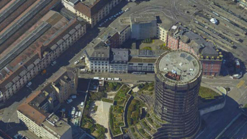
Aerowest of courtesy – Model Mesh 3D
Today urban planners and decision-makers rely on 3D maps to support a wide variety of initiatives and actions. 3D mapping is used to prepare for changes in city structures, population growth and urban planning, preventative measures for natural and industrial disasters, inhibit overuse of finite resources, incorporate sustainable practices, and more. City planners, therefore, require a reliable database that can be easily modified over time in order to gain a holistic look at the urban environment. An immediate advantage of acquiring oblique images is the possibility to view elements that are generally occluded or not visible in the vertical views. The oblique images provide additional viewpoints on objects such as road edges, facades and lower building parts. Classic nadir aerial imaging is accompanied by high-resolution oblique images and moves classic ortho-photos into 3rd dimension with the most detailed 3D point clouds and 3D mesh models. Aerowest combines both worlds with the newly developed IGI UrbanMapper system, which joins high-resolution nadir and oblique images in one single system set-up. Combining high geometric stability and high-quality images allows urban planners to zoom into the finest details. Cameras used in the UrbanMapper, therefore, need to have a high dynamic range to compensate for different light conditions (such as shadowed areas) and a high resolution.
3D City Models for Urban Mapping with Phase One Medium-format Cameras
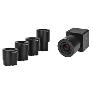
IGI’s UrbanMapper comprises 8 Phase One Industrial 100-megapixel cameras that capture multiple perspectives simultaneously with high overlap. The camera system is installed in a gyro-stabilized platform and operated with IGI's AEROControl GNSS / IMU system. This allows the exact determination of each exposure position and image orientation. This system enables the capturing of large format nadir and oblique aerial imagery in a single flight.
Hans Joachim Benfer, Aerowest CEO explains that the unique aerial sensor system simultaneously captures vertical (nadir) and oblique images with a forward overlap of more than 80% even with the highest resolution up to GSD of 2cm.
Four 100MP cameras are installed to form the nadir view, three of which are in RGB configuration to produce a 300-megapixel image. The fourth nadir camera detects the optional NIR channel.
"Based on the short exposure time and the highly sensitive CMOS sensors we can collect images at the flight altitude of 2,000 m (6,500 feet) with the same or even better image quality as camera systems operated in light aircraft or drones from lower flight altitudes”, says Benfer.
The quality and reliability of Phase One Industrial cameras are outstanding. Due to the high sensitivity of the camera, the IGI UrbanMapper can be operated under poor light conditions and at high aircraft speed while still retaining high-quality image capture. In 2 years we have successfully shot more than 1.2 million images. " - Hans Joachim Benfer, Aerowest CEO.
Generating 3D City Models
Each Phase One Industrial camera contains a 100MP CMOS sensor and each lens utilizes innovative RS shutters. A fast capture rate of 0.6 sec per image, and the high performances of Phase One Industrial RS lenses, integrated with an IGI processor, lead to outstanding image quality. The system is able to provide a 2cm Ground Sample Distance (GSD) at 400m flying altitude; 5cm GSD at 1000m flying altitude. A forward overlap of >85% is achievable at 160kn flying speed.

IGI UrbanMapper2
The UrbanMapper with its eight Phase One 100MP aerial cameras captures a huge amount of data. Processing this data and generating a comprehensive and detailed model out of it takes time. Aerowest uses SURE Aerial software by nFrames GmbH and PHOTOMESH software by Skyline Software Systems Inc. side-by-side to produce textured 3D models of cities. The oriented images can be processed with any matching or photogrammetric software on the market.
Even smaller municipalities can now achieve cost-effective, high-quality 3D city models as well as orthophotos with an accuracy of two to ten centimetres.
Multi-perspective aerial imaging opens many new opportunities in geodata-based applications. Aerial imaging with qualified cameras offers the fastest way to reproduce a digital 3D representation of reality for all kinds of planning, surveying or visualization.

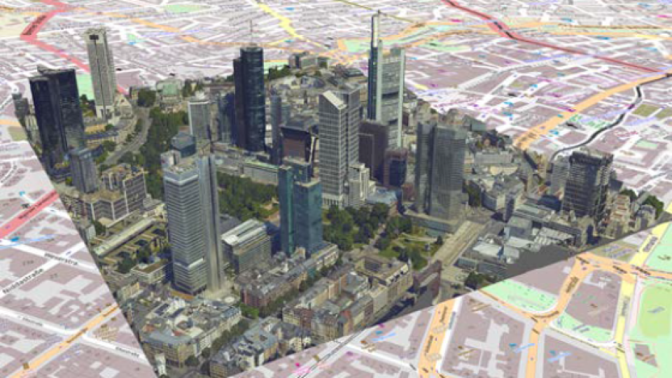
3D Representation of Frankfurt – Courtesy of Aerowest
Takeaways
Adding the IGI system with Phase One Industrial cameras enabled Aerowest to:
• achieve a fast method of reproducing digital 3D retransition of reality for all kinds of planning, surveying or visualization.
• provide affordable, cost-effective, high-quality 3D city models as well as true ortho-photos.
• accomplish multi-perspective aerial imaging, which opens many new opportunities in geo-data-based applications.
Do you have questions about this case study?
Get in touch with Phase One A/S, and they would be happy to answer any questions you have about pricing, suitability, availability, specs, etc.


