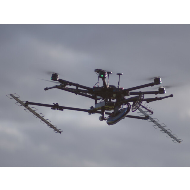
Forest Keeper RD350
A turn-key drone-borne multi-band interferometric Synthetic Aperture Radar system for automated forest inventory. It automatically estimates the forest Volume, DBH or DAP, height, list of dominant tree heights and basal area with an accuracy of 2%.
Description
The Forest Keeper RD350 can perform up to 500 hectares per day with an adequate drone. Figure 3 shows the operation chain. During the day the radar raw data is acquired and during the night processed. The operational team doesn’t need radar knowledge. The operation is similar to optical sensors. For more information visit: www.en.radaz.com.br
Specifications
-
Data storage
-
Type of storage
SSD
Disc capacity [GB]
256
Number of discs
1
Exported file formats
Raw data in binary format with header, LOG files in ASCII
-
Operation Characteristics
-
Platforms (e.g. Helicopter, fixed wing)
Class 3 drone
Min. flying height [m]
60
Max. flying height [m]
120
Min. stroke width [km x km]
0.1 x 0.1
Max. stroke width [km x km]
0.3 x 4
-
Software
-
Type of mission planning software
Radar mission planning, made by Radaz
Type of postprocessing software
Automatic InSAR processing software, made by Radaz
-
Application and Use
-
Training facilities
Yes
Main applications
Industrial Forest Inventory
Main users
Industrial Forest Industry
Distinguishable features:
Evaluates volume, forest height, DBH, basal area and dominant tree heights automatically, 500 hectares per day throughput
-
Recording
-
Time of flight
Y
Signal strength
Y
Frequency
Y
Phase
Y
-
Additonal sensors
-
Digital Camera
Yes
-
Onboard Unit Features
-
Unit Width (cm)
100
Unit Height [cm]
30
Unit Depth [cm]
120
Weight [kg]
5
Power requirements
15 W
-
Sensor Characteristics
-
Sensor arrangement/method
Synthetic Aperture Radar
Number of bands
3
Frequency in P band (> 300 MHz)
430
Frequency in X band (8-12ghz)
5
Azimuth resolution
0,5 m
Range resolution
0,5 m
SAR or SLAR
SAR
-
Positioning System
-
Brand of positioning system
Radaz
Inbuild positioning system
Y
-
General
-
Year of introduction
2021
Year of last update
2021