VQ-1260
Waveform Processing Airborne LiDAR Scanning System for High Point Density Mapping and Ultra-Wide Area Mapping
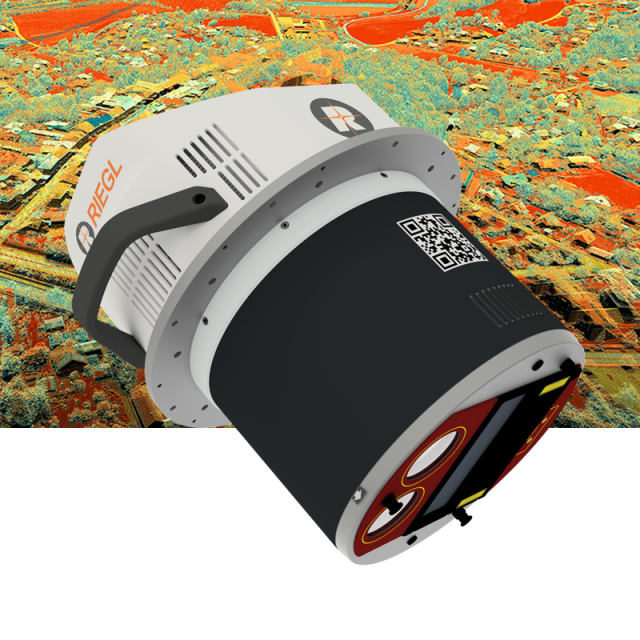
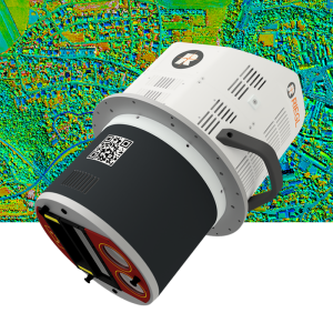
The VQ-1260 is one of RIEGL‘s latest high-end airborne laser scanning systems, suitable for a wide field of applications – from high-point density wide area mapping to ultra-high resolution city mapping or corridor mapping.

RIEGL | Innovation in 3D
Horn, AT
Description
The unique design features pulse repetition rates from 2.2 MHz, resulting in a regular point spacing and an almost constant point density distribution on the ground. The system features large measurement distances of up to 2300 m at maximum PRR, and 5400 m at minimum PRR, for a target reflectance of 20 %, resulting in an unsurpassed high efficiency in area acquisition of e.g. up to 500 km²/h at 150 knots flying speed for an average of 8 points per square meter.
A newly designed optical frontend significantly minimizes for near-range echoes due to atmospheric clutter, resulting in clean point clouds. Online-Waveform processing and full-waveform processing capabilities are a matter of course for this class of equipment.
Scan data and camera images are stored on removable hard disks that can be accessed directly on the device, eliminating the need for an external data recorder.
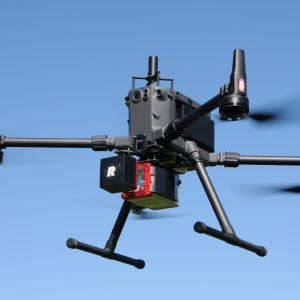
A high-performance IMU/GNSS unit and one or two optional high- resolution RGB/NIR cameras are seamlessly integrated in the compact and user-friendly designed housing. The standardized mounting flange fits typical hatches or gyro-stabilized leveling mounts for maintaining optimum point distribution.
Do you have questions about this product?
- Questions about price, availability, and/or retailers
- Questions about technical specifications and usage
- Questions about suitability for your project or application
Specifications
-
General
-
Year of introduction
2022
Total Weight [kg]
60
Power requirements
20 - 32VDC typ. 350W
Type of GNSS/INS positioning system
optional
Camera
optional
Data storage facilities
removable Harddisk
Mission planning software
RiPARAMETER,IGI Plan; TrackAir; or similar
Postprocessing software
RiMTA ALS, RiACQUIRE, RiPROCESS, RiWORLD
-
Application
-
Main applications
Ultra Wide Area / High Altitude Mapping • Ultra-High Point Density Mapping • Mapping of Complex Urban Environments • Glacier & Snowfield Mapping • City Modeling • Mapping of Lakesides & River Banks • Agriculture & Forestry • Corridor Mapping
-
Measurement Characteristics
-
Scanning method
rotating polygon mirror
Scan frequency [Hz]
600
Min. pulse frequency [Hz]
270000
Max. pulse frequency [Hz]
2200000
Max. field of view [deg]
60
Max. number of recorded echoes per pulse
31
Full-wave form digitization
Y
multiple pulses in air
Y
-
Operation Characteristics
-
Platform
Helicopter, Fixed-wing
Max. flying height [m]
6450
-
Laser Pulse Characteristics
-
Wavelength [nm]
1064
Type/class laser
4
-
More information
-
Distinguishable features
high pulse repetition rates of up to 2.2 MHz • up to 1.47 million measurements per second on the ground • best point distribution for optimum target resolution • excellent atmospheric clutter suppression • multiple target capability • online waveform processing and full waveform data recording • on-board graphical user interface for easy access to primary scanner parameters • integrated inertial measurement unit and GNSS receiver • prepared for the integration of up to two high resolution RGB/NIR cameras • optimized for interfacing with typical hatches and stabilized platforms • deteachable handgrips for facilitated handling
-
Application areas
-
Select an application area:
Documents
Brochure
datasheet_vq-1260
Other documents
-
Infosheet ALS Overview.pdf4.34 MB
-
RiACQUIRE Datasheet.pdf4.34 MB
-
RiPROCESS Datasheet.pdf3.99 MB


