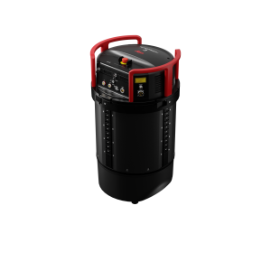
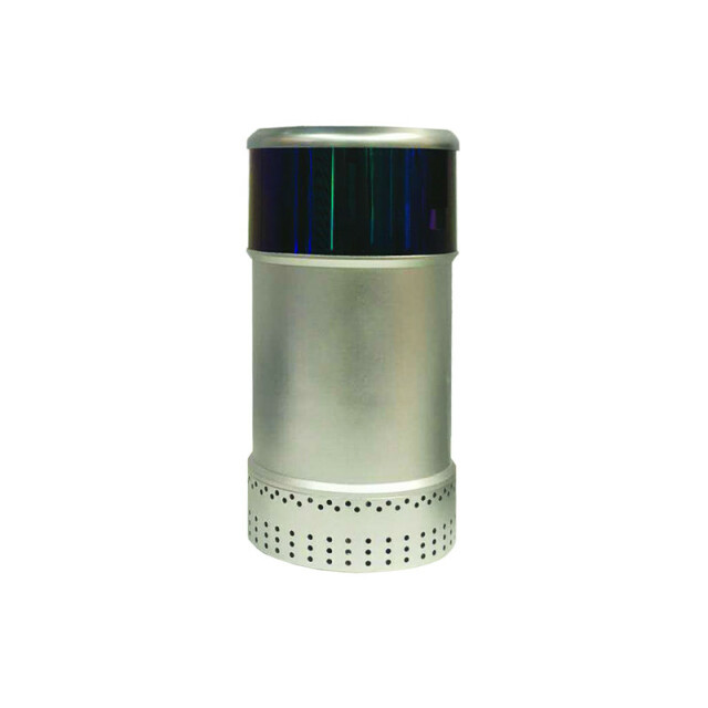
Join 40,000+ geospatial professionals and get technology news delivered straight to your inbox every week. Subscribe today.

LS31 Series

LS31 Series

360° scanning & TOF full waveform

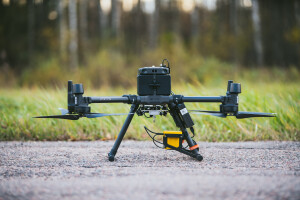
LS Airborne mapping LiDAR performs TOF full waveform scheme which has ability to detect surrounding environment by 2D scanning. Perfect for UVA mapping. Horizontal FOV 360°, measuring frequency 300 kHz, IP 67.

LeiShen Intelligent System
Shenzhen, CN

Description

  • FOV 360°
  • Detection range: 1.5 m – 500 m, 10 % reflectivity (LS31A)
  • Scanning frequency 5 Hz, 10 Hz, 20 Hz
  • Communication; ethernet port
  • Angular resolution at 5 Hz: 0.006°, 10 Hz: 0.012°, 20 Hz: 0.024°
  • ø 120 mm x 247 mm, weight 1.7 kg, IP67
  • Application: UVA mapping

Specifications

Operation Characteristics

Platform

Ask a question

LeiShen Intelligent System team is happy to assist.

LeiShen Intelligent System

We're available on all weekdays and usually reply within 1-2 working days.

Please provide detailed information. Your input helps LeiShen Intelligent System assist you effectively.

Let us know a little about you and your contact information.

Do you represent a company or organization?

Before we proceed, would you be interested in subscribing to our newsletter?

By completing this form, you acknowledge and agree to abide by our Terms and Conditions, Privacy Policy and Cookie Policy.

Thank you for your message! Our team tipically to respond to inquiries within 1-2 business days.