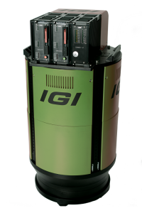

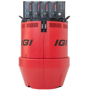
IGI LiteMapper 4800VQ
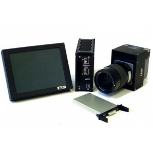
Designed as a rugged but also compact and lightweight system, the IGI LiteMapper can be used in a variety of aircraft, from large airplanes and helicopters to ultra-light airplanes and gyroplanes or even remote piloted aircraft systems (RPAS). All systems are installed on vibration damped platforms or stabilized mounts.

IGI
Kreuztal, DE
Description
Do you have questions about this product?
- Questions about price, availability, and/or retailers
- Questions about technical specifications and usage
- Questions about suitability for your project or application
Specifications
-
General
-
Year of introduction
2012
Year of last update
2018
Total Weight [kg]
18
Power requirements
18-32VDC typ. 150W
Type of GNSS/INS positioning system
IGI AEROcontrol compact- 600Hz
Camera
IGI DigiCAM & IGI DigiTHERM (thermal IR)
Data storage facilities
Removeable SSD, hot-plug
Mission planning software
IGIplan
Postprocessing software
IGI AEROoffice & Riegl ALS Software
-
Application
-
Main applications
All typical airborne applications: Corridor Mapping, City Modelling, Topography & Mining, Opencast Pits, Wide Area Mapping, Forestry, Mapping of Lakesides & River Banks, Agriculture & Forestry, Power Lines, Railway Track and Pipeline Inspection
-
Measurement Characteristics
-
Scanning method
time-of-flight
Scan frequency [Hz]
275000
Min. pulse frequency [Hz]
50000
Max. pulse frequency [Hz]
550000
Max. field of view [deg]
75
Max. number of recorded echoes per pulse
practically unlimited
Full-wave form digitization
N
Pulse sampling frequency [GHz]
0
Recording of intensity of return signal [bits]
0
multiple pulses in air
Y
-
Operation Characteristics
-
Platform
Helicopter, Fixed-wing, Gyroplane
Min. flying height [m]
0
Max. flying height [m]
2200
-
Laser Pulse Characteristics
-
Wavelength [nm]
1550
Standard pulse length [ns]
0
Beam divergence [mrad]
0.3
Type/class laser
Class 3R
Pulse length variation [ns]
0
-
More information
-
Distinguishable features
Flexible Integration with Modular Optical, Thermal and Hyperspectral Cameras, High-end GNSS/IMU, Certified Installations, Multiple Target Capability, Online Waveform Processing
-
Uncertainty and resolution
-
Pitch and roll pointing precision [deg]
0.001
Heading pointing precision [deg]
0.002
Elevation precision at 1 km [m]
0.07
Planimetric precision at 1km [cm]
0.07
Across-track point spacing at 1km [m]
0.45


