


Geosun LiDAR GS-130X
GS-130X Mobile Vehicle-mounted Lidar Scanning System
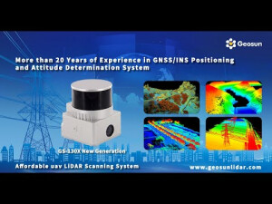
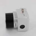
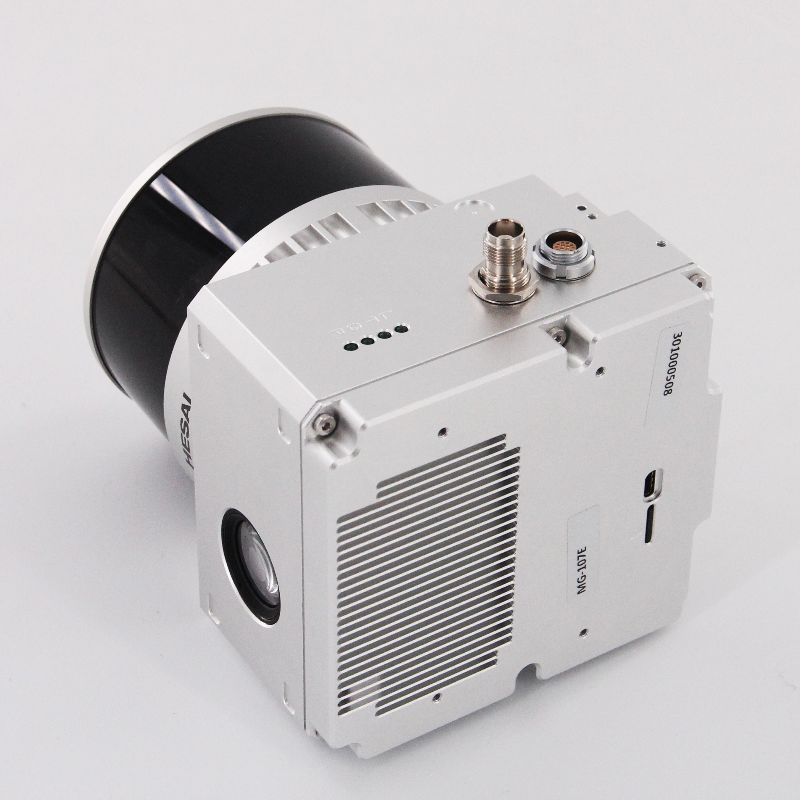
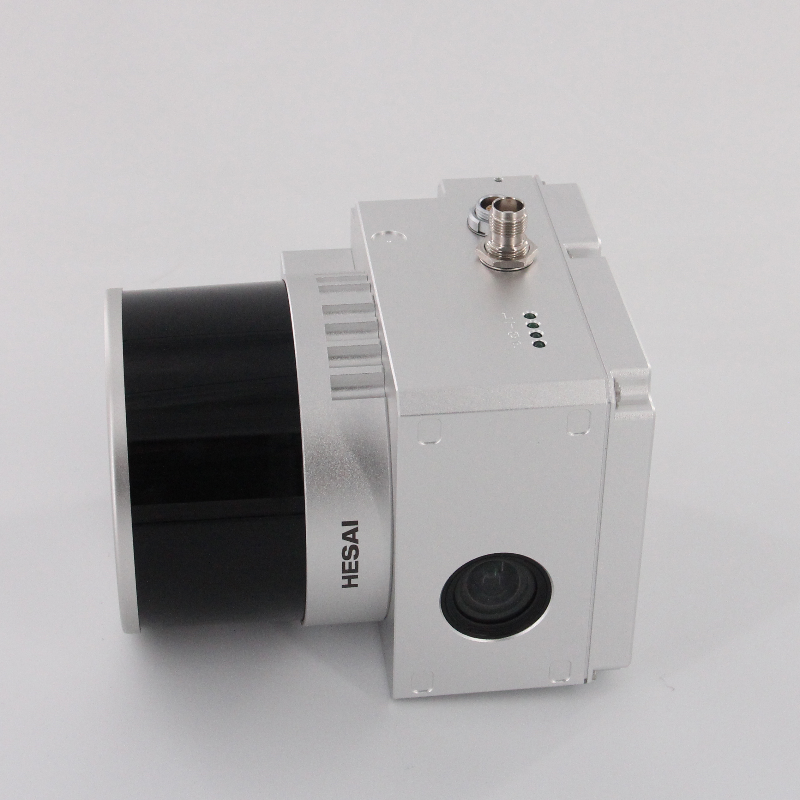
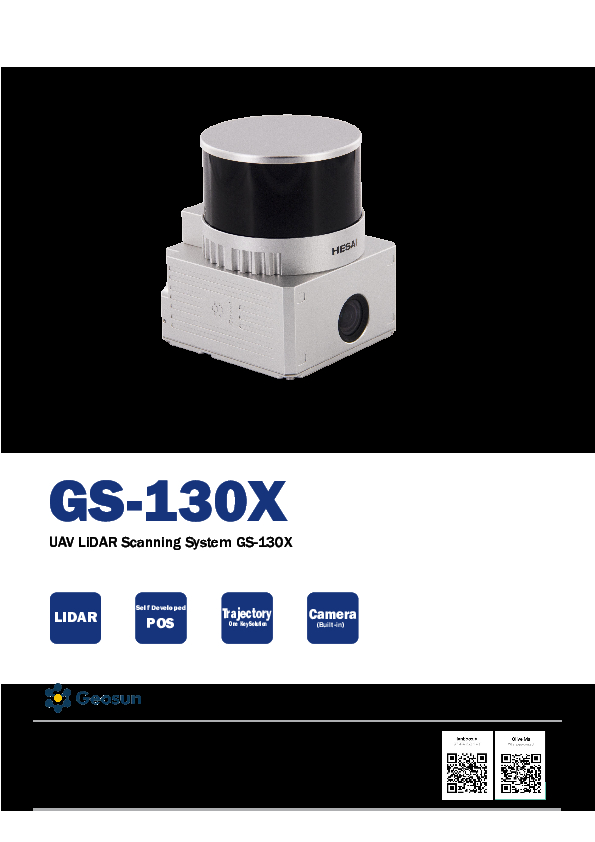
The GS-130X LiDAR scanning system is a UAV measurement system independently developed by Geosun. It highly integrates a laser scanner, GNSS satellite positioning system, INS inertial navigation system, and optional camera, enabling the quick acquisition of high-precision laser point cloud data. This system can be widely used in digital city construction, industry, land surveying, forestry, and agriculture.

Geosun Navigation
Wuhan, CN
Description
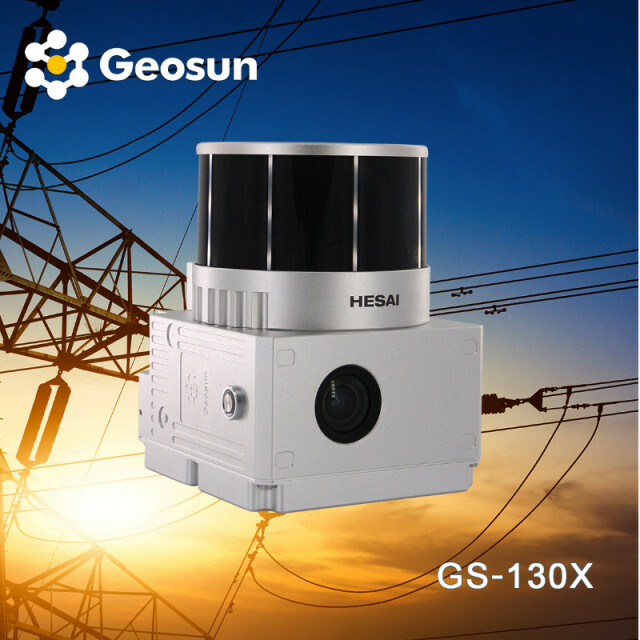
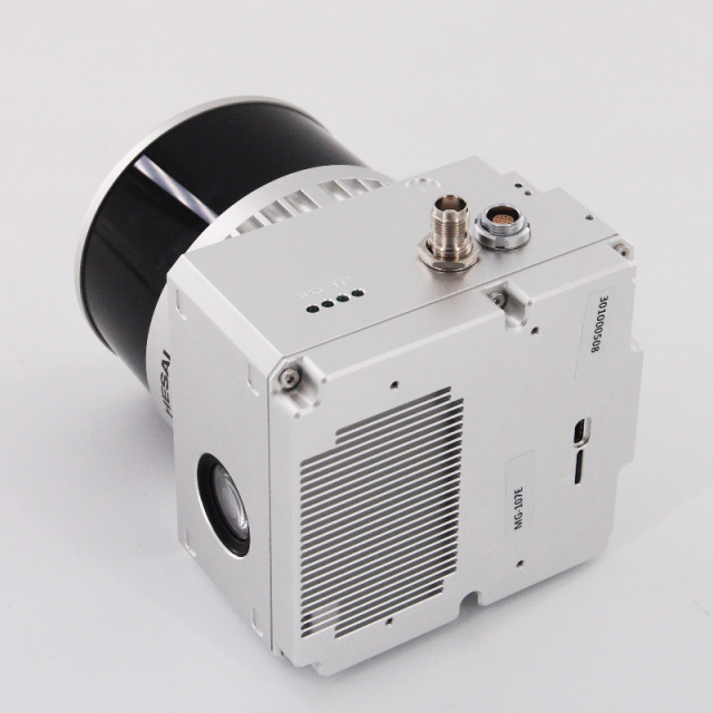
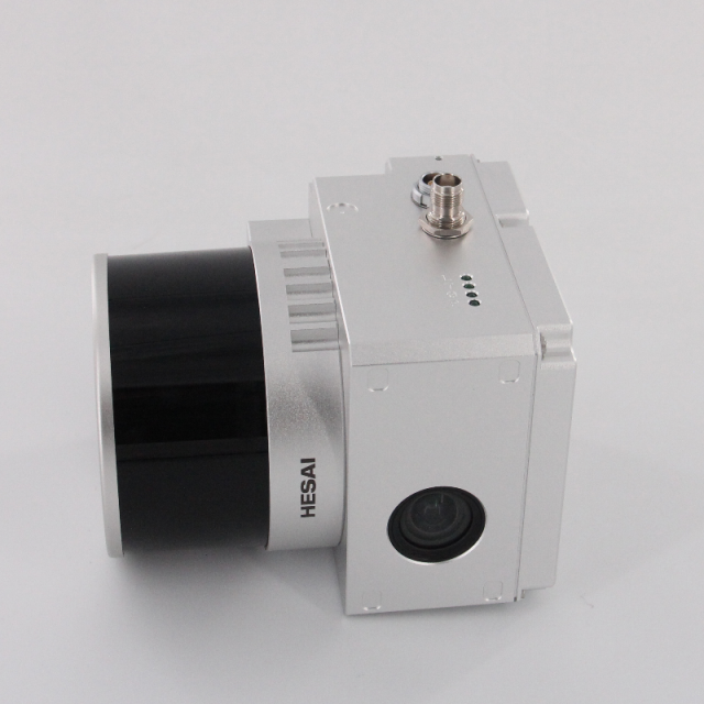
The Geosun GS-130X UAV Lidar Mapping System features an AGL of 120m and a built-in 26MP RGB camera, making it ideal for power line and forestry surveying. The system integrates a Hesai XT32 laser sensor and all built-in units to deliver a futuristic look while standing out with strong penetration and small beam divergence in the same UAV Lidar scanning system class for better performance in vegetation areas.
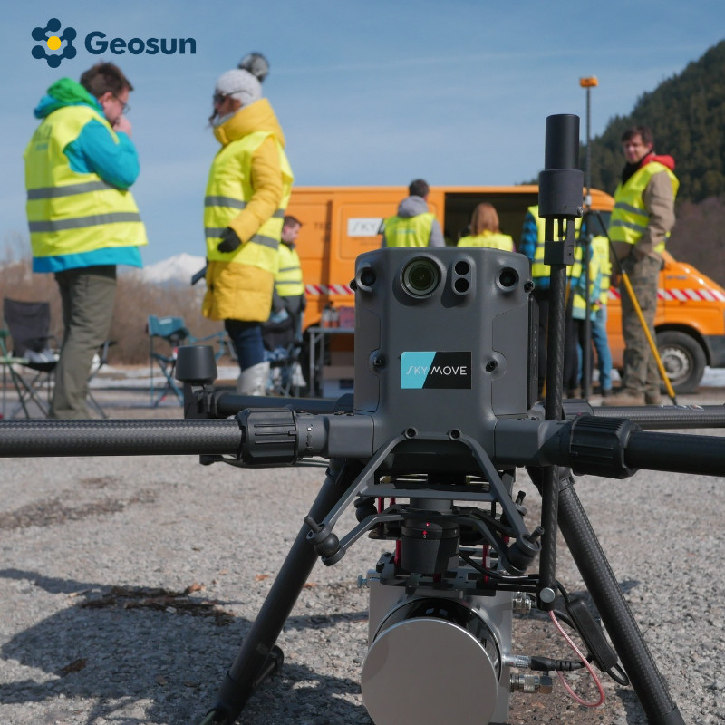
Application of this UAV LiDAR Scanning System
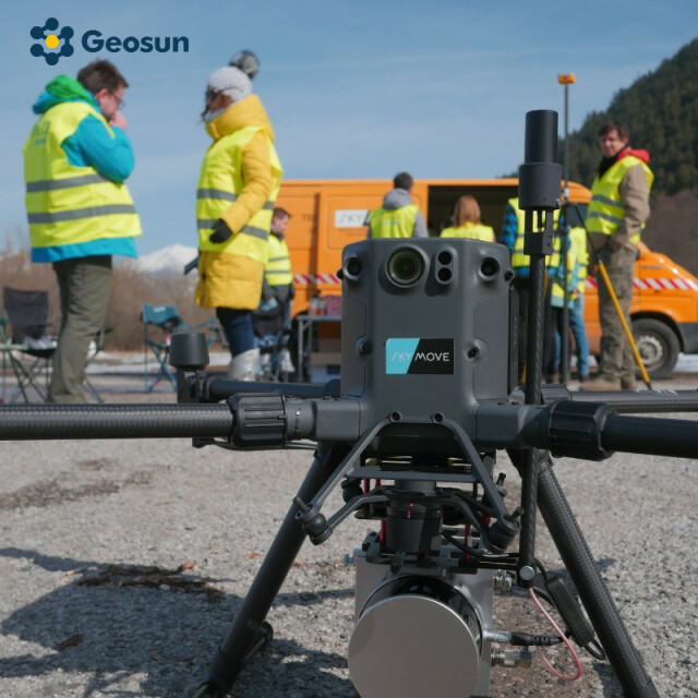
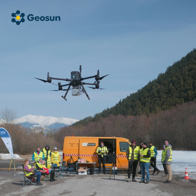
The UAV LiDAR Scanning System GS-130X is mounted on the M300 and comes with free trial software.
Point Cloud Pre-Processing Software Integrated With Trajectory Processing
Geosun Self-developed gAirHawk 5.0 Key Features of gAirHawk 5.0 Software:
- Intelligently loads raw data.
- Four default coordinates.
- Point cloud optimization.
- Start and stop calculation. Free trial testing is available to achieve high precision.
Package
The UAV Lidar Scanning System is packed in a suitcase with EVA material liner inside and then covered by a hard carton box, making it suitable for air and sea shipment.
Delivery
The system will be delivered by express or as per the customer's requirement.
Do you have questions about this product?
- Questions about price, availability, and/or retailers
- Questions about technical specifications and usage
- Questions about suitability for your project or application
Specifications
-
Application
-
Main applications
forestry, agriculture, mining industry ,autonomous vehicles, mapping, environmental monitoring, robotics navigation, measurement and inspection
Training, maintanence and support
A professional team provides training and technical support, 12 months warranty
Distinguishable features
Short Range
-
Measurement Characteristics
-
Max. field of view [degrees]
360
Max. number of recorded echoes per pulse
Double Echoes
Scanning method
32-beam
Recording of intensity of return signal [bits]
1280
-
Physical Properties
-
Height [cm]
12
Length [cm]
14.2
Width [cm]
10.9
Weight [kg]
1.26
-
Laser Pulse Characteristics
-
Laser Class
905nm Class1 (IEC 60825-1:2014)
-
Power Supply
-
Power consumption
20W
Power requirements
12-24V
-
Positioning System
-
Type of GNSS positioning sensors
GPS L1/L2/L5,GLONASS L1/L2 BDS B1/B2/B3,GAL E1/E5a/E5b
-
Operation Characteristics
-
Camera included
Yes
Mounting
yes
Requirements for compatible UAVs
Aircraft, VTOL Fixed-wing drone, Car
Camera specifications
26 MP
-
Data and Software
-
Included software
POS software and point cloud software
-
General
-
Year of last update
2022
Year of introduction
2022
Documents
Brochure
gairhawk-gs-130x-ags-303-pos.pdf
2.32 MB
Videos

