
SecureWatch
A New Era In Accessing Geospatial Information
A SecureWatch subscription gives you instant access to the best satellite imagery and geospatial data via web browser or API integration
European Space Imaging
Munich, DE
Description
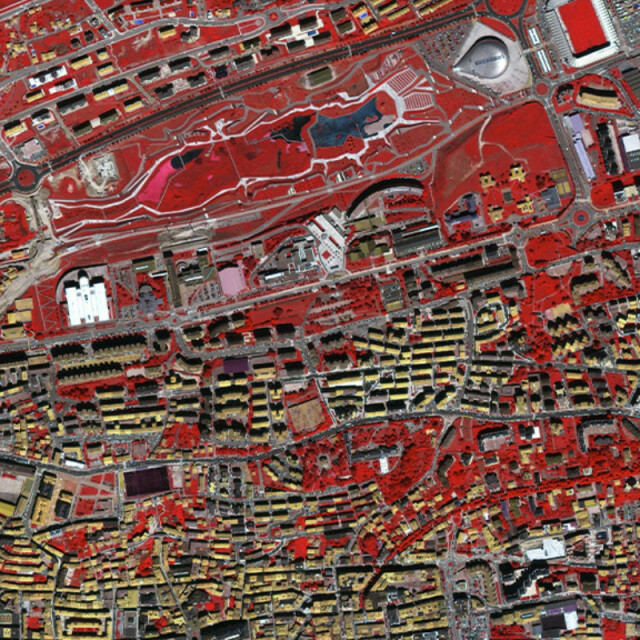
A SecureWatch subscription gives you on-demand access to the world's most recent, highest resolution satellite imagery and geospatial data. And you don't have to be an imagery expert or have in-house tools. With flexible access options including online streaming and download, API, and integrations with Esri ArcGIS, SecureWatch is designed to make imagery accessible to anyone who needs it, whether you're interested in a specific area or monitoring the entire globe.
Specifications
-
General
-
Year of introduction
2019
Deliverable raster products
Orthorectified imagery, Timelapse mosaics
Options for delivery
FTP, Individual Files, Webservices (WMS)
Deliverable vector products [2D and 3D]
Satellites or constellations of delivered products
WorldView-1, WorldView-2, WorldView-3, WorldView-4, GeoEye-1, Quickbird
aircraft or satellite
Continents
-
Image corrections
-
Proces of geometric correction
Ortho-Rectification, Atmospheric Compensation
Image sharpening methods
Pan-Sharpening
Sensor corrected
Y
-
Imagery Specifications
-
Spectral band types
Red, Green, Blue, Red edge, Near-infrared, SWIR
Data formats of imagery
-
Revisit time and delivery
-
Revisit time for defined data products
Less than one day
Delivery time [Time between data capture and delivery; in hours]
1
-
Resolution and Accuracy
-
Resolution of RGB imagery [best GSD in centimeters]
100
Geolocation accuracy [RMSE at nadir in centimeters]
200
Geolocation accuracy [CE90 at nadir in centimeters]
300

