


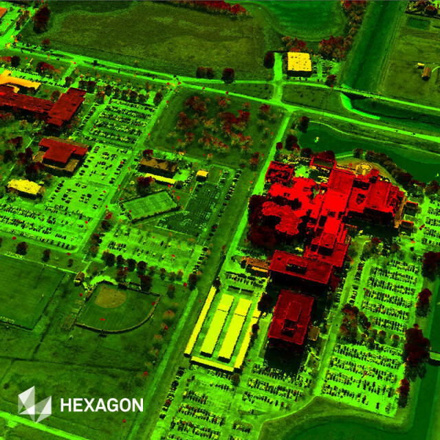


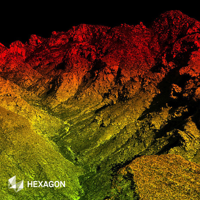

Digital Surface Models (DSM)
Off-The-Shelf Elevation Models for a Complete 3D View
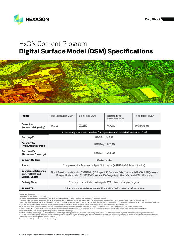
Hexagon’s HxGN Content Program offers nationwide digital surface models (DSM) up to 20 cm resolution (nominal point spacing) across the United States and Europe. The data is orthorectified, standardized and homogeneous, making it ideal for extracting features and deriving analytics.
Description
The HxGN Content Program, Hexagon’s aerial data program, offers the largest library of high-resolution multispectral aerial imagery and elevation data of the United States, Europe, and parts of Canada. Hexagon is the only aerial data provider to offer off-the-shelf nationwide DSM at 80 cm resolution across the United States and Europe.
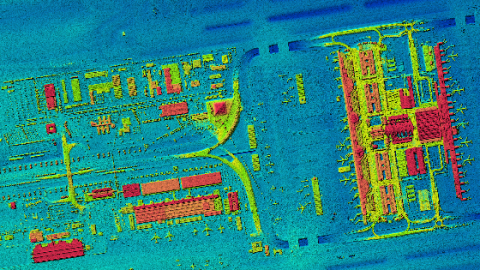
Derived from quality controlled, high-accuracy aerial imagery, the HxGN Content Program’s DSM provides a clear view of the surface and its above-ground features in a 3D format. It is readily available and can be used for landscape modelling, city modelling, visualization applications, flood modelling, land-use studies, and geological applications. Unprecedented consistency and positional accuracy makes it an ideal data source for automatic feature extraction and machine learning applications. Flexible data use terms allow users to create derived products.
Do you have questions about this product?
- Questions about price, availability, and/or retailers
- Questions about technical specifications and usage
- Questions about suitability for your project or application
Specifications
-
General
-
Deliverable raster products
Stereo Imagery, Orthorectified imagery, DEM, DTM
Options for delivery
FTP, Hard Drive, Individual Files
Deliverable vector products [2D and 3D]
aircraft or satellite
Aerial (aircraft)
Continents
Europe, North America
Year of introduction
2014
Satellites or constellations of delivered products
NA - Aerial Imagery
-
Image corrections
-
Proces of geometric correction
Photogrammetric bundle adjustments
Image sharpening methods
Several options
Sensor corrected
Y
Proces of sensor correction
Geometric - insitu flight calibration Radiometric - lab with integrating sphere
Radiometrically corrected
Y
Process of radiometric and/or atmospheric correction
Several options
-
Imagery Specifications
-
Spectral band types
Red, Green, Blue, Near-infrared
Data formats of imagery
Spectral bands [specify wavelengths]
Red 619-651 nm, Green 525-585nm, Blue 435-495, NIR 808-882nm
-
Revisit time and delivery
-
Delivery time [Time between data capture and delivery; in hours]
Variable
Revisit time for defined data products
NA
-
Resolution and Accuracy
-
Resolution of other bands [GSD in centimeters]
All bands are acquired at the same resolution
Documents
Brochure
hxgn-content-program-ds-dsm-0620-en.pdf
594.49 KB


