Description
Specifications
-
General
-
Year of introduction
1992
Deliverable raster products
Raw Imagery, Stereo Imagery, Orthorectified imagery, DEM, DTM
Deliverable vector products [2D and 3D]
Point cloud, Triangulated mesh
Options for delivery
FTP, Individual Files, Webservices (WMS), Maps API, Ortho Tiles or GeoJSON
Satellites or constellations of delivered products
WorldView-1, GeoEye-1, WorldView-2, WorldView-3, WorldView-4.
aircraft or satellite
Continents
-
Image corrections
-
Proces of geometric correction
Imagery is projected to a plane using map projection and datum, coarse DEM applied to normalize for topographic relief
Image sharpening methods
4-band pan sharpened imagery available.
Sensor corrected
Y
Radiometrically corrected
Y
Process of radiometric and/or atmospheric correction
A relative radiometric correction is performed on raw data from all detectors in all bands during the early stages of WorldView-3 product generation. This correction includes a dark offset subtraction and a non-uniformity correction (e.g. detector-to-detector relative gain).
-
Imagery Specifications
-
Spectral band types
Red, Green, Blue, Red edge, Near-infrared, SWIR
Spectral bands [specify wavelengths]
Coastal: 396 - 450. Blue: 430 - 545. Green: 466 - 586. Red: 590 - 694. Near-IR1: 715 - 920. Near-IR2: 856 - 1043. Pan: 405 - 1053. ---SWIR 1: 1195–1225 nm. SWIR 2: 1550–1590 nm. SWIR 3: 1640–1680 nm. SWIR 4: 1710–1750 nm. SWIR 5: 2145–2185 nm. SWIR 6: 2185–2225 nm. SWIR 7: 2235–2285 nm. SWIR 8: 2295–2365 nm.
Dynamic range of RGB image [bit depth]
16
Data formats of imagery
-
Revisit time and delivery
-
Revisit time for defined data products
1
-
Custom inquiries and license
-
More information and distinguishable features
DigitalGlobe owns and operates the most agile and sophisticated constellation of high-resolution commercial earth imaging satellites. WorldView-1, GeoEye-1, WorldView-2, WorldView-3 and WorldView-4 together are capable of collecting over one billion square kilometers of quality imagery per year and offering intraday revisits around the globe.
-
Resolution and Accuracy
-
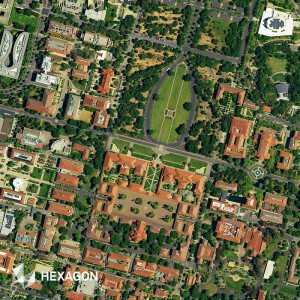
Resolution of RGB imagery [best GSD in centimeters]
30
Resolution of other bands [GSD in centimeters]
120
Geolocation accuracy [CE90 at nadir in centimeters]
500
