


Aerial Imagery
Off-The-Shelf Multispectral Aerial Imagery at Multiple Resolutions
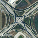
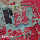
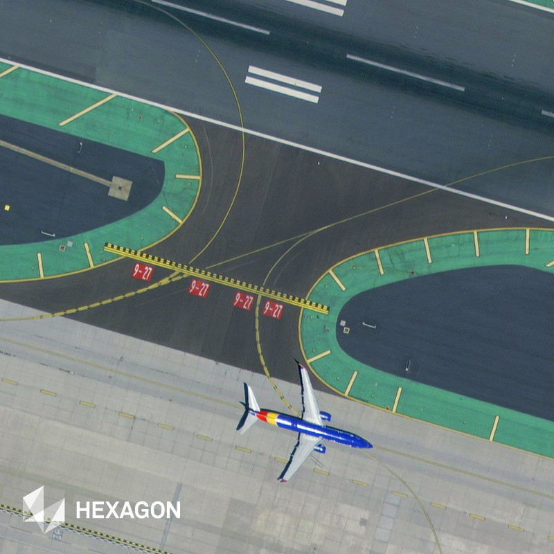
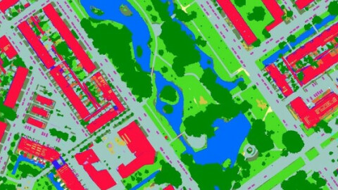
Hexagon’s aerial data program, the HxGN Content Program, offers the largest library of aerial imagery and digital surface models across the United States, Europe and parts of Canada. The data is ortho-rectified, highly accurate, and available at multiple resolutions. The exceptional data consistency over large areas makes this the ideal training data set for machine learning and AI algorithms. Flexible data use terms allow users to extract features and derive analytics.
Description
The HxGN Content Program, Hexagon’s aerial data program, offers the largest library of high-resolution multispectral aerial imagery and elevation data of the United States, Europe, and parts of Canada. The aerial data is orthorectified, accurate, and available at multiple resolutions. Data is captured on pre-defined schedules with flexible flight plans, enabling 100% artefact-free imagery with unparalleled consistency and accuracy.
Hexagon follows rigorous acquisition and processing standards to offer the highest positional accuracy for applications such as mapping, urban planning, asset management, public safety, utility mapping, insurance, app development, and many more. The exceptional data consistency over large areas makes it the ideal training data set for machine learning and AI algorithms. Flexible data use terms allow users to create derived products.
Do you have questions about this product?
- Questions about price, availability, and/or retailers
- Questions about technical specifications and usage
- Questions about suitability for your project or application
Specifications
-
General
-
Deliverable raster products
Stereo Imagery, Orthorectified imagery, DEM, DTM
Options for delivery
FTP, Hard Drive, Individual Files, Webservices (WMS), Maps API, Ortho Tiles or GeoJSON
Deliverable vector products [2D and 3D]
Point cloud, Triangulated mesh
Year of introduction
2014
Satellites or constellations of delivered products
NA - Aerial Imagery
aircraft or satellite
Continents
-
Image corrections
-
Proces of geometric correction
Photogrametric bundle adjustment
Image sharpening methods
Several options
Sensor corrected
Y
Proces of sensor correction
Geometric - insitu flight calibration Radiometric - lab with integrating sphere
Radiometrically corrected
Y
Process of radiometric and/or atmospheric correction
Several options
-
Imagery Specifications
-
Spectral band types
Red, Green, Blue, Near-infrared
Data formats of imagery
GeoTIFF, JPEG, TIFF, jpg2000, MrSID, ECW, IMG
Spectral bands [specify wavelengths]
Red 619-651 nm, Green 525-585 nm, Blue 435-495 nm, NIR 808-882nm
Dynamic range of RGB image [bit depth]
14bit
Dynamic range of other products [specify bit depth and spectral band]
14bit dynamic range for all bands. 8 or 16 bit RGB, RGBN or NRGB products
-
Revisit time and delivery
-
Revisit time for defined data products
Variable
Delivery time [Time between data capture and delivery; in hours]
NA
-
Resolution and Accuracy
-
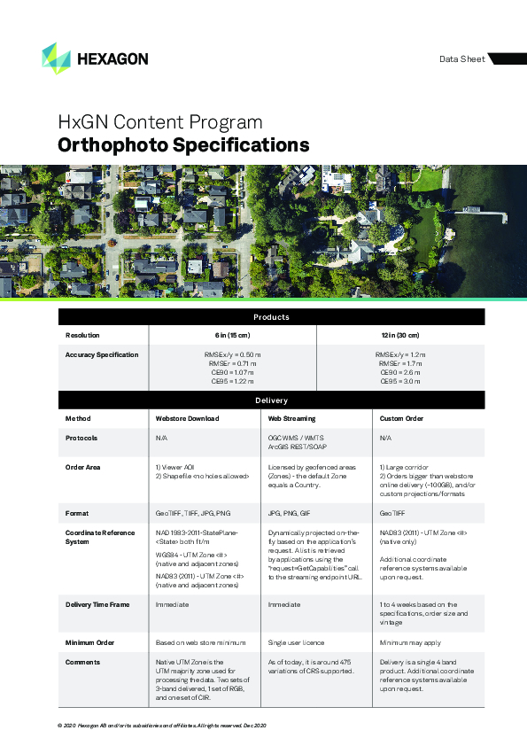
Resolution of RGB imagery [best GSD in centimeters]
15 cm resolution 30 cm resolution
Resolution of other bands [GSD in centimeters]
All bands acquired at same resolution
Geolocation accuracy [RMSE at nadir in centimeters]
20 cm nominal GSD RMSE x/y = 50 cm RMSEr = 0.71 m 40 cm nominal GSD RMSEx/y = 120 cm RMSEr = 170 cm
Geolocation accuracy [CE90 at nadir in centimeters]
20 cm nominal GSD CE90 = 170 cm 40 cm nominal GSD CE90 = 260 cm
Documents
Brochure
hxgn-content-program-ds-ortho-1220-en.pdf
273.11 KB

